Skuleskogen

High Coast by sailboat: safe mooring + hiking from the same base camp

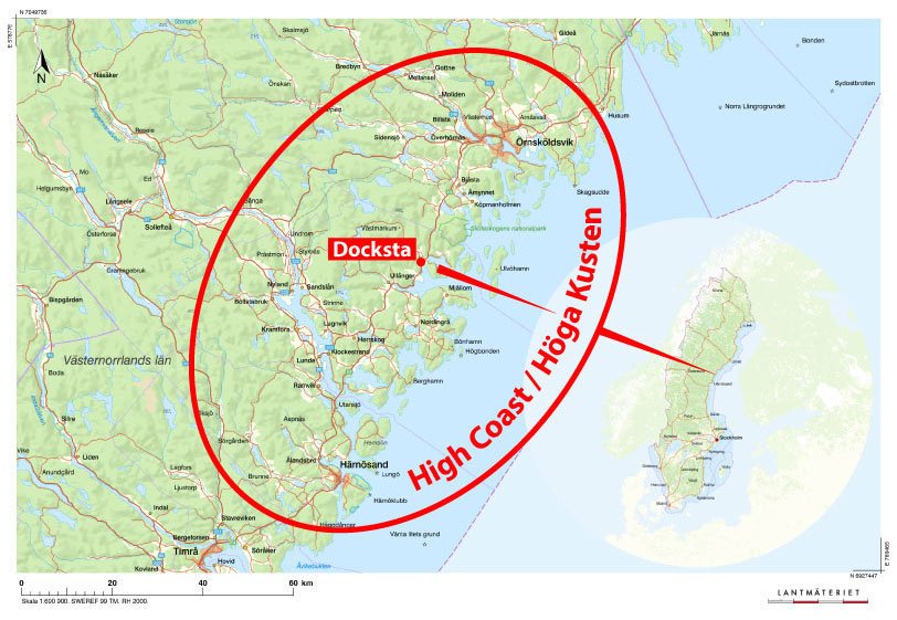
High Coast Sailors: Docksta Base Camp (Safe Mooring + Hiking)

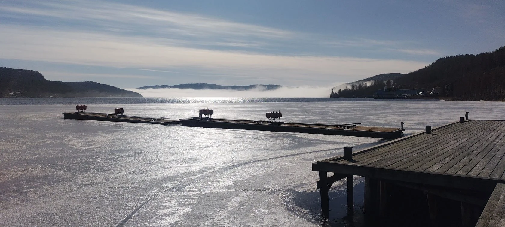
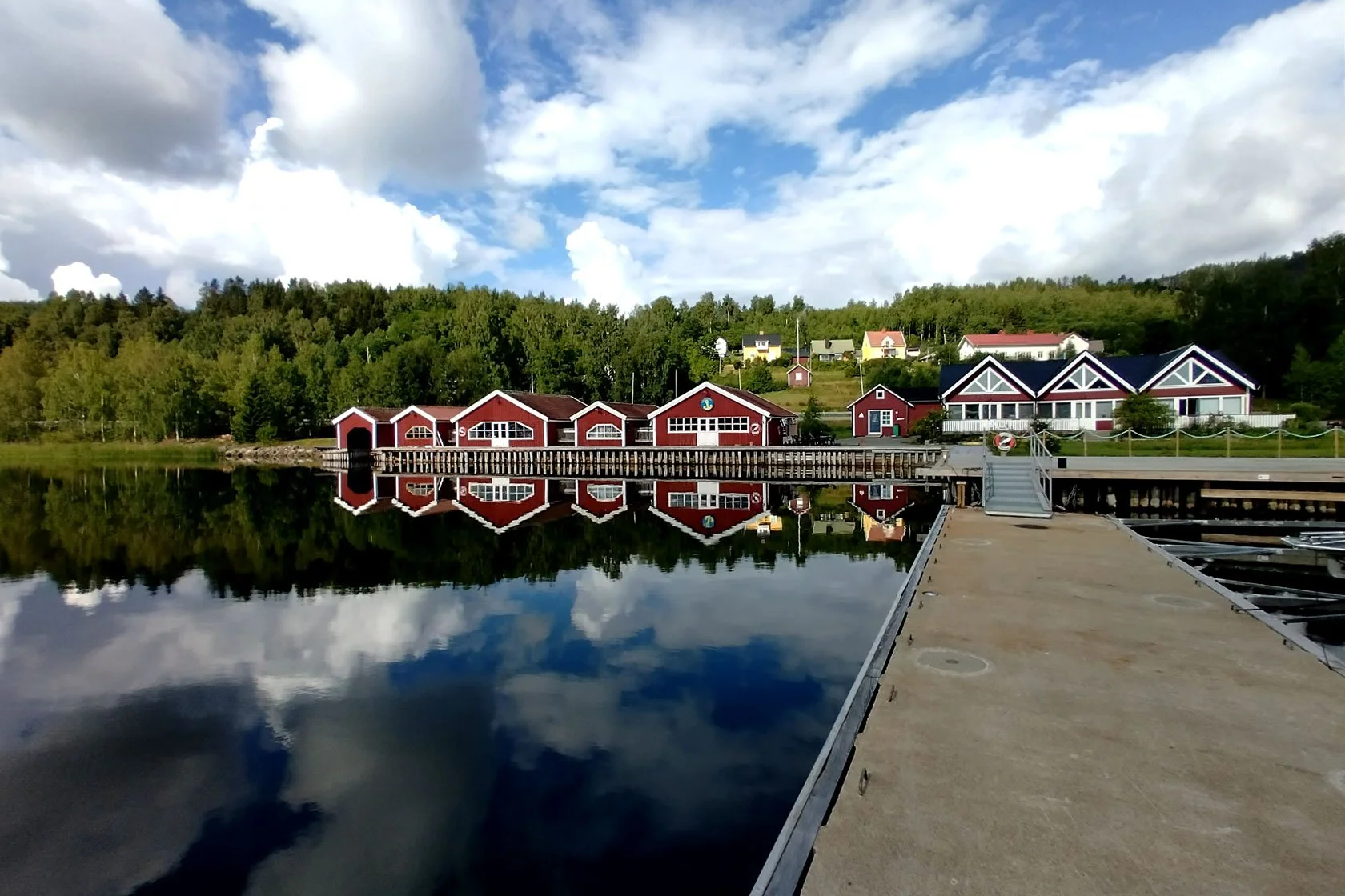
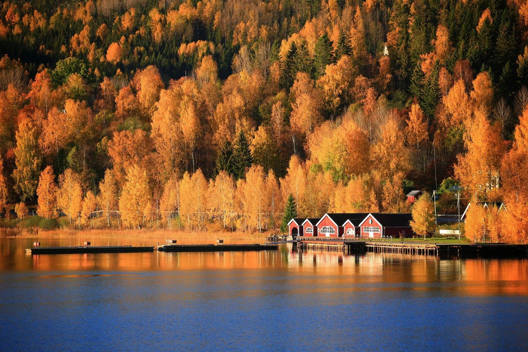
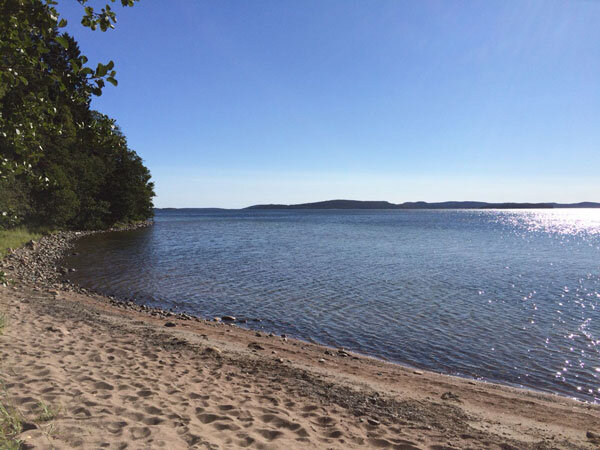
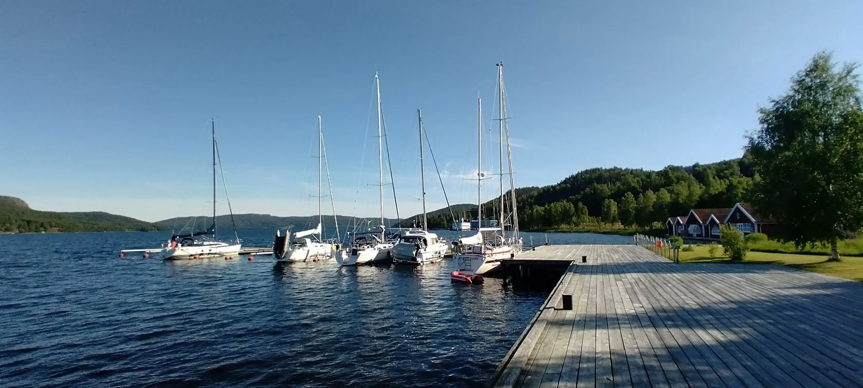
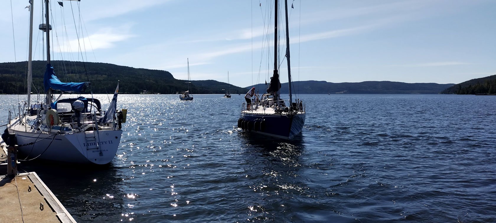
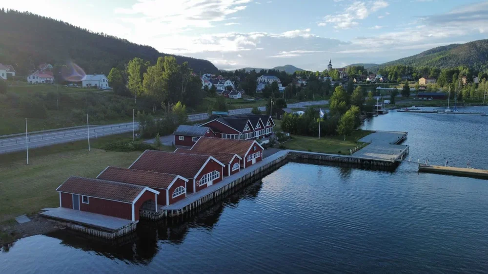
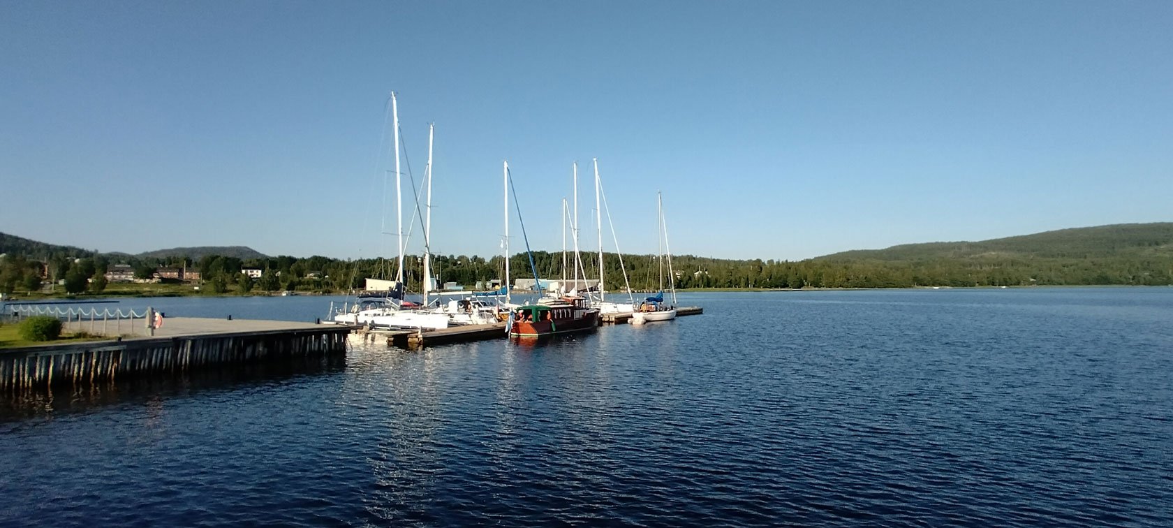
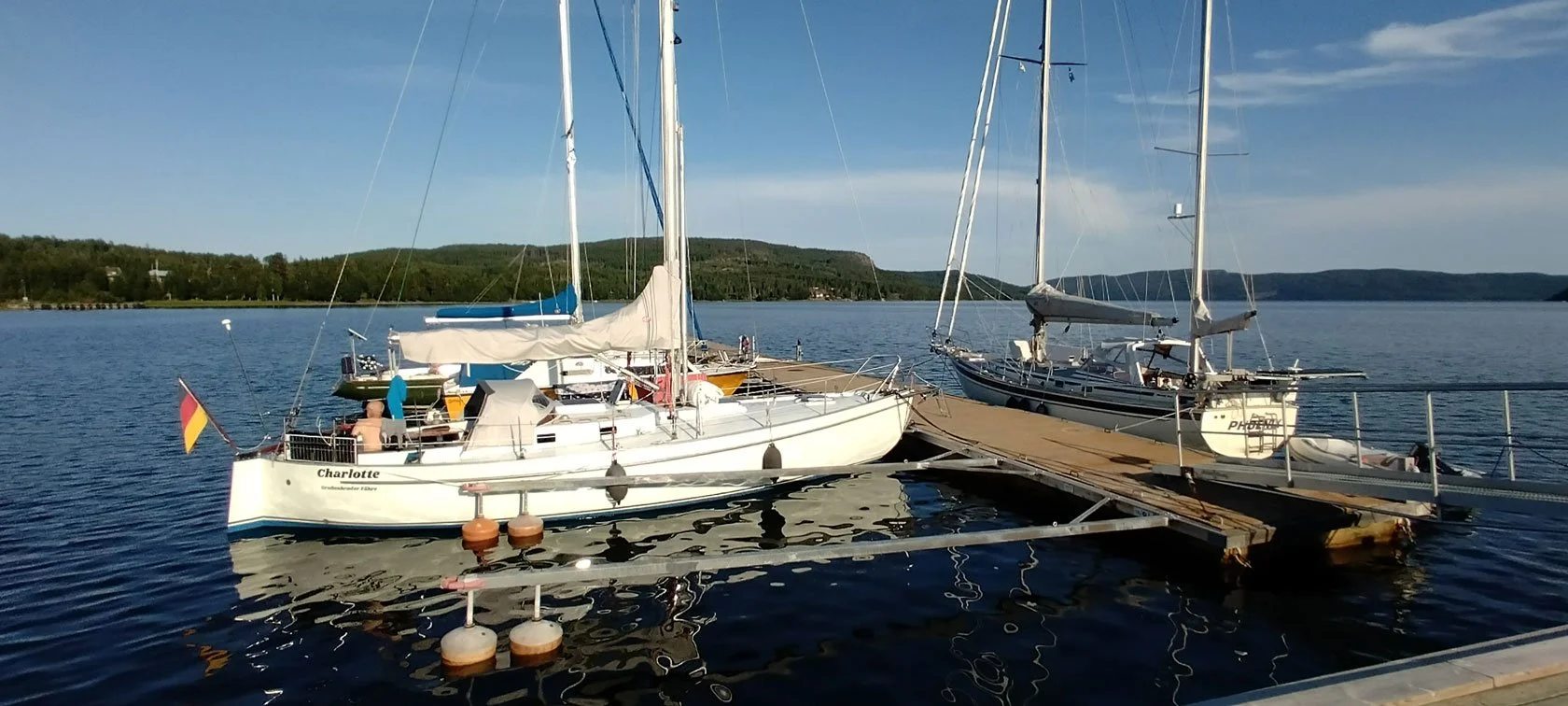
Docksta Havet is a guest harbour (gästhamn / marina) in Docksta, in the sheltered Dockstafjärden fjord, offering Y‑boom berths (finger pontoons) and alongside mooring on quays and pontoons—a calm setup when the weather shifts. Summer 2026 is our 20th season here in Docksta: two decades of welcoming crews into a harbour that’s more than a berth—it’s a sailor’s base camp, and that approach keeps crews coming back. That’s why Docksta Havet often becomes the one High Coast stop that isn’t a pit‑stop — you arrive, tie up, and your hiking day is already plugged in.

From here, turn 24–72 hours on shore into a real base‑camp day: Skuleskogen National Park first, Skuleberget next, plus Grab&Go bike rental, the Sailor’s Club House (espresso and a simple lounge to reset and plan), and a local harbour host with a solid bad‑weather plan. If you only have time for one proper shore‑leave plan in the High Coast, this is the simplest one to make work.

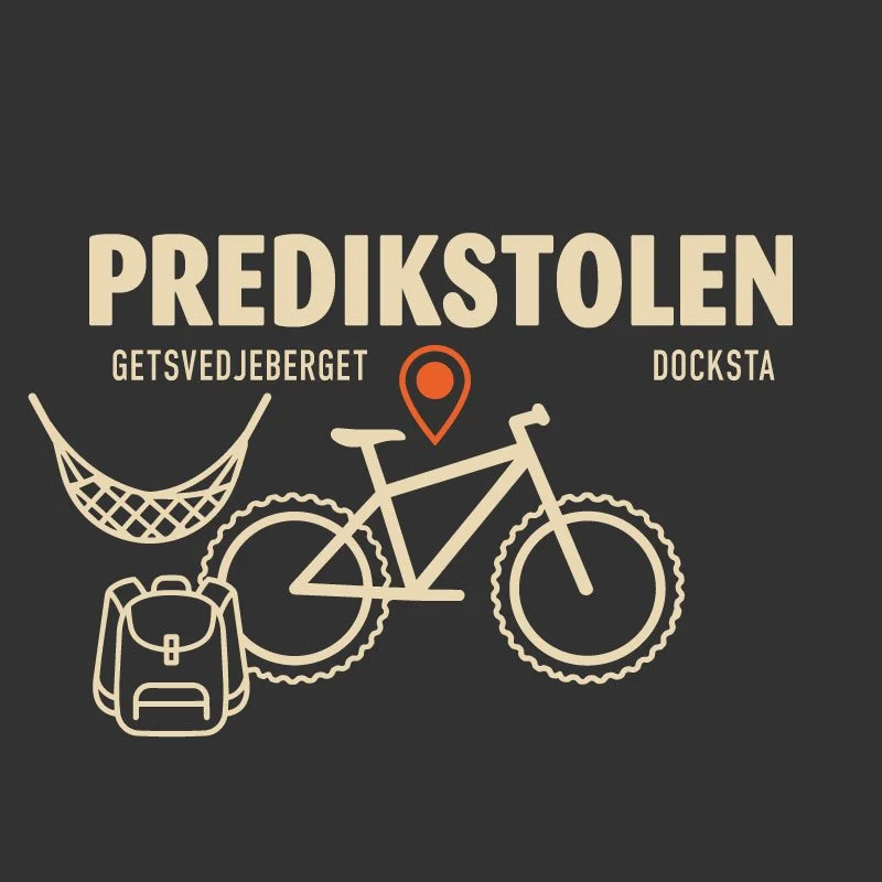
Predikstolen viewpoint, Getsvedjeberget. Easy hike on foot — or ride there with our bikes from Docksta Marina.


Why Docksta works as a sailor’s base camp (not just a stop)

If you’re sailing the Swedish coast, you know the pattern: you arrive, you tie up, and then you spend half your shore leave solving logistics.

Docksta is different: it’s a shore‑leave base camp — safe mooring, then real hiking without the logistics headache.

  • Protected moorings: sheltered from the main wind directions — arrive calm, sleep well, and keep your plan flexible.

  • Harbour host on site: local timing + route intel — “what makes sense today” based on wind, rain, and your shore window.

  • Over 30% of our guests are international repeat visitors—crews who come back because this stop simply works: safe mooring and an outdoors-first shore leave.

  • Want the captain’s shortcut? Start with the High Coast Sailor Mini‑Guide.


Shore leave that starts from the pontoons (Skuleskogen first)

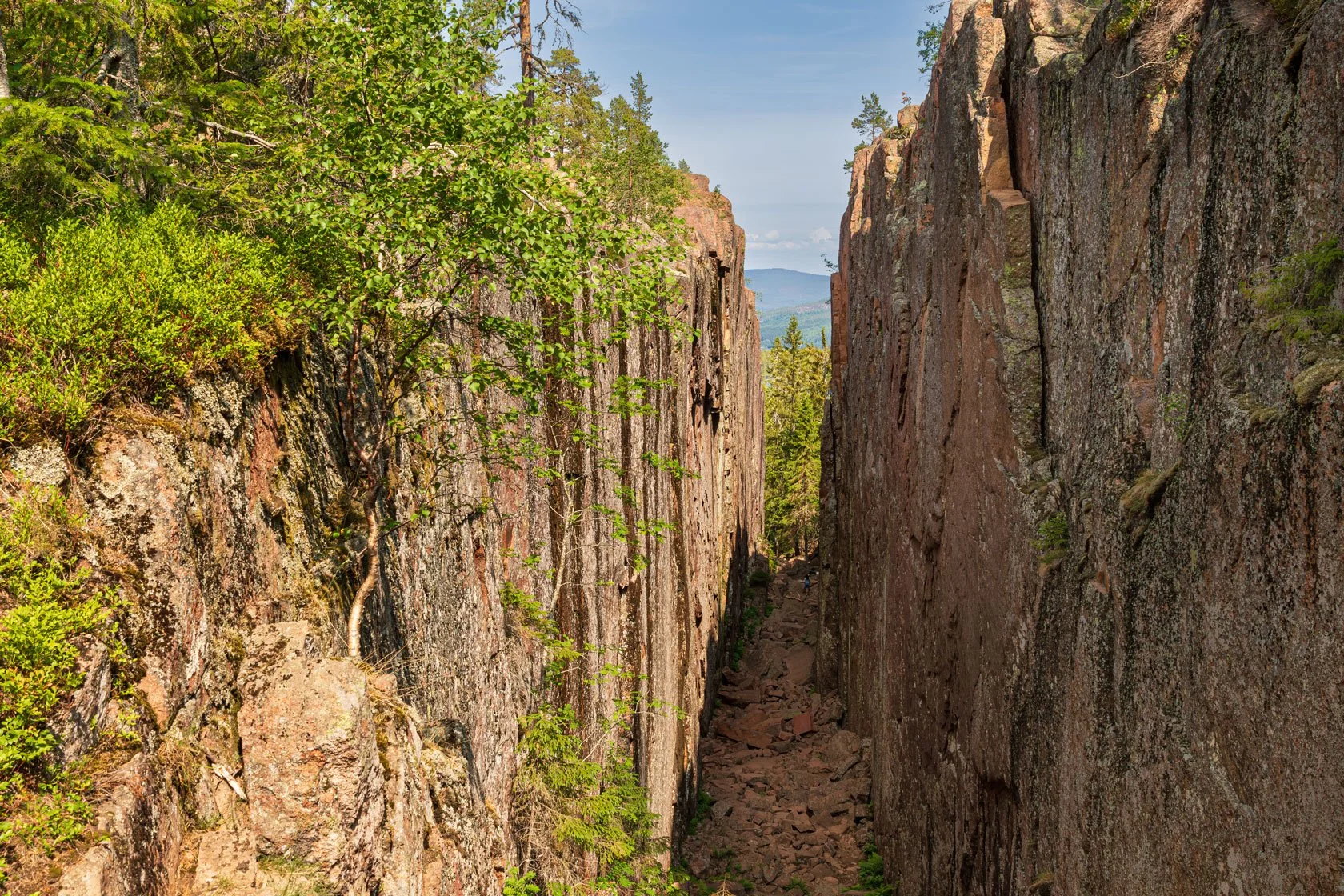
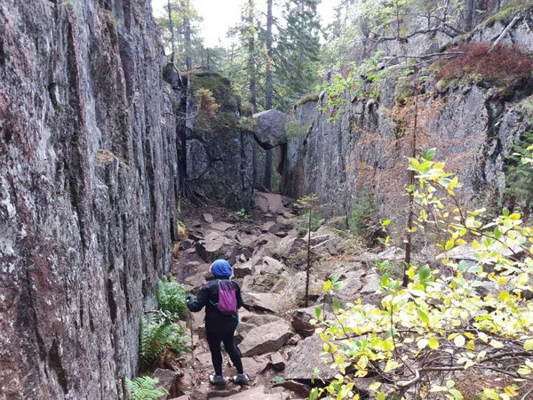
Slåttdalskrevan crevice, Skuleskogen National Park. An iconic “must-see” spot in the High Coast.

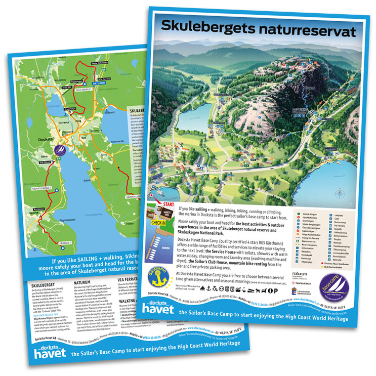
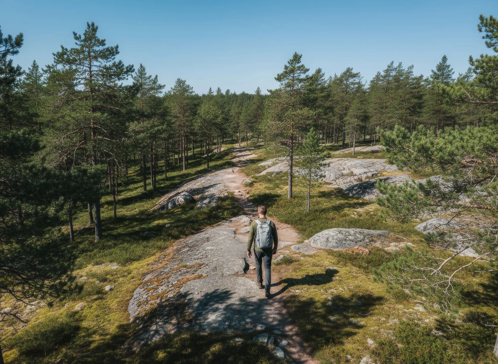
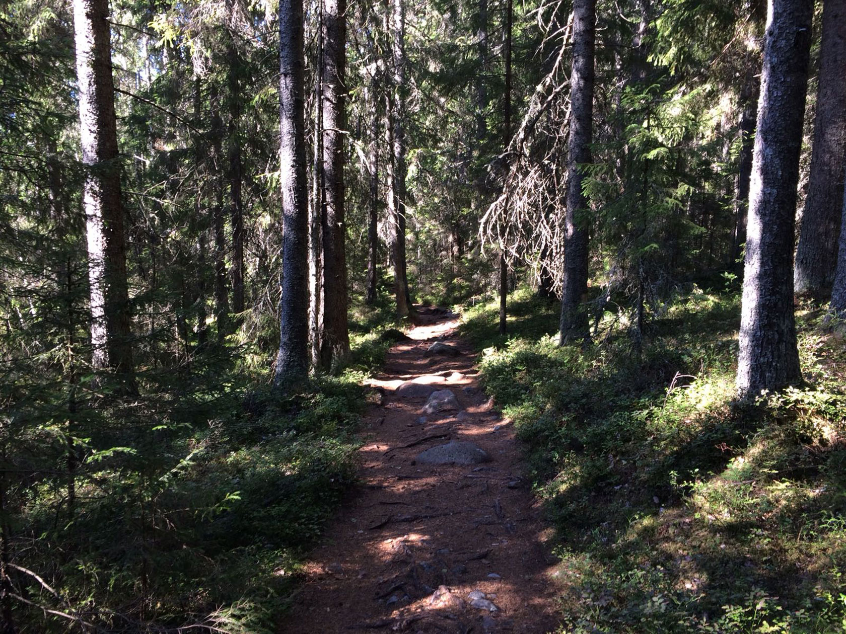
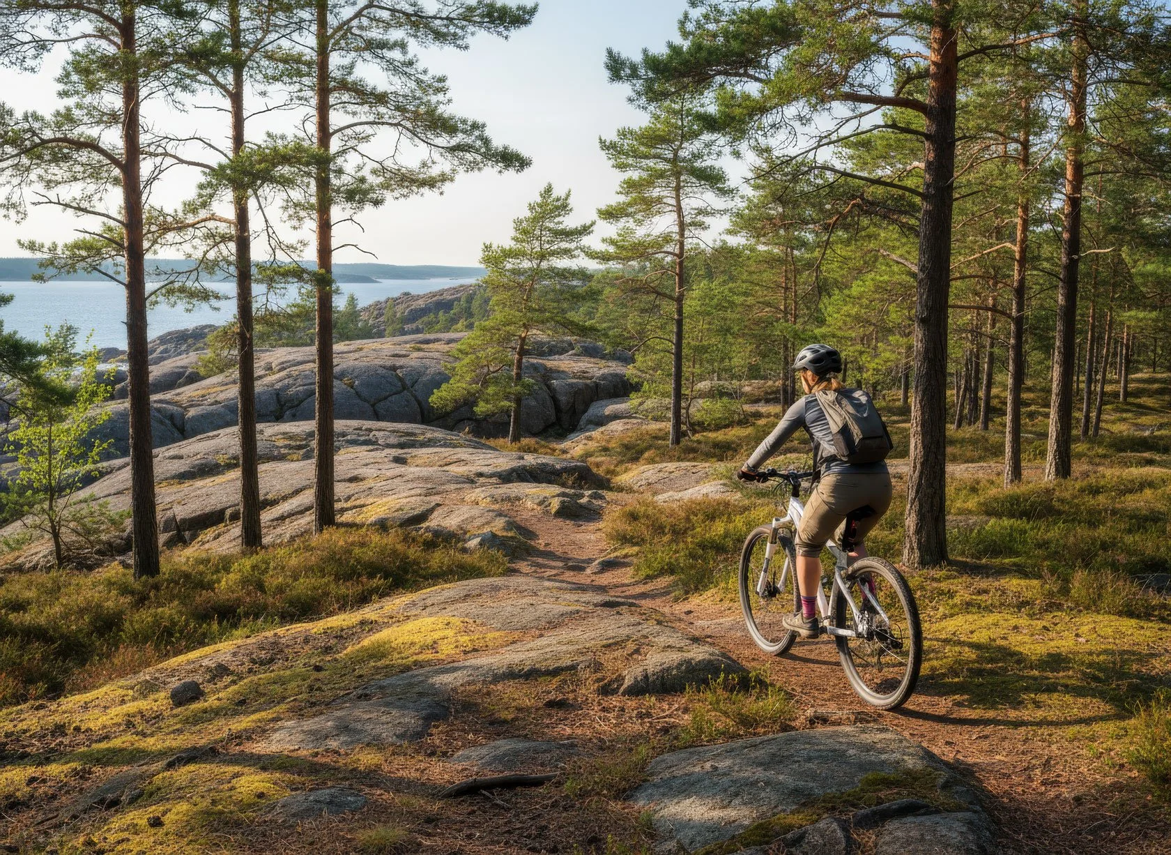
From Docksta, Skuleskogen National Park is the obvious first choice—and the easiest way to make it work is to start from Entré Syd. It gives you a clean, sailor‑friendly day plan: a proper High Coast hike with big landscapes, without turning shore leave into a transport puzzle.

There’s one loop from Entré Syd that’s become a favourite among sailors — our signature shore‑leave hike, and it’s increasingly shared between crews planning their High Coast stop. If you tell me your time window and the weather, I’ll point you to the best version (and you’ll find the detailed trail posts linked below).

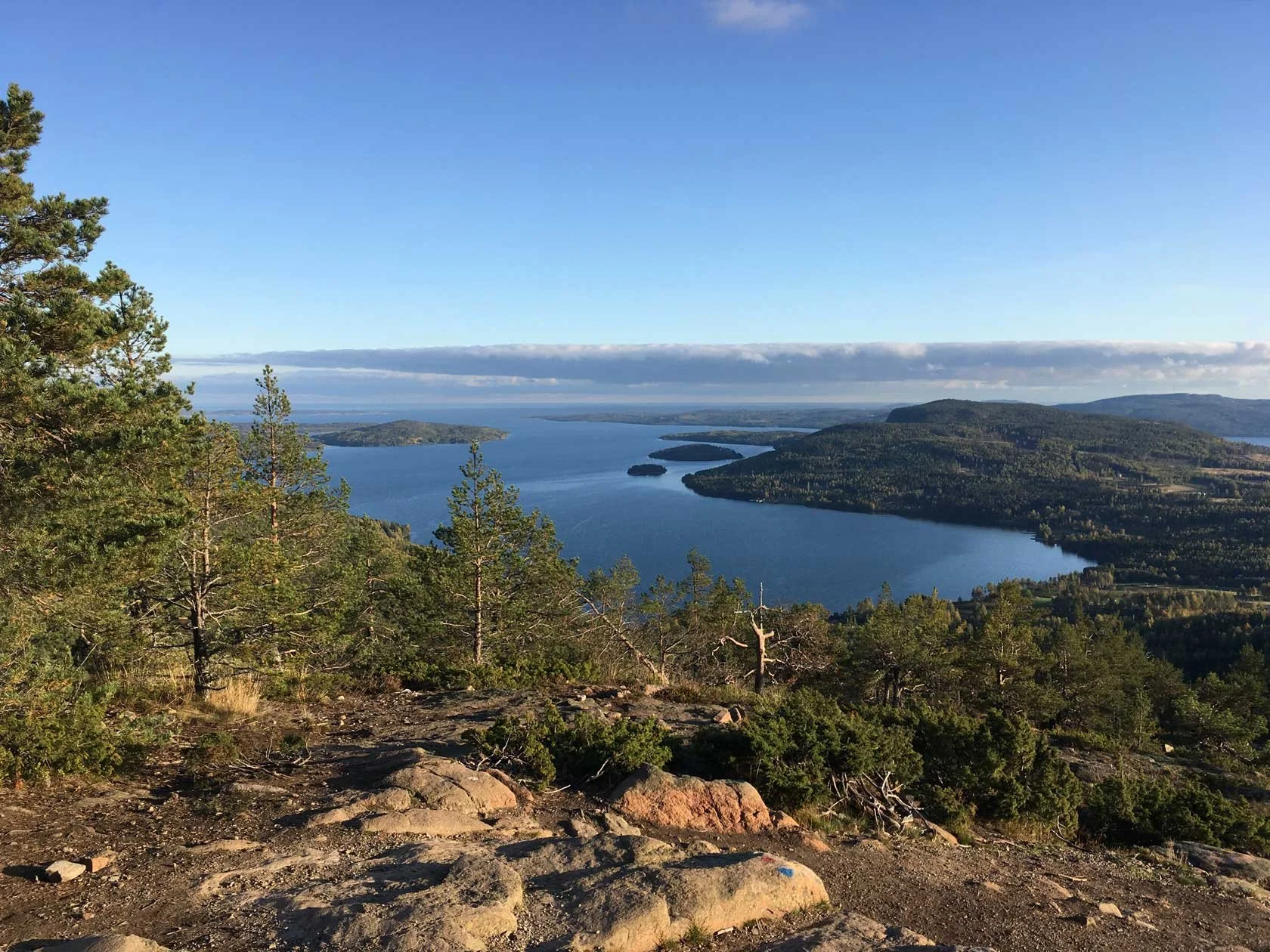
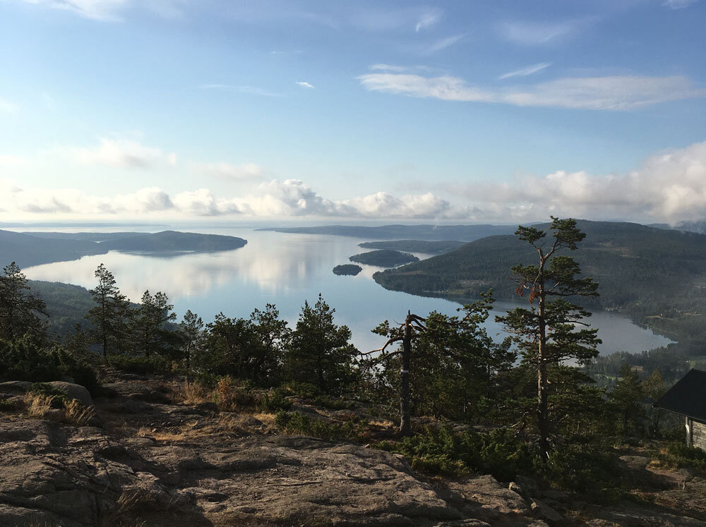
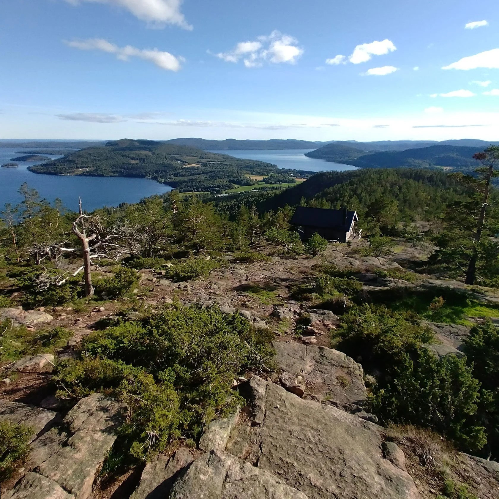
View over the High Coast fjords from the top of Skuleberget — one of our key places in Docksta. If you want the best way up (and the best loop), start here (Docksta Havet Base Camp).

For day two (or a shorter “high reward” option), Skuleberget is right there: the Naturum museum, Via Ferrata, classic summit trails, and the chairlift are all part of the same compact area—exactly the kind of shore leave sailors look for when they want maximum experience with minimum hassle.

Below you’ll find links to our Skuleskogen and Skuleberget guides (routes, timing, and Plan B options).

Via Ferrata Skuleberget (Docksta) — one of the High Coast’s most iconic adventures.


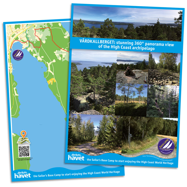
Free mini-guide for High Coast sailors

Planning your stop in Docksta? Download the High Coast Sailor Mini‑Guide: practical shore-leave ideas, what to do with 24–72 hours, and the simplest ways to reach Skuleskogen and Skuleberget.

Get it here: High Coast Sailor Mini‑Guide

It’s the fastest way to plan a 24–72h stop.


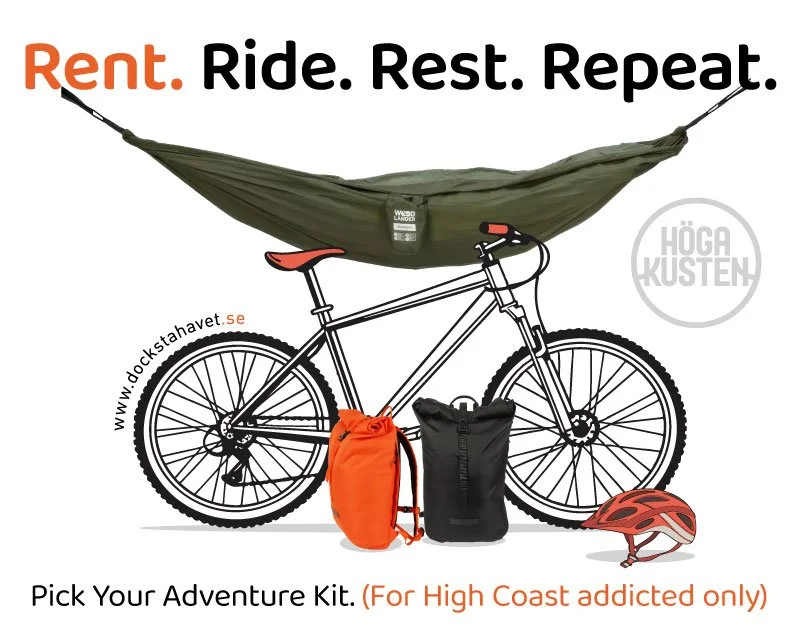
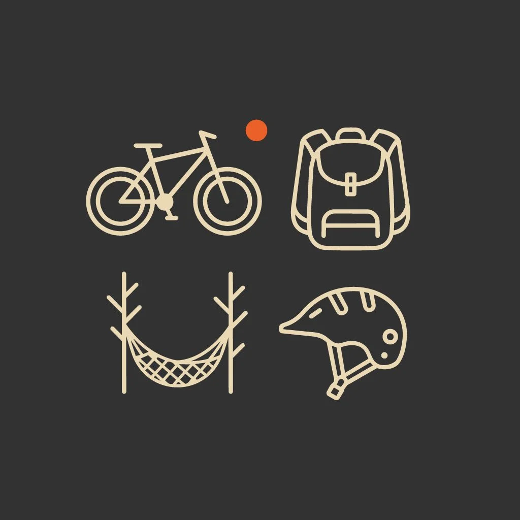
Grab&Go: shore leave mobility (bike rental, made simple)

This season we’re introducing Grab&Go: a simple way to unlock a real outdoor day even if you arrive without gear or a car. It starts with bike rental, but the idea is bigger than bikes: it’s “base-camp mobility” for sailors—quick, flexible, and built around the High Coast day rhythm.

Message me your ETA and your plan (Skuleskogen / Skuleberget / bad-weather option) and I’ll tell you what setup makes sense.

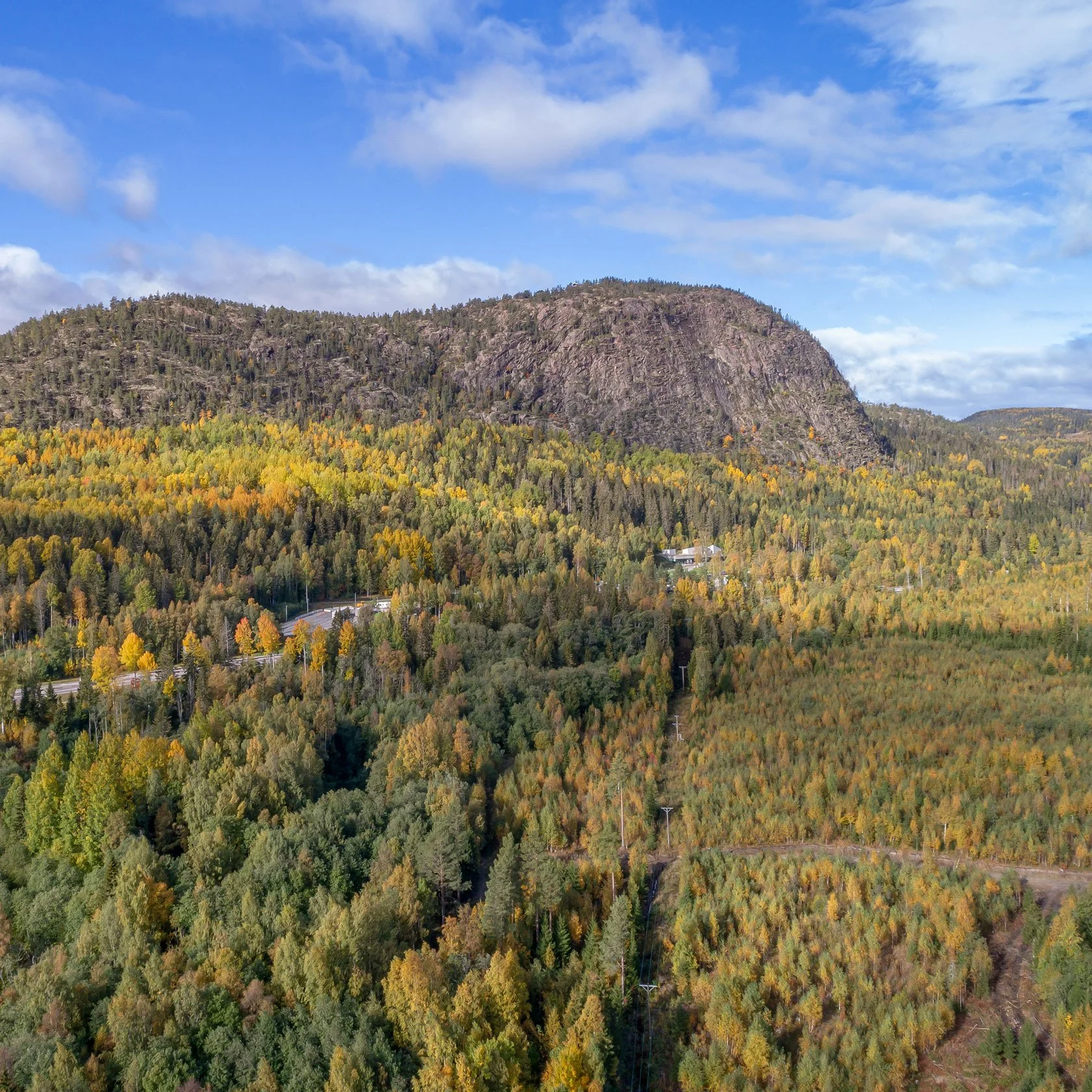
East side of Skuleberget — the unmistakable profile of Docksta’s home mountain.


The Sailor’s Club House (simple, but it changes the day)

Between sea and forest, you need one thing: a place to reset and plan.

Our Club House is that point: espresso, a warm corner to sit down, and the kind of small local guidance that saves you hours of trial-and-error when you only have one or two days.


Getting here + essentials in Docksta (E4 + shore logistics)

Docksta sits right by the E4, which makes it surprisingly easy for crews and visitors to connect by car or bus.

In the village you’ll find the basics you actually need on shore leave:

  • Grocery: ICA supermarket

  • Fuel: available locally (message me and I’ll point you to the quickest option based on your timing)

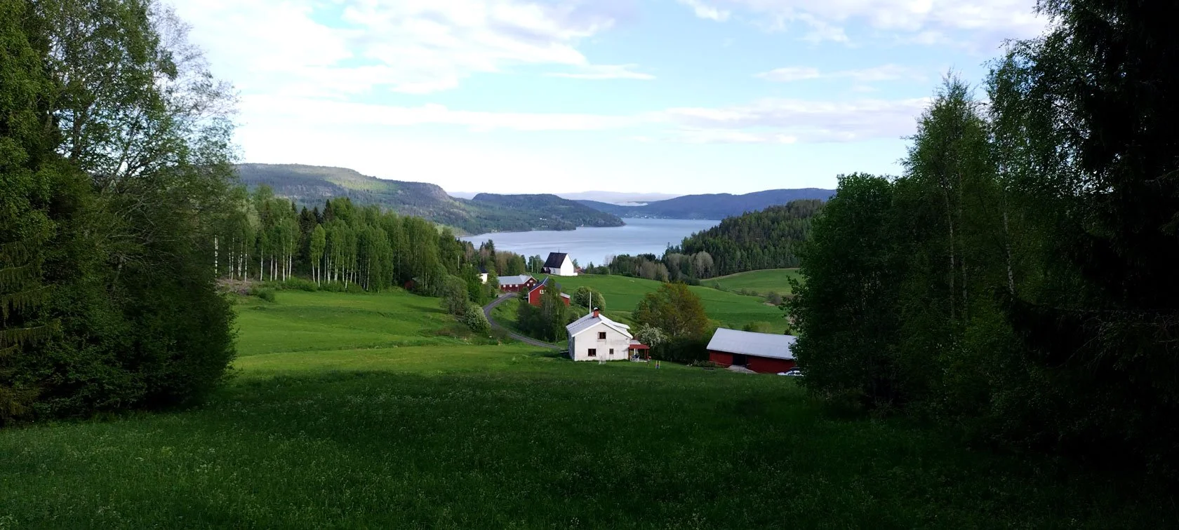
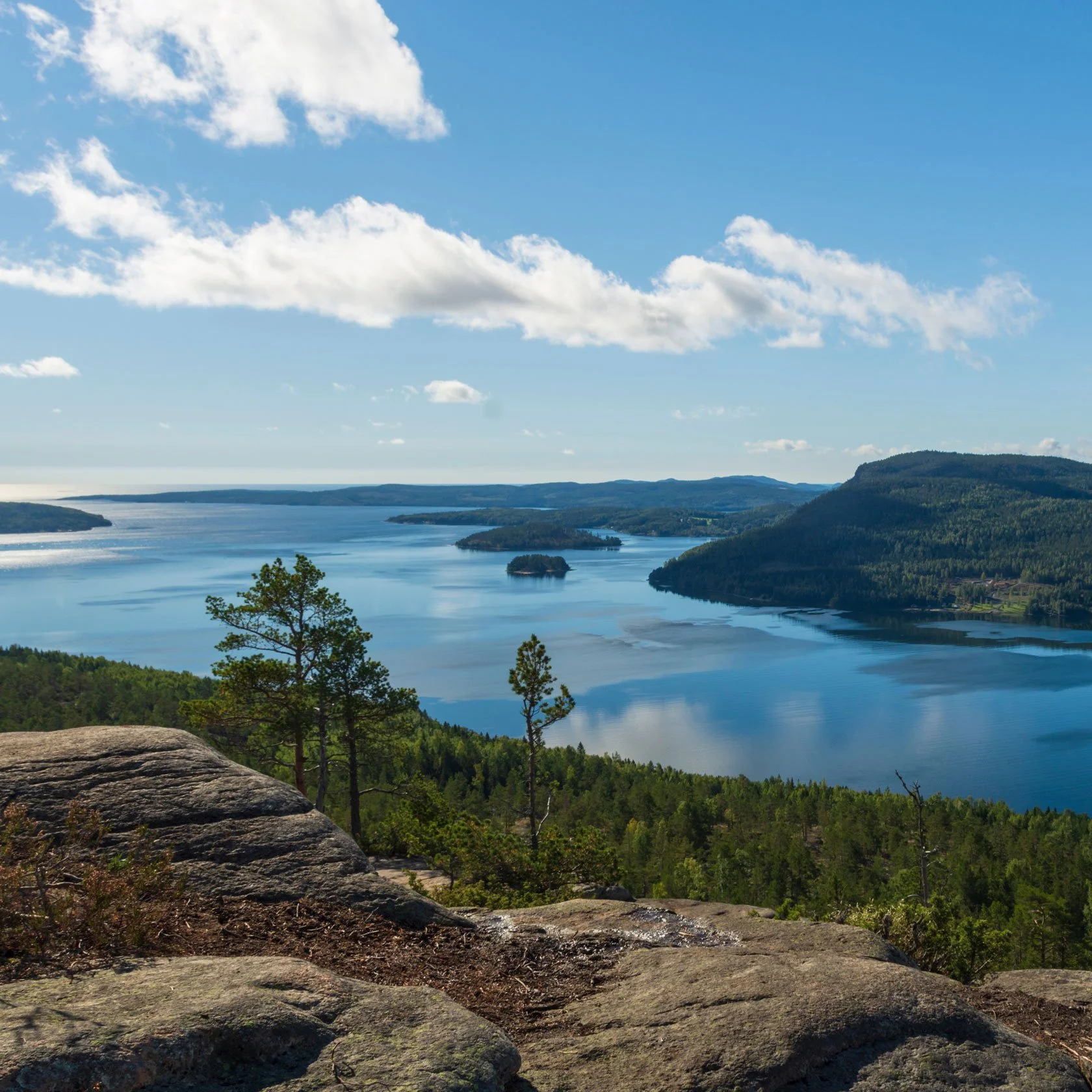
Panoramic view over the Docksta fjord, looking out from the area around Docksta’s old medieval church.


Suggested plans (choose your shore leave window)

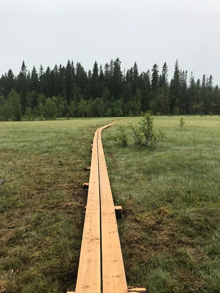
Boardwalk trail through the wetlands of Nätra Fjällskog Nature Reserve — a perfect day trip by bike from Docksta Marina.

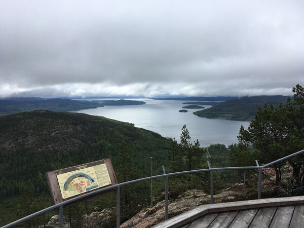
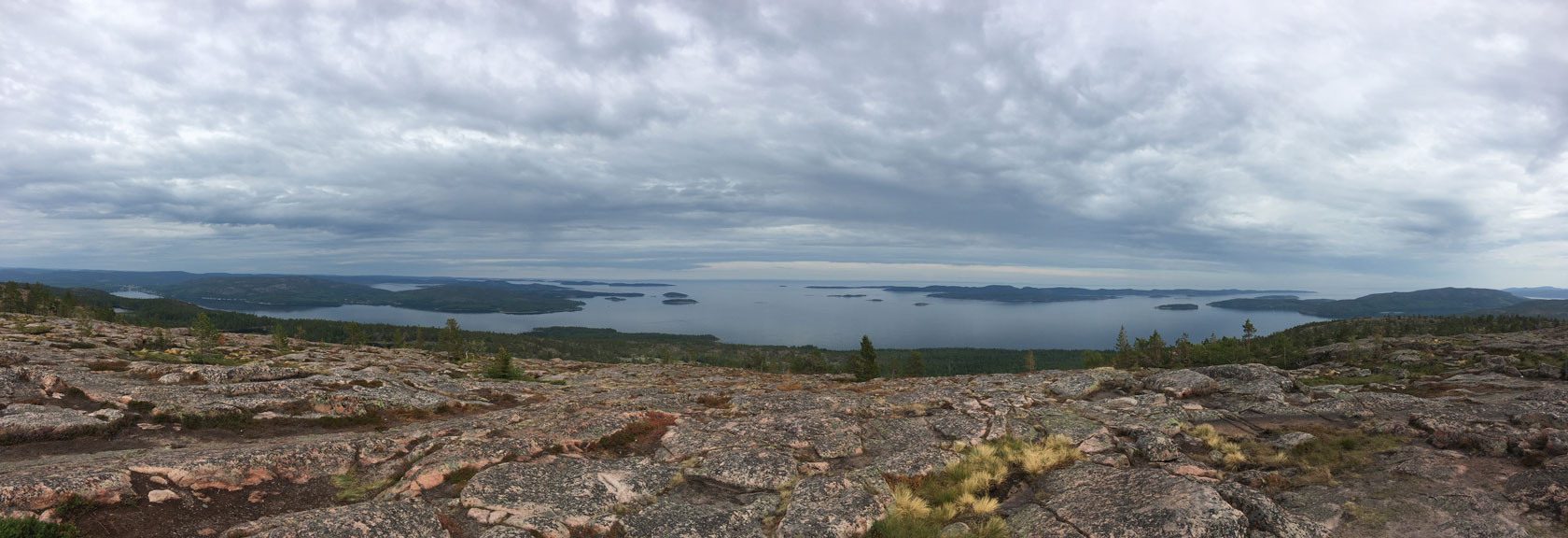
Panoramic view over Docksta’s two fjords from Skuleberget.

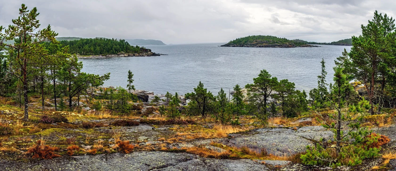
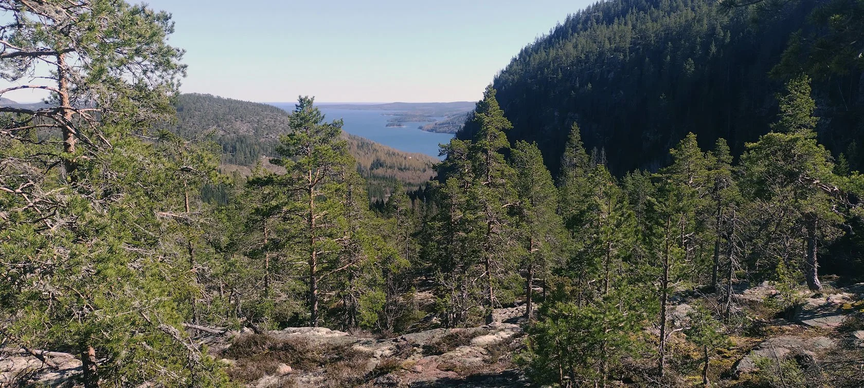
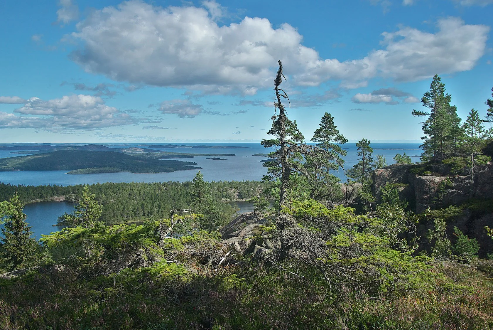
High Coast Archipelago view from the top of Slåttdalsberget, Skuleskogen National Park.

  • 24 hours: the “proper reset”

    Arrive, tie up, and keep it simple: a short outdoor loop, a viewpoint, and a calm evening. If the weather is unstable, I’ll point you to the best “low-risk, high-reward” option for the day.

  • 48 hours: Skuleskogen day + easy second day

    One full day for Skuleskogen National Park, then a second day for a shorter hike or Skuleberget—with time to enjoy the harbour and actually rest.

  • 72 hours: the High Coast base camp rhythm

    This is the sweet spot: one bigger trail day, one flexible day (bike + hike or archipelago mood), and one day that stays open for weather. You get the High Coast feeling without rushing.

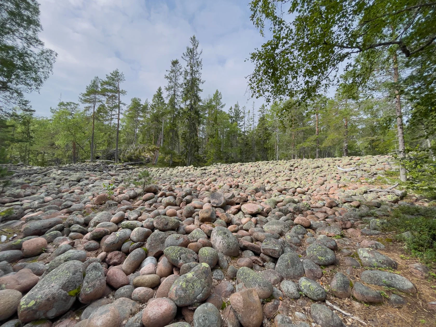
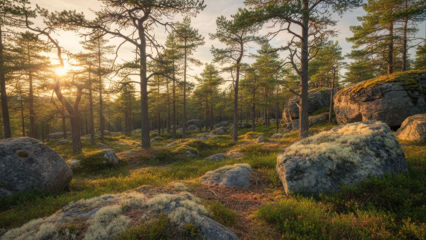
A classic klapperfält (boulder field) — one of the High Coast’s most distinctive landscapes.


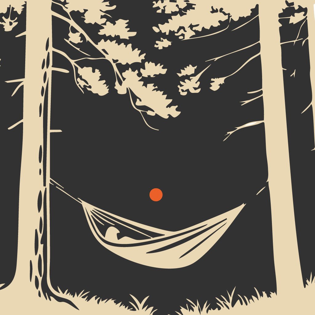
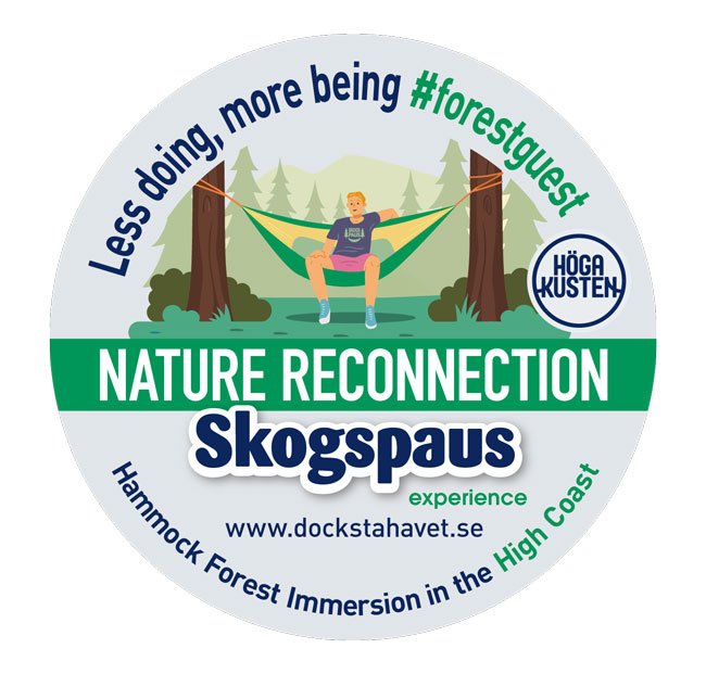
Skogspaus: a 3-hour forest reset (bookable on Airbnb)

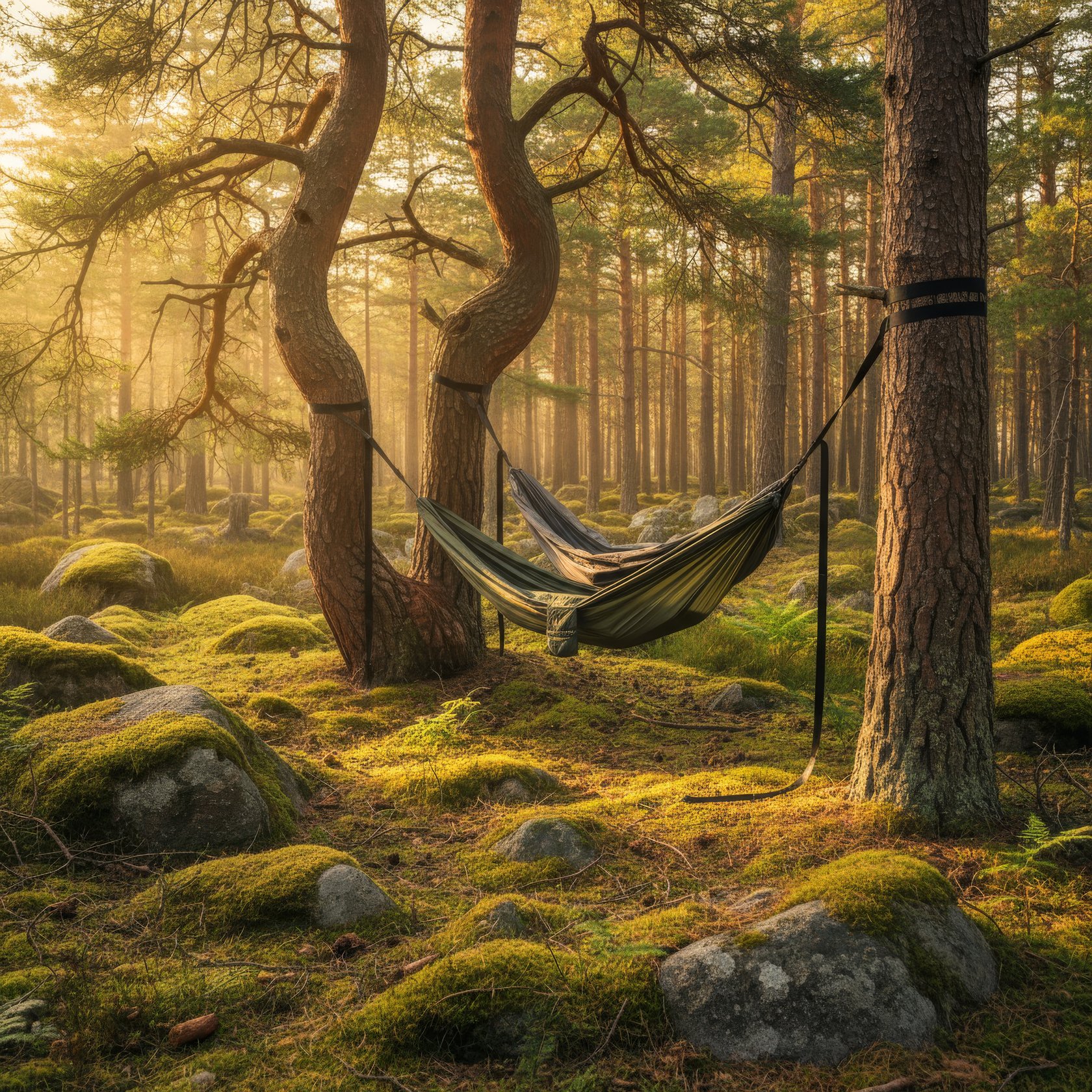
If you want a different kind of shore leave—quiet, grounded, and surprisingly powerful—there’s Skogspaus, our 3-hour forest immersion. Small groups, simple gear, and a slow rhythm designed to help you reset after days on the water (or long drives).

It’s a new experience for 2026 and you can book it on Airbnb (or message me if you’re unsure which day fits the weather).


Bad weather plan (this is why the harbour matters)

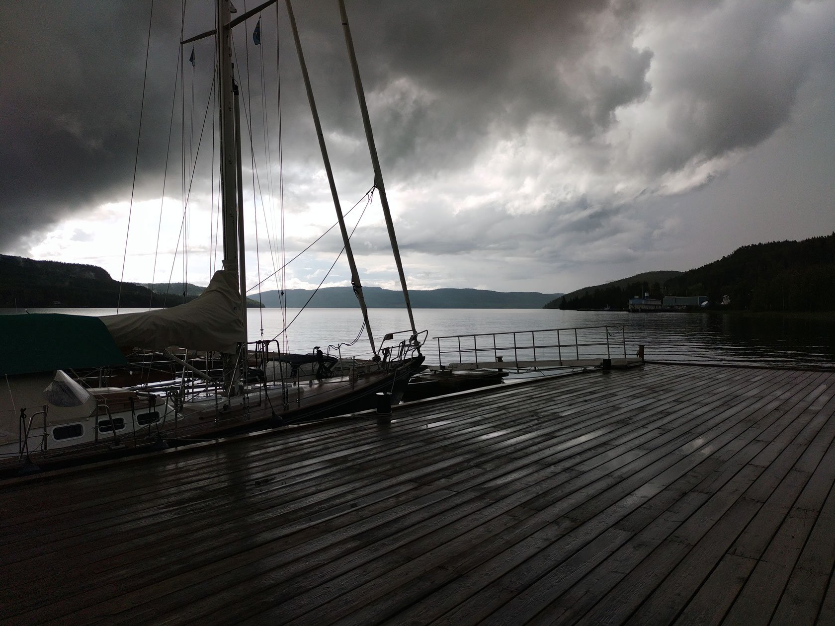
Weather is part of sailing—so your stop should work even when the forecast changes.

At Docksta, you have:

  • Safe, protected moorings — sheltered from the main wind directions. (More detail here: Safe mooring for yachts cruising.)

  • Inland options for your shore leave

  • A real Plan B for hikes and viewpoints (I’ll help you choose based on wind, rain, and timing)


Bonus: my Google Map (pins for sailors)

Open the map below, pick your weather window, and you’ll instantly see the key pins around Docksta: Skuleskogen (Entré Syd), Skuleberget (Naturum, Via Ferrata, chairlift), plus a few favourite viewpoints and shelters.


High Coast Sailors: guides & stories (start here)

Below you’ll find a small library of practical shore leave ideas: practical shore leave ideas, how to move inland, simple planning notes, and local “what works today” guidance.


Explore by category (if you’re planning ahead)

If you’re the kind of sailor who likes to save a few good ideas before casting off, this is your shortcut. Our blog is organised like a small base camp library: practical shore‑leave routes, local timing notes, and “what works today” plans—each one built around a different way of exploring (and a different kind of crew mood).

  • For exploring the High Coast: start here—essential routes, day‑trip logic, and “what makes sense today” planning

  • For Sailors: safe mooring, shore‑leave plans, and sea‑to‑mountain days from Docksta

  • For Hikers: Skuleskogen, viewpoints, trail notes, and weather‑proof alternatives

  • For Trail Runners: flow trails, vertical days, and High Coast running routes

  • For Bikers: bike days, bike + hike combos, and simple mobility without a car

  • For Workation: quiet weeks, shoulder season, and a slower rhythm for focused days

  • For Outdoor Enthusiasts: Gear rental / Outdoor Ready Grab&Go ideas, and micro‑adventures close to the harbour

  • Forest Pause Experience: Skogspaus stories and the 3‑hour hammock forest reset

Pick the category that matches your forecast (and your crew), and you’ll land on posts that make planning feel simple.


Arriving soon?

To plan fast, grab the High Coast Sailor Mini‑Guide first—then message me your ETA and I’ll help you choose the best shore leave plan for the weather window.

Message WhatsApp or call the harbour host: +46 763136628
Tell me your ETA + what kind of shore leave you want (Skuleskogen / Skuleberget / bike day / bad-weather plan).


A note from your harbour host

I’m Tommaso. I live the High Coast from these piers in Docksta—where the sea meets the mountains—and I love helping crews turn a simple stop into a real shore‑leave adventure. When you arrive and you see me on the docks, say hi. Tell me what kind of day you want (Skuleskogen, Skuleberget, or a calm Plan B) and I’ll point you in the right direction.

Tommaso — harbour host at Docksta Havet

3 days in Docksta: discovering its classic day tours (without a car or a boat)

Exploring-Hoga-Kusten-High-Coast-Docksta.jpeg

If you are lucky to spend your holiday in the High Coast, the Skuleskogen national park, the Ulvön island, and the Skuleberget mountain have to keep a priority place into your summer’s bucket list.

In Docksta, you find the perfect “base camp” to start visit them.


You can even leave your personal means of transport at rest - your own car or boat is not essential to discover the surroundings of Docksta.

Here you have some transportation alternatives:

  • by free bus service, you can reach the nearest entrances of the park;

  • by ferry from Docksta, you can reach the typical fishing village of Ulvön;

  • by walking you can conquer the summit of the Skuleberget just following its beautiful paths or taking the chairlift (if you are not confident with hiking uphill).


DAY 1#

Hiking the Skuleskogen best trails

hoga-kusten-national-park-skuleskogen-hiking-trailrunning-overview-archipelago.jpg

The National Park is the target of a full day spent hiking and enjoying the beauty of the Höga Kusten world heritage outdoors.

The bus starts from Kustlådan campsite 2km south of the village and stops at Docksta Marina on the E4 (just 50 meters from our piers), then it picks up people at the campsites on the southwest side of the Skuleberget and at the museum & Tourist High Coast Center on the east side, and has a last stop to the campsite at Veåsand before to leave you at the southern entrance of the park. From there, you enter some of the best trails and the most popular spots.

This bus service operates during the summer: here you find more info about how to easily reach the park from Docksta with the summer bus >

One spot recommended:

Start visiting the beaches at the Kälaviken bay and walk the suggestive path in the forest alongside the coastline and step on its beautiful spots seaside. In the morning particularly, it’s an amazing walk with the rays of the low sun entering in the wood from the sea.


DAY 2#

Cruising to the charming Ulvön

view-village-of-ULVON-island-high-coast-hoga-kusten-top-spot-from-docksta.jpg

It is the ideal trip to discover the beauty of the archipelago and the magic of a renowned fishing village: for its traditional houses and docks and for the delicacy of its fermented fish, the surströmming.

During the summer, the ferry M/S Kusttrafik starts from the harbor in Docksta every morning at 10am. The cruise along the Docksta and Ullångersfjärden covers the nautical miles to Ulvön in one hour while people enjoy the view of the natural coastline from the deck.

High-Coast-Hoga-Kusten-Ulvohamn-morning-view-from-the-sea.jpg
 
overview-village-of-ULVON-island-from-lotsberget-high-coast-hoga-kusten-top-spot-from-docksta.jpg

One spot recommended:

Don't miss the short walk to the step up at the Lotsberget hill to the high viewpoint over the village and the harbor or an incursion on the coastline close to the bay of Flågstängsberget that faces toward the open sea to east.


DAY 3#

Up-up-up to the Skuleberget

view-from-the-summit-of-skuleberget-mountain-in-docksta-hoga-kusten.jpg

Walking its trails or taking the chairlift to reach the summit, from the top of the mountain the views over the surroundings are always astonishing.

If you're based in Docksta, the slopes of the mountain are one step away from your front door (and from the piers of the Marina, too). But you can also have an enjoyable ride, lock your bike and start hiking, taking the chairlift, or visiting the museum about the High Coast World Heritage, or… climbing up a route of the Via Ferrata!

ONE SPOT RECOMMENDED:

The Naturum Höga Kusten Museum lies at the foot of the Skuleberget mountain about 3 km walking or biking north of the village: if you want to know more about the highest uplift of the land in the world, and geology & landscapes of the High Coast, start there!


Staying in Docksta even few days during your holiday, you will notice that there is no shortage of things to discover and do around here outdoor.

If using your car isn't in your plan or you decided to safely dock your boat, start from here to discover the coastline and inland beauty of the High Coast, where the heart of the world heritage beats even stronger.


FREE HIGH COAST INFO MAPS:

HANG YOUR #HÖGAKUSTEN PASSION ON A WALL:


We suggest you these readings:

Skuleskogen National Park without a car: Docksta as a simple starting point

Skuleskogen National Park: overview of the High Coast archipelago from Slåttdalsberget hill.

Skuleskogen National Park

Updated: December 2025 — now includes a more reliable car‑free planning approach and official maps.

This article was originally written with seasonal bus info in mind. It’s now updated to help you plan a smooth Skuleskogen day even when public transport isn’t running.


For years, reaching Skuleskogen National Park without a car was easier thanks to seasonal public transport. In recent years, this service hasn’t been running every season, so it helps to plan a car‑free day with flexible options.

Instead, think of it as a better kind of day: a ride + hike adventure.

Starting from Docksta (Docksta Havet Base Camp), you can turn the commute into part of the experience. The ride to Skuleskogen is around 10 km, on a mix of paved road and gravel. You follow the coastline of Norrfjärden, then continue on a newer road that crosses the forest towards the park’s South Entrance. It’s generally easy, with a few gentle ups and downs.

It’s not “zero effort” — but it’s a beautiful way to arrive: you warm up, you slow down, and you enter the park already in the right rhythm.

Docksta is a practical starting point for Skuleskogen — especially for Airbnb guests, sailors on shore leave, and travellers who prefer a simpler, flexible plan.

Below you’ll find official resources (maps + visitor info), a few highlights, and a straightforward car‑free mindset approach to planning your day.

Quick plan (no car, no stress)

  • Start: Docksta Havet Base Camp (Docksta marina)

  • Goal: Skuleskogen National Park (day hike)

  • Mindset: ride + hike (the commute becomes part of the experience)

  • Traveling light? You can rent a bike, a daypack, and a hammock kit (hosted at the marina, no deposit, flexible return)

  • WhatsApp us: we’ll confirm availability + suggest the simplest route for today.

The southerly entrance of Skuleskogen is the nearest to the Slåttdals crevice (Slåttdalskrevan).

Public transport note (check each season)

The World Heritage Bus (Världsarvsbussen) ran with a summer timetable in 2023. Always double-check current info before planning.

Source: www.hogakusten.com/en/world-heritage-bus

 
Overview of Docksta Havet guest harbour. Photo © Courtesy of Mia Wålsten S/Y Atla3

Picture above: Docksta Havet Base Camp

The Docksta starting point (why it works)

Docksta is a natural base for exploring the High Coast because you can combine:

  • Seaside stays (Airbnb) and a safe guest harbour / marina (leave your boat while you explore on land)

  • Local, real-time advice (weather, daylight, trail conditions)

  • A flexible day plan that doesn’t depend on a single timetable

If you’re staying with us (or passing by), just ask — we’ll suggest the simplest way to plan your Skuleskogen day based on your pace and the conditions.

From Docksta, the most straightforward access point is Entré Syd (South Entrance) — a simple starting point for a ride + hike day.

At Docksta Havet Base Camp we also run Outdoor Ready / Grab&Go — simple bikes + essential gear for a smooth day in nature without overplanning.

Grab&Go (Outdoor Ready): bikes, daypacks, hammock kits — pricing & how it works →


Official Skuleskogen resources (recommended)

If you want reliable, up-to-date information, these are the best starting points:

  1. Official park overview (Sveriges Nationalparker)

  2. Visitor information (rules, seasonality, practical notes)

  3. Skuleskogen - Official PDF folder (English) (Länsstyrelsen)

If you want a simple hiking-oriented overview (what it feels like, how to pace your day, and what to expect), read about my recommended trek at Skuleskogen.

Free Info Maps about the High Coast
 
Hiking the natural paths into the Skuleskogen forest

Why Skuleskogen is worth a full day

Skuleskogen is one of the few remaining large, ancient forests of the coastal region. Red Nordingrå granite cliffs, the uplifted coastline, and dense coniferous forest — with rare species of lichens — shape the park’s character.

Main attractions include:

  • Spectacular views over the national park’s dramatic landscape and the surrounding High Coast

  • The 7-metre-wide, 30-metre-deep “Hell Gap” crevice (Slåttdalskrevan), which cleaves Slåttdal mountain in two

  • Hiking the natural paths deep into the Skuleskogen forest


A simple car-free mindset (practical, not technical)

  • Plan your visit as a full-day outing (so you’re not rushed by logistics)

  • Keep your plan flexible (weather and daylight matter)

  • Bring the essentials: good shoes, water, a wind/rain layer, and lunch

  • If you want the easiest version, start from Docksta and ask for the best “today plan” (we share the most suitable starting point and route idea based on conditions)

If you want to visit Skuleskogen without a car, we can help you keep it simple:

  • Bike Rental (Grab&Go) — best for a ride + hike day plan

  • Perfect Forest Day Kit — bike + daypack + hammock kit (for an easy “full day” setup)
    → Grab&Go Pricing & Booking


Make it easy (Outdoor Ready / Grab&Go)

Many travellers arrive without a car — and often without the right gear for a full day outside.

With Outdoor Ready / Grab&Go, you can keep it simple: bike access, a daypack, and the small essentials that make the day smoother.

Ask us at Docksta Havet Base Camp and we’ll match the setup to your pace, weather, and daylight.


What to bring (quick checklist)

  • Good shoes (grip matters)

  • Water + lunch

  • Wind/rain layer (the coast changes fast)

  • A small daypack helps

  • Traveling light? Ask us about Grab&Go (bike / daypack / hammock kit)


One last host note

Skuleskogen is best when you’re not rushing. Plan a full day, keep your route flexible, and let the park set the pace.

Need help planning today? Ask us at Docksta Havet Base Camp — we’ll suggest the easiest car‑free plan and the right Grab&Go setup.

Looking for more local day trips? Explore our Guides & Stories >


Hang your #HÖGAKUSTEN passion on a wall:

SAFE-MOORINGS-SKULEBERGET-SKULESKOGEN-docksta.jpg

Sailing to Skuleskogen: the National Park between land and sea

One of the best green breaks, in your cruise discovering the High Coast, is a visit to the National Park of Skuleskogen.

The National Park designation is the best a nature area can receive, as well as unique locations of outstanding natural beauty which ensure that nature can be fully experienced.

Skuleskogen is close to Docksta Havet Base Camp so - by bus, or walking/biking from the piers - it's a fantastic destination after your days of serious sailing around the coast!
 

Explore the Skuleskogen National Park sailing the High Coast in Sweden

Suggestions for cruising in the High Coast:
Sailing to Skuleskogen National Park to enjoy its stunning natural beauty

Sights:

  • The views over undulating forest and the sea.

  • Slåttdalsskreven.

  • The Kalottbergen mountains and their forested peaks and bare slopes.

  • The flora.

  • The Bronze Age barrows.

Area: 2,360 hectares. 
Established: 1984, extended 1989. 
 

Location: Approximately 40 kilometres south of Örnsköldsvik in Örnsköldsvik and Kramfors municipalities, Västernorrland County.

Visiting Skuleskogen: Signs on European Highway E4 show the way to the national park. There is an access road from the south via Käl, and from the north via Näske. The High Coast Visitor's Center (Naturum Höga Kusten) provides an introduction to the park´s human and natural history. There are 30 kilometres of hiking trails, as well as three sleeping cabins and two shelters that are open year around.

Skuleskogen National Park is a wild and majestic section of Ångermanland’s “High Coast”, where the rolling hills of the Norrland forest meet the northern Baltic Sea. This roadless wilderness offers the visitor magnificent views over sea and forest, beautiful lakes, verdant spruce-clad valleys, and fascinating geological formations which, more clearly than anywhere else, demonstrate how much of modern Sweden has risen from the ancient sea.

This national park is a heavily undulating rift valley adjoining the coast, featuring forest and outcrops of flat bedrock, in untouched condition where vegetation and animals have been able to develop freely. This area will offer the visitor the opportunity of enjoying fabulous experiences of unspoilt nature. Features especially worth seeing are Slåttdalsskreven, a gorge, 200m long, 40m deep and 7 metres wide, the bronze age cairn, extensive shingle fields, interesting vegetation and, not least, magnificent views of the archipelago. There is a total of thirty kms of marked trails which offer the hiker several alternative circular routes. The High Coast trail crosses the national park. Overnight cabins are located at Skrattaborrtjärn, Lillruten, Tärnättvattnet and Näskebodarna. (Font: www.y.lst.se)


HIGH COAST SAILOR'S TIPS:

Sailing to the heart of the World Heritage: experience Skuleberget and Skuleskogen National Park >


Skuleskogen National Park (1984) and Nordingrå Nature Conservation Area (1983) are classified Category V - Protected Landscape/Seascape: protected area managed mainly for landscape/seascape conservation and recreation - and defined as "Area of land, with coast and sea as appropriate, where the interaction of people and nature over time has produced an area of distinct character with significant aesthetic, ecological and/or cultural value, and often with high biological diversity. Safeguarding the integrity of this traditional interaction is vital to the protection, maintenance and evolution of such an area."

The purpose of Skuleskogen National Park is to preserve in unspoiled condition a coastal landscape of forest, rocky terrain, fissure valleys and steep rolling hills where plant and animal life may develop naturally. (Font: www.naturvardsverket.se)


Skuleskogen is a stupendous area. It combines high mountains, ancient forest and sea coast in a landscape which is without equal in Sweden. Pronounced peaks covered with windswept rocky pine forest are divided by deep rift valleys sculpted by the sea and the inland ice.

There are, in spite of the deserted appearance, traces of human habitation. The oldest of these are Bronze Age burial cairns. The inland ice was unusually heavy here, and pressed the mountains down under sea level. The country has been rising from the sea ever since, to reach today's level of almost 300 metres above sea level. There are also bare boulder fields, swamps and tarns in the park.

The fertile stream valleys are home to many species of bird, such as the very rare grey-headed woodpecker. Several Swedish plants have their most northerly limit in Skuleskogen, for example the decidious trees maple, lime and hazel. The trees are probably relics from warmer ages when deciduous forest was found this far north.

The foremost sights of Skuleskogen are the views of the rolling forest and the sea, Slåttdalsskrevan ravine, Kalottberget mountain with its forested top and treeless slopes, the flora and the Bronze Age burial cairns.

(Font: www.naturvardsverket.se and www.y.lst.se)

Your boat safely moored to start exploring Skuleskogen and Skuleberget