This excursion covers the most breathtaking spots, making it ideal for those who love to explore Skuleberget Mount. You will find described two manageable few-hour walk that will take you to the summit and allow you to visit the Naturum Museum about the High Coast World Heritage site.
They accomplish this by following some of the most well-known pathways inside the unique mountain environment and its natural reserve, enjoying a leisurely stroll around the top, and including the panoramic descent down the Höga Kusten Stigen segment into each itinerary.
The foot of the mountain can be reached in less than two kilometers from the marina in Docksta.
The paths of the excursion allow you to visit the museum if you so choose, which is located on the eastern side of the mountain (if you go there riding, you can leave the bike at the museum before starting the hike).
Turn right toward the gas station after crossing the bridge heading toward the school, and then continue on the road next to the E4. Continue on the route that retains the mountain to your left after a few hundred meters by staying to the right.
The relief you see from Docksta is the southern portion of the Skuleberget, called the Litoberget (224m a.s.l.). You will pass it on the way back as you descend from the top of the Skuleberget along the Höga Kusten Stigen trail.
To reach the museum by arriving from Docksta, there is a pleasant terrain road between the mountain and the highway, which is less than two kilometers from the end of the village and quite flat.
📍
Naturum is where you begin your journey to the summit.
About Naturum
The museum was built in 2007 right under the vertical walls on the eastern side of Skuleberget. Here are also the 5 slopes on the equipped wall of “Via Ferrata”, which attracts climbing enthusiasts from all over Europe.
The Naturum Höga Kusten Museum serves as the starting point for anybody interested in learning more about the history of the High Coast and the network of nature heritage sites that crisscross the coast. The elevation of the terrain served as the rationale for the site's designation as a World Heritage Site. There are always both temporary and permanent exhibitions, along with additional events throughout the spring and summer. With unique information bars that provide visitors with information on the many themes, the show, which looks at land uplift, geology, and living on the High Coast, adopts a contemporary and lighthearted approach.
Reaching the top of the Skuleberget is an enjoyable excursion, and it is within reach of everyone. Simply appreciate the pathways and ascend in a relaxed manner. There are plenty of indicators, and the paths are clearly marked.
What’s the recommended route?
👇
Hike the “Eagle” path or the “Lynx” path uphill to the summit of Skuleberget and then follow the “Höga Kusten Stigen” path to return down.
I suggest you have two options of routes to climb: the first (in GREEN on my map), along the path that leads right next to the museum. The second (in LIGHT BLUE) slides from the east side to the north side of the mountain, offering panoramic views and really fascinating areas in the forest.
The difference in altitude on these pathways is less than 300 meters (EAGLE segment D+213m; LYNX segment D+227m), but you don't have to think of the experience as a straightforward stroll. The Skuleberget has all the characteristics of a mountain, despite its height, which should lead us to classify it as a hill. Even the most seasoned hikers should give their paths due thought and respect.
Option #A:
up along the EAGLE segment
This steep trail takes you to the summit in a little more than 800 m, overcoming almost 250m of dislevels along a rather vertical route that also leads, with a short indicated deviation, to visit the cave.
The cave is known as Kungsgrottan or Rövar Grottan, is a round cave formed from erosion by sea waves thousands years ago.
This path is indicated on the sign as “Grottsstigen”. Mountain riding enthusiasts have nicknamed it “Eagle”, and it is one of the most challenging segments of the five trails that lead to the summit.
You won't have really “to climb” along this path, but you will need appropriate footwear and a little climbing attitude! You will walk on stones, rocks, and roots; some points are challenging but absolutely safe; and with iron steps, you will run to overcome the most vertical sections.
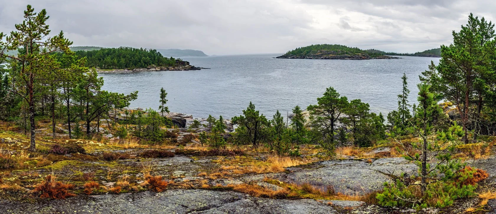
The stunning scenery, which includes the national park to the west and the Norrfjärden and archipelago to the east, will make the effort well worth it. You'll be glad you made the journey when you reach the peak.
A couple of tips related to the EAGLE segment 👉 when it's raining or the ground is wet, take an alternate path to ascend instead of facing down the Grottanstigen. This is not the road for your dog if he is with you.
Option #B:
up along the LYNX segment
The second track climbs to the top following the “Blå stigen / Östra bergsstigen” trail. You can catch it by continuing from the museum to the north along the route of the Höga Kusten Leden in just over 800 meters. On the left, after the paths leading to the trails of the Via Ferrata, starts the “LYNX” segment, which on the signs you will see indicated as Stigen/Norra Stigen.
It is a beautiful route and probably the most suggestive to walk. You can see, especially in the first part, the high vertical walls on the side of the railway roads, which fall into the most impervious forest of the trail, and the characteristic subforest of these woods, with moss on the rocks, the roots appearing, and the remains of tree trunks.
A tip related to the LYNX segment 👉 in the warmer summer days (sometimes they are damp even at these latitudes), this is the route to climb that offers the most cooling. In the morning, in particular, this is the side of the mountain to choose, and then descend instead from the side exposed to the south, which is super-panoramic and sunny.
📍
Finally, you are on top.
Right next to the Toppstugan, there is a panoramic wooden platform where you can find the bronze sculpture “Skrubban” by Hans Hedberg, a tribute to the small island of the same name that lies south of Trysunda and to the Höga Kusten UNESCO heritage. At the end of the climb, it is tradition to pass by the Skrubban and touch it.
You are about 286m above sea level, at a height that ideally outlines what more or less 10,000 years ago was the coastline of a small, nine-meters-high island (the peak of the Skuleberget, that's now is 295 meters above the sea level) that emerged from the surface of the sea, completely surrounded by ice during the last glacial period.
Today, there is a path marked with red signs on rocks and trees that runs on this hill on a circular path around the summit of Skuleberget. The “Kalottstigen” is a fairly flat walk, a little more than a kilometer long, offering unforgettable panoramic views. I suggest you take this trail; maybe stop for a break with your breakfast in the bag before starting the return route.
A panoramic route back:
Go down the Höga Kusten Stigen trail enjoying the sea views.
The sunny path with views of the sea, called “Höga Kusten Stigen”, was opened in 2017 on the south-facing side of Skuleberget to welcome new hikers to the world's highest shoreline at 295 meters above sea level, connecting Friluftbyn to the summit of the mount.
It is a very panoramic trail (in BLUE on the map) that offers views of the two fjords, Norrfjärden and Dockstafjärden, and the main mountains that divert the area: Getsvedjeberget to the East, the Vårdkallberget peninsula (🧭S-E), the particular duck form of Fäberget (🧭S), where the Ullångersfjärden is forced, and Herrestaberget westward (visible from the top of the Skuleberget, on the opposite side of the Gällstsjön lake).
The path begins a hundred meters from Toppstugan, on the left, at the beginning of the ski slopes. You'll see the signs indicating it. It slides down on the southern slope, along a forested crinale that reconnects to Litoberget, and then turns a little east, opening up towards the beautiful view of the fjords and Docksta.
The Södra Stigen continues to descend steeper along endless red granite walls, down to the valley before twisting. On the left, you return to the woods towards the museum; on the right, you turn around the mountainside and descend to Friluftbyn.
Ah! Walking the Höga Kusten Stigen, you descended from the segment nicknamed "FOX,", another of the five paths, along with BEAR and ELK, of the Skuleberget Mountain.
Whatever route you choose to ascend Skuleberget, I'm sure the trail will be etched in the memories you carry from Höga Kusten. I am familiar with all of this mountain's pathways; each has a unique personality and the capacity to evoke strong feelings and memories in you.
🔎 LYNX, EAGLE, FOX, ELK, and BEAR: know more about the five paths that brings you to the summit of Skuleberget Mount >
SET YOUR #HIKING BASE CAMP TO EXPLORE THE HÖGA KUSTEN WORLD HERITAGE SITE:
📍
These waterfront Airbnbs are situated just a step away from the Skuleberget Mount and close to Skuleskogen National Park.
Based in Docksta for your vacation, you can walk to the trails that lead you to the summit of Skuleberget Mount that I have described, and you will be close to the national park Skuleskogen. You can also easily get around by car or by bus, and you will be in the ideal location to start exploring the area. 👉 Take a look at our vacation Airbnb accommodations by the seaside >
Tommaso De Rosa
See my host profile and contact me on Airbnb
If you would like assistance planning your stay in one of our waterfront accommodations at the marina, need hiking advice at Skyleskogen Park or Mount Skuleberget, or have any other questions regarding things to do on the High Coast during the summer, please contact me via the Airbnb chat. You are welcome :)
_Tommaso
Please write me by email or WhatsApp at +46.763136909
P.S. I’m a trail runner passionate. I like to explore new routes with a hiking mindset, especially those on the High Coast. Here below you find what I highlighted in these blog posts.
