Walk in the forest to the “magic” wind shelter of Per-Olsbo

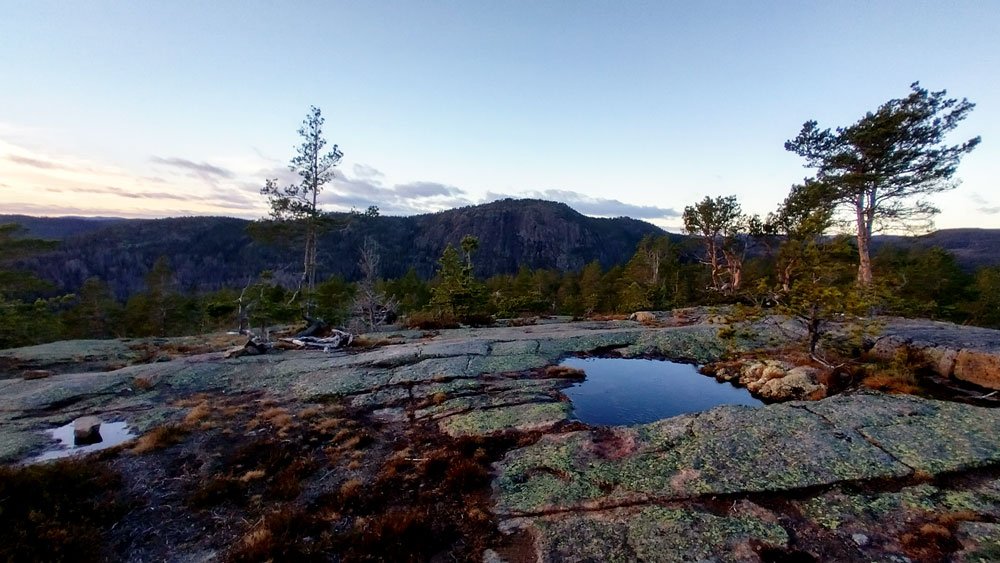
The shelter was built in 1997 by Gunvor Eriksson, Åke Olson, Lilly and Karl Mellberg and dedicated to Per Olsbo; they opened it to any hiker passing through this beautiful part of the High Coast World Heritage site. It is unique and a really magical place!

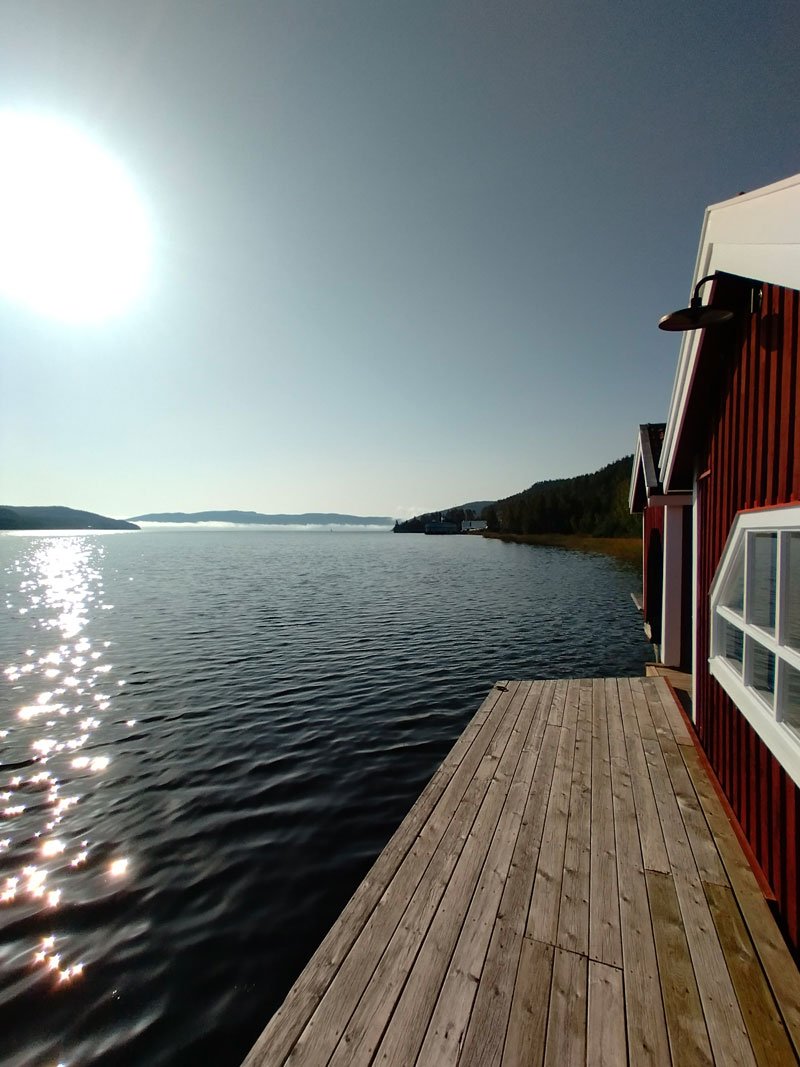
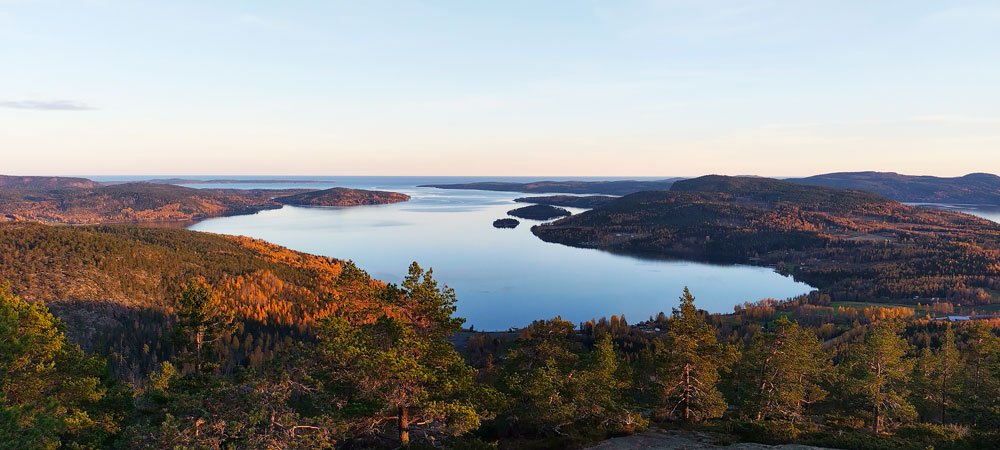
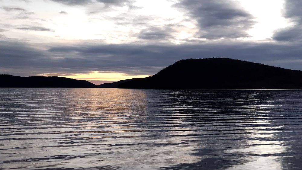
Starting from the piers of the marina, the walk to South to Skovedsberget brings you to an amazing viewpoint over the Dockstafjärden.

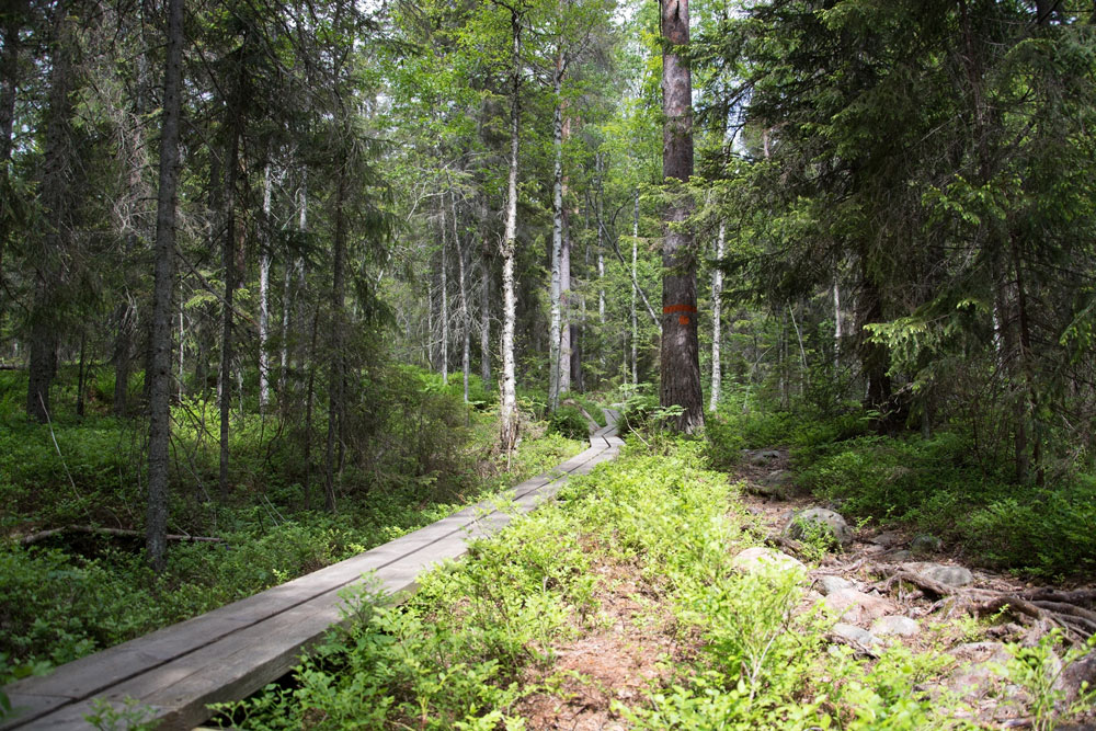
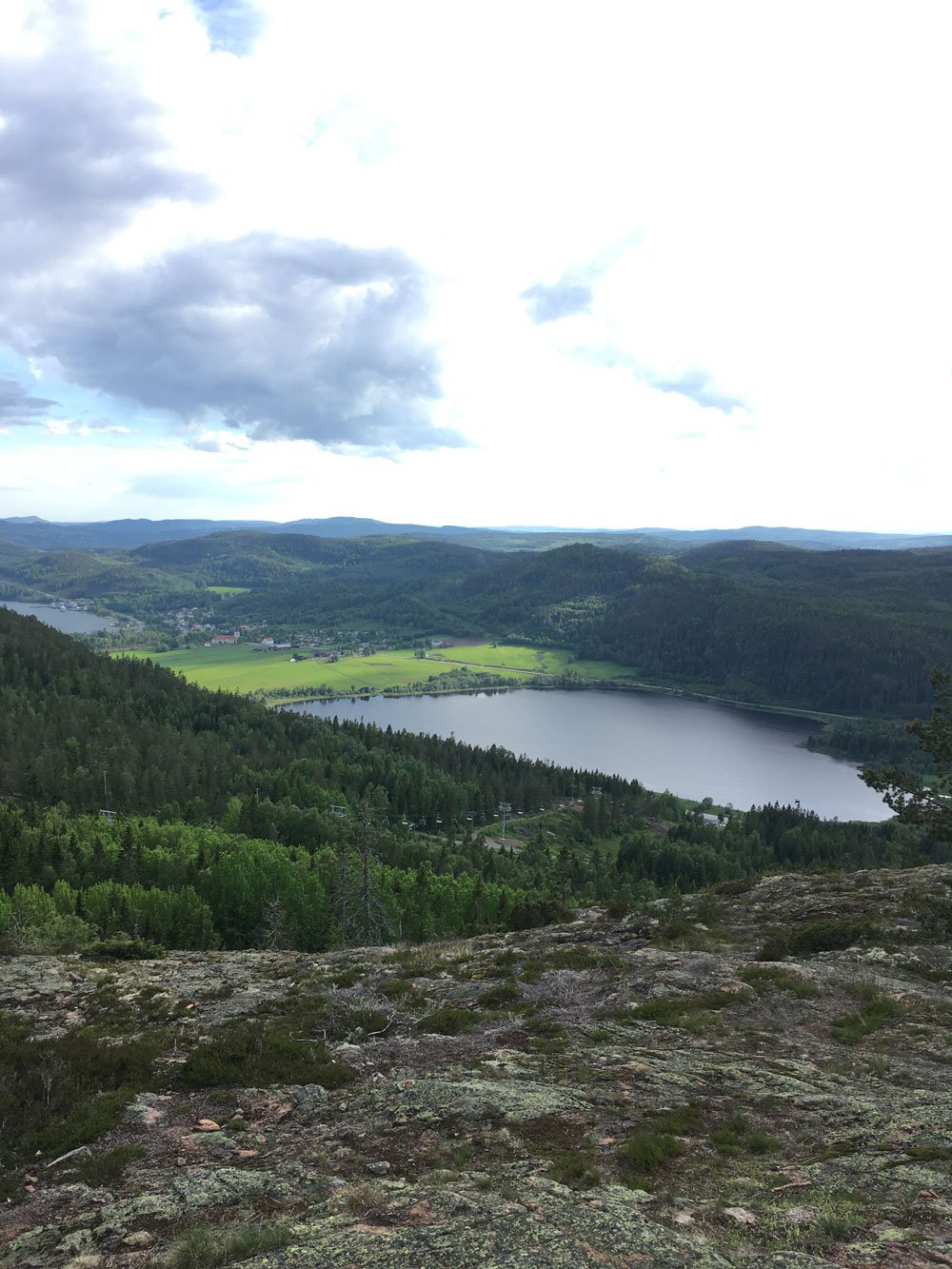
From the old church at Vibyggerå, the Höga Kusten Leden's path heads into the fields of the countryside and into the forest. It's an easy walk that everybody can approach, but it's 100% hiking into nature!

(👉 Don't forget to take with you a Swedish "fika.")

WALKING: 40 min
TOTAL DISTANCE: 3,8 km

  • Docksta Havet Base Camp -> Old Church 2 km

  • Old Church -> Skovedsberget utsiktsplats 1,8 km


FREE DOWNLOAD:

INFO-MAP for your excursion to Per-Olsbo wind shelter >

(.pdf - 4MB)

Hike at the feet of SKOVEDSBERGET Mount:

Short walk in the forest to a magic shelter over the Dockstafjärden

During your stay at Docksta, take a moment to take a walk there :)

At the end of the main road of the village, take the upward road (Prästbacken) that leads to Sätra.

The ancient church you meet where the path begins, the old church of Vibyggerå, was probably built in the late 1200s or early 1300s.

After the new church of Docksta was completed in 1874, at Herresta, the Vibyggerå old church was abandoned until 1916. The new church was then burned down by lightning and the old one had to be restored to worship use again.

The interior is decorated with beautiful frescoes from the 17th century. The altar dates from 1771. The pulpit was made in 1740 and triumph crucifix dates from the Middle Ages. (Source: Wikipedia)

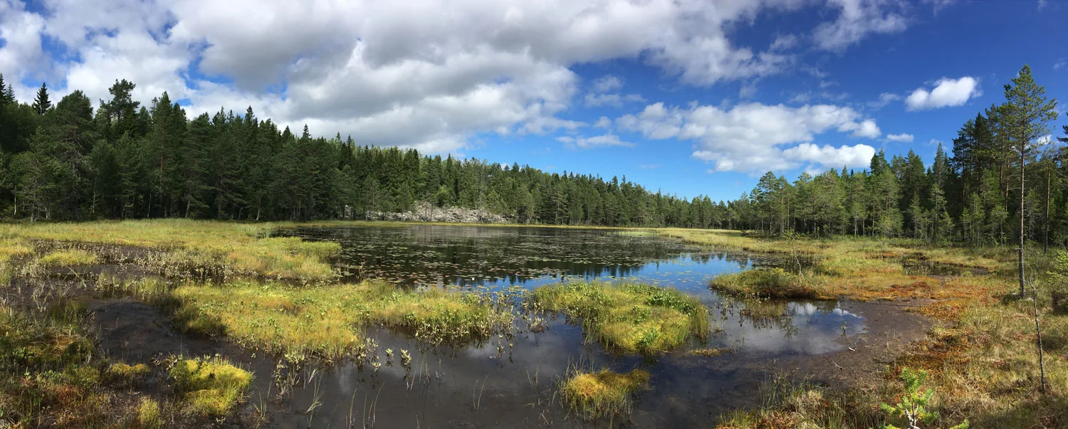
From the church, the trail crosses the meadows and feed fields before entering the woods after a few hundred meters.

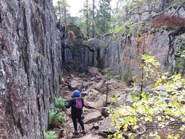
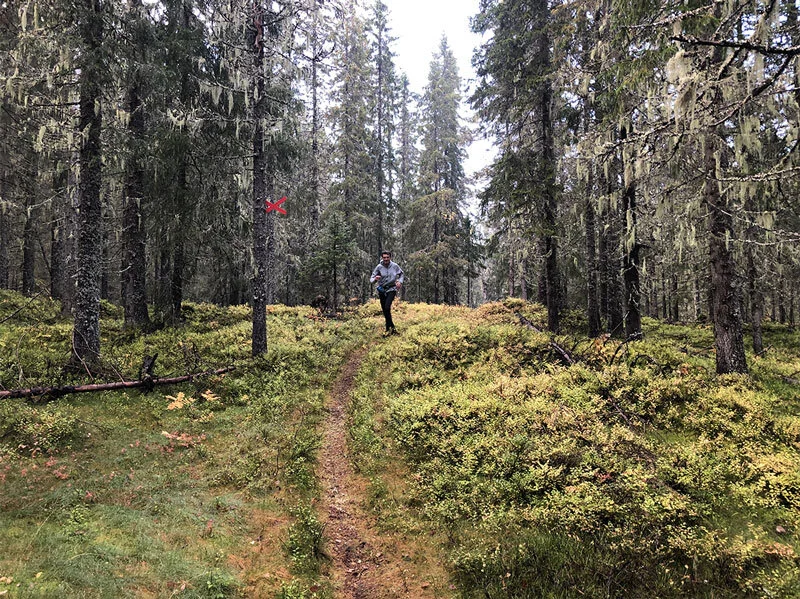
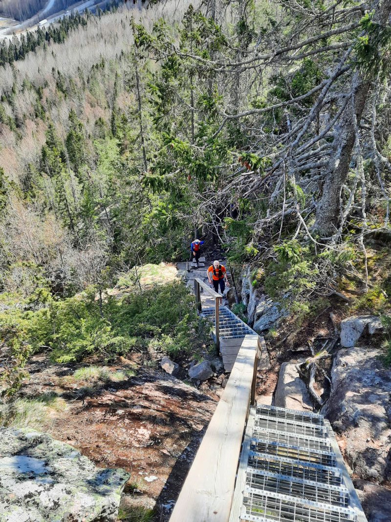
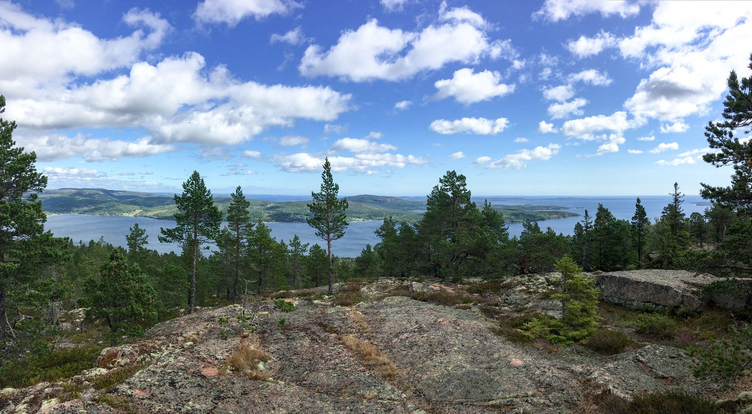
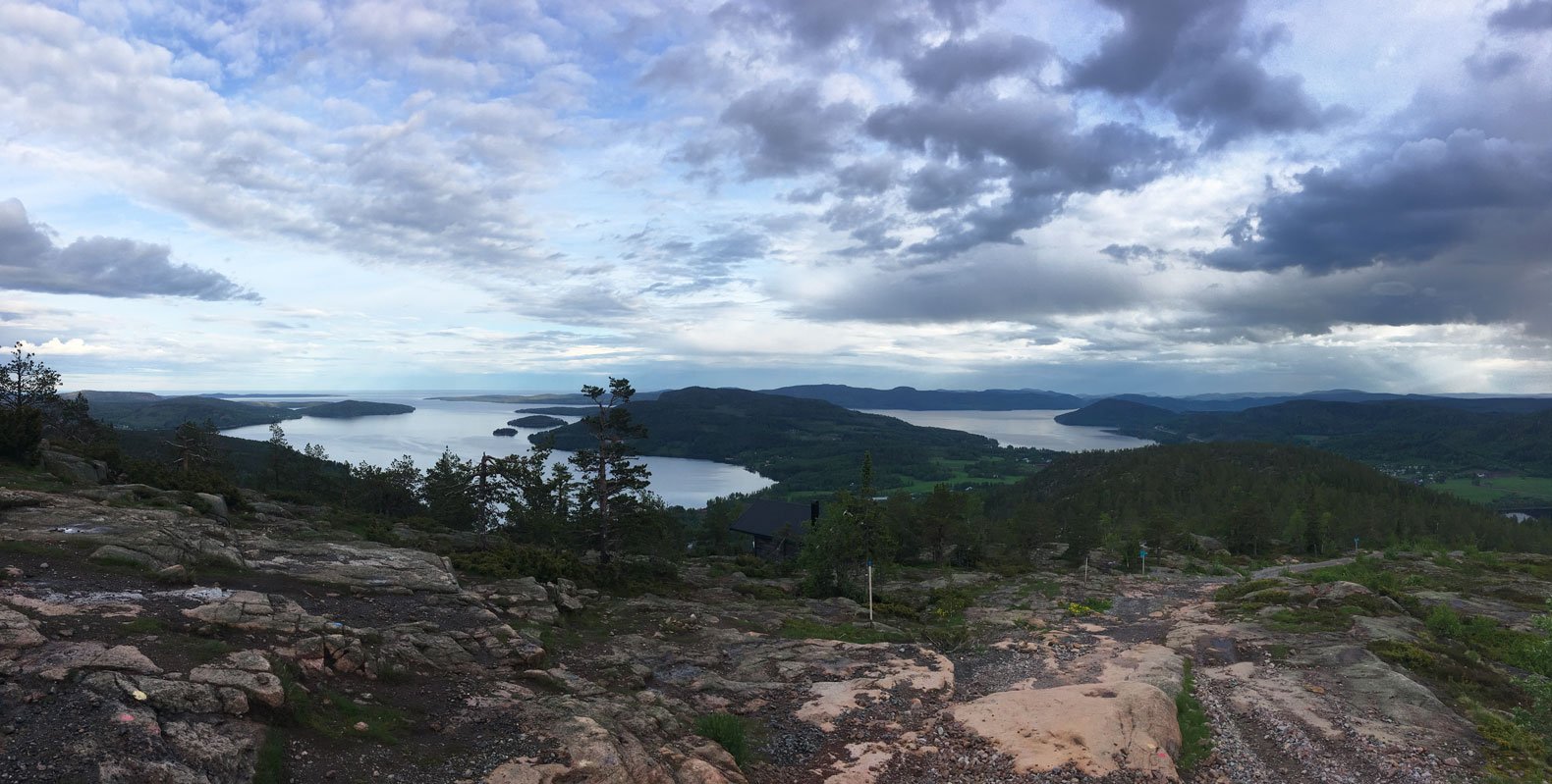
You are on the Höga Kusten Leden trail, southward. The path to the shelter rises gradually; it is a pleasant walk. After a little more than one and a half kilometers, there is an outlook that leads to the panoramic point (utsiktsplats) where the shelter was built.

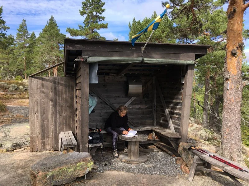
Per's shelter is different from any other you'll encounter on your excursions. It is a special place, and it is understood that it is there to make the stop as pleasant and comfortable as possible for the passersby.

It is well equipped; you will find everything you need to prepare a falò safely, and much more will surprise you, such as the binoculars and the guest book.

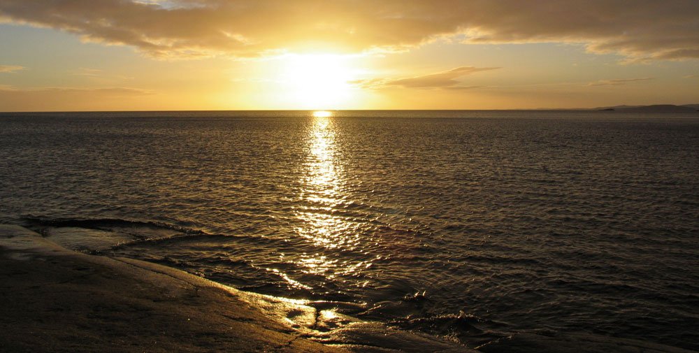
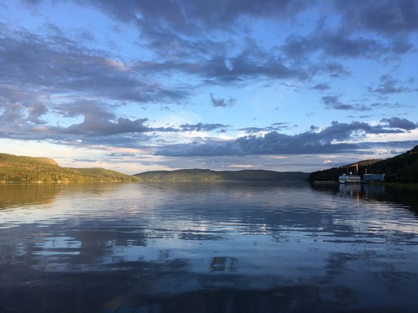
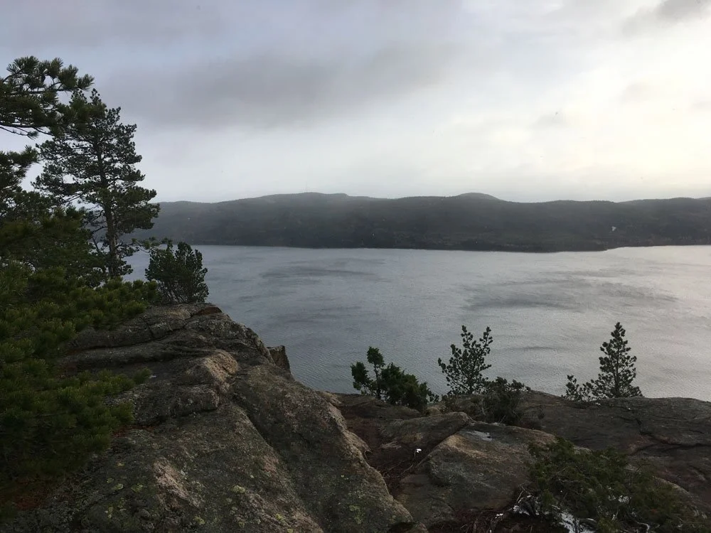
Above all, you will adore this unique nook that feels like it belongs to you and touches your heart, even more than the view! That is gorgeous over the Dockstafjärden to the south-east and Vårdkallberget Mount, and toward the north, over Docksta and Skuleberget.

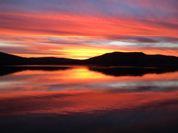
Usually, I go to the wind shelter running from the marina (this route has a couple of funny Strava segments), but walking will really make you enjoy it. The sun rising directly in front of Skovedberget in the morning adds a unique light and ambiance to this spot.

See Utsiktsplats Per-Olsbo on naturkartan.se >


P.S. I’m a trail runner. I like to explore new routes with a hiking mindset. Here you find what I highlighted to explore the High Coast Worls Heritage Site >

Feel free to contact me:

Tommaso De Rosa

Instagram: @tominthehighcoast

+46 (0)76.3136909 or +39.335.1309207 (WhatsApp too)

e-mail: dockstahavet@gmail.com

See my host profile and contact me on Airbnb

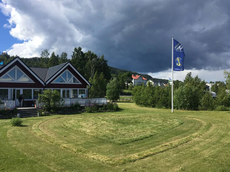
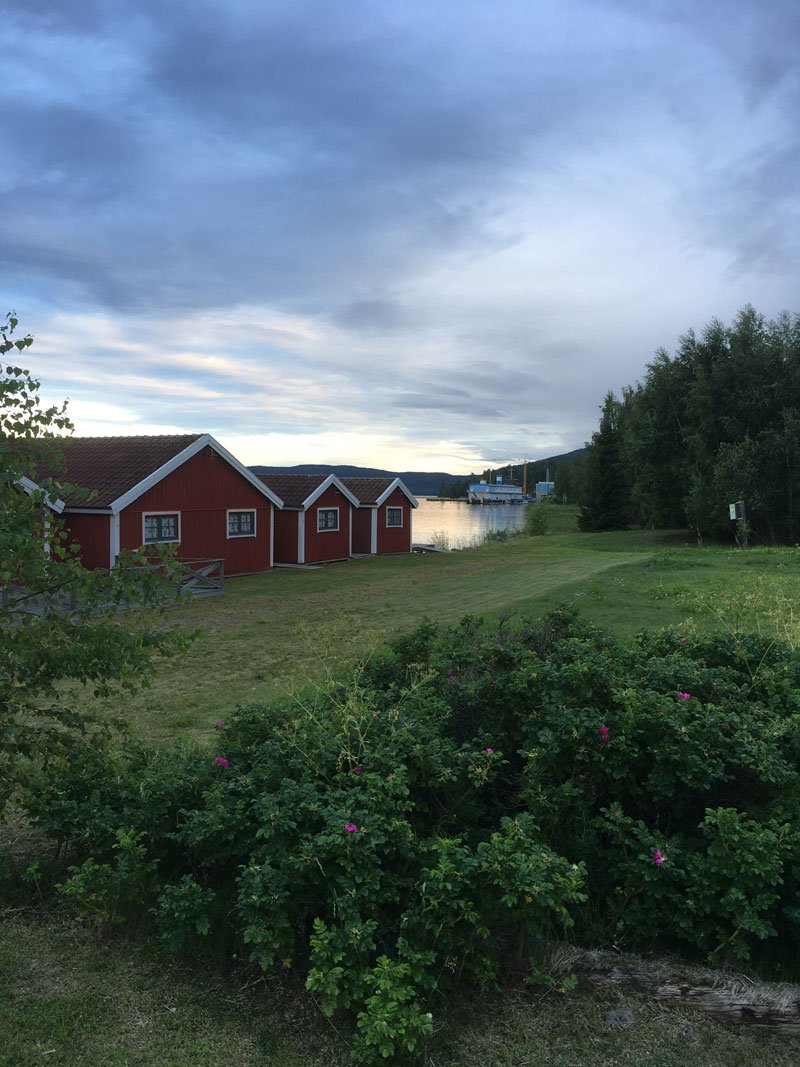
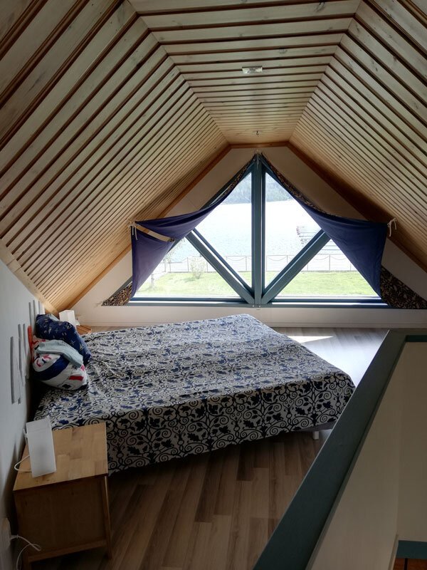
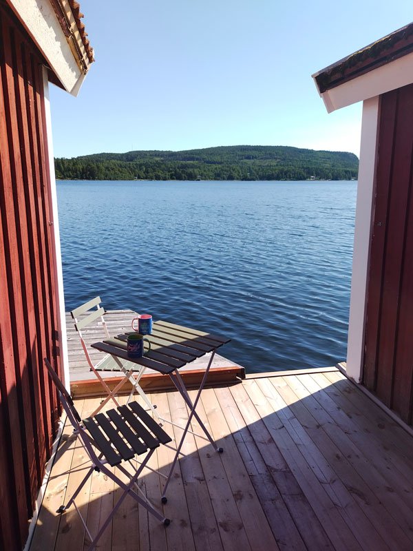
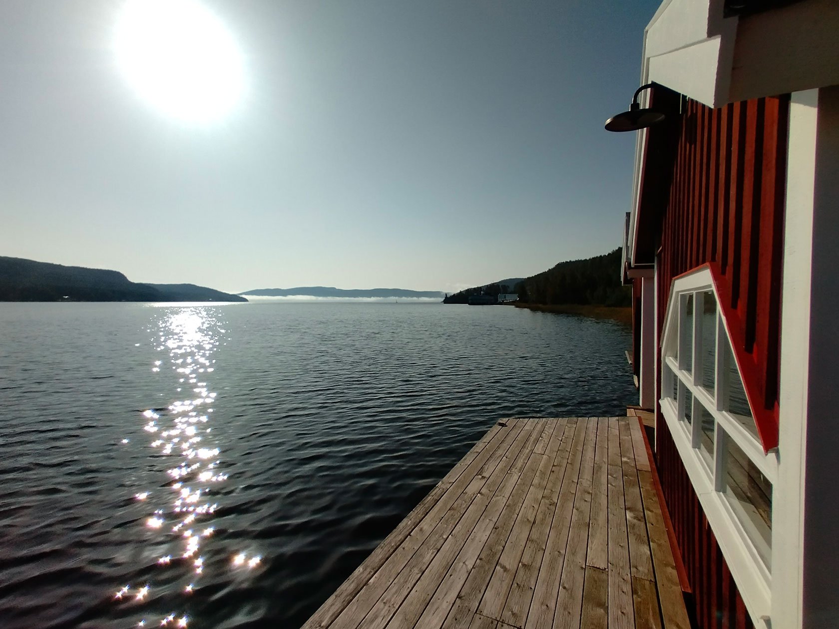
Just below, you can read about our holiday Airbnb accommodations by the seaside in Docksta: starting from the piers of the marina, you will be in the ideal location to enjoy the area, the national park Skuleskogen and the trails at Skuleberget Mount (plus, the other summits that surround Docksta).

How to get to Docksta, Höga Kusten, by flying to Sweden at Stockholm

🛬🇸🇪

You land at Stockholm International Airport Arlanda, which is roughly 40 minutes from the downtown center of the capital. You can go to Höga Kusten from there in at least four ways: by car, by train, by bus, or by air.

Docksta is located in the north of the country, about 500 km from Stockholm. The village, in the heart of the High Coast World Heritage Site, is crossed by the main north-south connecting route, the E4.

Docksta is very well connected to the buses that run north-south the coast of the country. Long-distance buses reach the capital at Stockholm City Terminal or the Arlanda Airport, and regional bus connections make it convenient to reach the cities that are on your public transport route: they are Sundsvall and Härnösand (you get there by train from Stockholm), or Örnsköldsvik if you arrive from the north.

In the village, there are two stops for these buses, "Docksta Marina" 50 metres from us, and "Docksta Busstation" right next to the ICA supermarket a few hundred meters from the marina.


How to get to Docksta?

You just have to choose:

1# 🚍

Docksta can be reached by bus departing from Arlanda (or from Stockholm City Terminal), the journey takes over 6 hours. If it fits your travel times, the bus can be cheap, there's usually free wifi, and best of all, you don't have to drive—just unwind and take in the scenery (much like on the train).

Find more at www.ybuss.se


2# 🚄+🚍

From the airport at Arlanda, you can also go straight by train to Sundsvall or Härnösand, from where you can continue by bus, which leaves from the destination railway stations. Buses take you to Docksta, the stops at are just a short distance from the marina.

In example: Arlanda Central Station 🚄 -> Härnösand station 🚍 -> Docksta busstation

TIP 👉 To ensure that the bus service is truly available on the day of your choosing, check and make your reservation in advance.

Find more at: www.sj.se (search your journey from “Arlanda C” to “Docksta”)


3# ✈️+🚍*or🚙**

When you land at Arlanda (ARN) on an International flight, you can reach the airport area where domestic flights depart: there are sixty-minute flights with SAS to "Midlanda” (Sundsvall/Härnösand Airport), alternatively, you can look up flights with SAS to Örnsköldsvik.

* From the airports you have to take a taxi to reach the bus terminals. The bus will take you to Docksta. Make your reservation of the bus in advance and confirm that the service is actually available on the day of your choice.

** Alternatively you can rent a car. Distances from the airports: Midlanda (SDL) -> Docksta: 98Km; Örnsköldsvik (OER) -> Docksta 61Km

Find more at: www.sas.se


4# 🚙

In Arlanda, you can also rent a car and drive to the High Coast on the highway (E4). The drive from the south to the north—through forests mostly—is a pleasant trip in and of itself. 462 km to arrive in Docksta from the airport; simply follow the E4 to the north (with direction North -> Sundsvall/Haparanda).

See also, car rental at Arlanda airport, Stockholm (by economybookings.com)

This latter case is particularly an option to think about if you're not a solo traveler. If you are traveling with other people, renting a car together can make it easier and more convenient for you to get around and explore freely on the High Coast.

The area of Höga Kusten is very large; only its coastal portion expands across a distance of around 100 kilometers to the north and south. There are many of locations that you will like to visit, but unless the purpose of your holiday is to go trekking—a beautiful mode in this natural setting—you will value having a car available for your trips.

🚙 In the north of the country, tähe traffic is generally minimal. You will be able to take in the breathtaking scenery of Sweden, which includes huge forests and dazzling lakes. Particularly in more isolated places, keep an eye out for wildlife when driving. 


TIP 👉 Moving to Sweden during the summer holidays in particular requires careful planning of your travel. Whether it’s flights, train tickets, or buses for the main destinations, remember to make all reservations in advance, in any case, before you start your trip.

TIP 👉 Pay attention, on public holidays and on Saturdays in particular, to the actual availability of public transport services (especially buses); routes and schedules are often reduced: to be sure, book and buy your tickets in advance :)


Do you know how to get to the marina when you arrive in Docksta?

This is our address:

👇

Docksta Havet AB - Hamnen, 10 - 87396 Docksta

It's simple because we are on the seaside right in Docksta, about 100 meters from the pier of the ferry to Ulvön Island and the bus stop "Docksta Marina".

When you arrive in Docksta on the E4, just at the end of the Dockstafjärden in front of the village, you will see our floating wharfs, the docks and boathouses, and the main red building with light blue signs (with www.dockstahavet.se) on its roof.


I hope that this blog article was helpful for you. I looked at the many ways to go to and from Docksta and Arlanda International Airport, so you can make an informed decision based on your timetable and budget to travel to the High Coast during your holiday.


Rent one of these unique vacation rentals to maximize your trip to the High Coast:

Located near the Skuleskogen National Park and the Skuleberget Mount, these seafront Airbnbs are situated at the Docksta marina. The coastal lodgings are in an ideal location for exploring the Höga Kusten World Heritage site.


Tommaso De Rosa

See my host profile and contact me on Airbnb

If you would like assistance planning your stay in one of our waterfront accommodations at the marina, need hiking advice at Skyleskogen Park or Mount Skuleberget, or have any other questions regarding things to do on the High Coast during the summer, please contact me via the Airbnb chat. You are welcome :)

_Tommaso

Please write me by email or WhatsApp at +46.763136909

P.S. I’m a trail runner. I like to explore new routes with a hiking mindset, especially those on the High Coast. Here below you find what I highlighted in these blog posts.

👇

Basic tips to get ready for your day hike (or run) on High Coast paths

The great outdoors is calling: a walk's quality need not be determined by its duration or level of difficulty, nor does it have to be an intense hike.

Being on the High Coast represents an opportunity to move in nature in an unparalleled way.

It's a good idea to keep in mind a few recommendations to ensure the success of any excursion you have planned that may be completed in four or five hours, even if it's only a few kilometers on paper.


6 suggestions to prepare you for your outdoor walks on the Höga Kusten

1. You need suitable footwear. With few exceptions, all the paths that lead you to climb or descend on the reliefs are very technical, you will also walk on rocks, roots and pebbles. You do not need heavy or rigid shoes, good shoes are enough, for example for hiking or trail running, that are comfortable, with a good grip and possibly tasselled.

2. Move with a light backpack, always carry a reservoir of water with you and something to eat to replenish your energies. Remember that you won't be able to easily access stores to "supply" or just stop for a drink when you're in the woods or on the national park's trails.

3. Check the weather forecast, bringing appropriate clothing (to stay warm and dry, particularly).

The applications YR.no and SMHI.se are excellent for puntual locality forecasting.

4. Plan your route. The paths within the national park or protected natural areas, and the Höga Kusten Leden are average well marked, you will generally find signs with the indications that are needed or more easily than signs made with colored paint on rocks and trees.

Taking a look at a map, to know the territory where you are moving, is always a good idea. Tourist information points can in most cases provide you with a useful one.

👉 You can find many maps even downloadable online, (below, you can free download our info-maps, too), or use apps (like Kamoot, Outdoorsactive...), when you have network coverage. A good resource are naturkartan.se website and app.

👉 Have a look also at our outdoor MAP-POSTERS >

If you're adventuring on trails that you don't think are popular, let someone know about your route and your excursion plans.

5. Bring a cell phone with the batteries charged but remember that you will not always have the coverage guaranteed, especially if you are in roaming with a non-Swedish telephone contract.

6. Carrying hiking or Nordic walking poles in your backpack could be an excellent alternative if they are foldable. Although they are helpful equipment, many of the rough and rooty pathways you may come upon are not suitable for them.


Little etiquette guidelines

Additionally, you will find here a few basic etiquette rules for a more environmentally conscious outdoor experience.

📍Keep it wild.

Just remember that the natural environment you are moving into is unique and delicate.

Stay on the existing paths (do not venture off the trails creating new ones or cutting switchbacks). Remain on it to avoid harming the natural spaces around it. With so many visitors enjoying natural areas for their outdoor recreational activities, a simple shortcut through a dune, around a wet trail, or across a meadow can have long-lasting negative impacts.

📍Do not disturb wildlife.

Your surroundings are home to many plants and animals: you are the visitor.

📍Do not litter.

Take all of your belongings home with you :)


Set your #hiking BASE CAMP to explore the Höga Kusten World Heritage site:

These coastal Airbnbs are located at the marina in Docksta, along the Höga Kusten Leden (Etapp 5: Ullånger–Skuleberget) and just a step away from the Skuleskogen National Park and the Skuleberget Mount. The accommodations are seaside and perfectly located to explore the Höga Kusten World Heritage.


Tommaso De Rosa

See my host profile and contact me on Airbnb

If you would like assistance planning your stay in one of our waterfront accommodations at the marina, need hiking advice at Skyleskogen Park or Mount Skuleberget, or have any other questions regarding things to do on the High Coast during the summer, please contact me via the Airbnb chat. You are welcome :)

_Tommaso

Please write me by email or WhatsApp at +46.763136909


P.S. I’m a trail runner. I like to explore new routes with a hiking mindset, especially those on the High Coast. Here below you find what I highlighted in these blog posts.

👇

Vacation lodgings along the Höga Kusten Leden ideal for trekkers

While trekking, sometimes all you want is a place to rest and spend the night; other times, you want an experience in and of itself.

Set your trekking base camp

These coastal Airbnbs are a little different from other places you might stay. They are located at the Docksta marina, along the Höga Kusten Leden route (Etapp 5: Ullånger–Skuleberget).

They are in a prime location near Skuleskogen National Park and the Skuleberget Mount trails.

You find one or two sleeps in the comfortable, tiny room of a real Nordic boathouse.

In the dock house, which is a glamorous lodging above the sea, you will find a 40sqm cabin with a spectacular double bed facing the sea, living room, and kitchenette.

For families or a group of friends, a spacious, well-equipped apartment overlooking the Docksta fjord with a breathtaking sea view is ideal.


Highlighting the Boathouse's features for backpackers

During your trekking vacation, the Boathouse is an ideal place to locate a safe haven in inclement weather or to have a "rest" day to recover.

Accommodation: 2 sleeps - 1 bedroom (~ 8 sqm)

1 sleep: 350:-sek

or 2 sleeps: 650:-sek

DURING THE SUMMER ONLY:
check on AIRBNB the availability of the boathouse between May and September.


Flexible check-in and check-out times and last-minute reservations (we are aware that you can hike from the forest)

• When you arrive, your bed is already made; bed lines are included.

• There is a “towel kit” available at 50:- sek if you are traveling with little luggage (1x 140x70, 1x 70x50, 1x 50x30).

SERVICE HOUSE - A laundry room, a countertop for dishwashing, a changing room, toilets, and warm water showers available all day.

• You're welcome into the Sailor's Club House, with free espresso coffee and a living area.

• You can park free your car or motorcycle at the marina and recover your sporting equipment, such as bikes and kayaks, into the boathouse.

MTBs are available for rental (100:- sek/day)

200 meters from the ICA supermarket in Docksta or the Höga Kusten Leden track that crosses the village's main road.

• 50 meters from the "Docksta Marina" bus stop on the E4 (in summer, the bus that takes you to the national park stops here as well).

• 50 meters from the dock of the ferry "Höga Kusten Trafik," which cruises to Ulvön island.


Some ideas and tips to make the most of your vacation break in Docksta:

👉 The highest point of land in the globe to have been raised by a postglacial isostatic rebound is located at 286 meters above sea level highest at the summit of Skuleberget Mounth: there are beautiful trails to reach it.

👉 Hiking the Skuleskogen national park's wonderful routes and taking in its breathtaking scenery should take up an entire day.

👉 Naturum Museum, Via Ferrara, and concerts at Skuleberget Mount: have fun with outdoor activities a step away from the marina.

👉 The old church of the village (2 km from the marina) and Per-Olsbo wind shelter (at 3,8 km)  can be reached with an easy walk along the southerly segment of the Höga Kusten Leden.

👉 The magnificent trail that leads to the summit of Vårdkallberget Mount is surrounded by rocky pine forests.

👉 A day trip with the ferry to discover the renowned Ulvön island and beauty of the archipelago: the ferry starts from the harbor in Docksta at 10am.

👉 The outdoor sessions of functional group training with Marcus Lindberg (every Monday or Wednesday at 6:30 in Berg).

👉 Shops & Highlights in Docksta: that’s my guide >


Your holiday accommodation at our Airbnb is just a step from the trails at Skuleskogen National Park and Skuleberget mountain in Docksta. We are seaside and perfectly located to explore the top spots in the paradise for trail running Höga Kusten.


Tommaso De Rosa

See my host profile and contact me on Airbnb

If you would like assistance planning your stay in one of our waterfront accommodations at the marina, need hiking advice at Skyleskogen Park or Mount Skuleberget, or have any other questions regarding things to do on the High Coast during the summer, please contact me via the Airbnb chat. You are welcome :)

_Tommaso

Please write me by email or WhatsApp at +46.763136909


P.S. I’m a trail runner. I like to explore new routes with a hiking mindset, especially those on the High Coast. Here below you find what I highlighted in these blog posts.

In the light of the midnight sun, a run on the rocky cliff of Rotsidan

Rotsidan Nature Reserve, located between Barstahamn and Fällsvikshamn, a few kilometers south of Bönhamn, is a unique four-kilometer low-lying "beach" made of smooth, flat, gigantic rocks.

Running these cliffs is going to be one of your most memorable High Coast vacation experiences. For trail runners and hikers, Rotsidan is a fantastic place to be!

The waves' slow labor continuously buffs the rocks' surface and the route along the long ribbon of stone shoreline offers an incredible evocative spectacle, but the highlight is the truly amazing experience of running on a diabase rock bottom that appears to have been there since the beginning of time.

Come here to run in the springtime, when the sky is clear all night and the light always casts the sea and the coast in a softly toned filter, or when the sun is already far above the sea horizon even if you get here very early in the morning.

You'll probably find yourself exploring alone, free to enjoy all of the sensations that this trail out of the patterns has to offer.

In some parts, the smooth and compact rocks of the cliff interrupt to leave room for large beaches of rocks and rounded, smaller stones. Aside from a few algae, occasionally, you will come across old tree trunks that have been bleached white by the sea.

On the north-south axis, the trail along Rotsidan that is shown on the maps is somewhat longer than 4 kilometers. It extends a little inside, but you can walk the beach off-road without restriction by keeping much closer to the water's edge and “dancing” on the rocks—basically, just staying in the bathtub.

Starting and returning from Barsta or Fällsvikshamnen along the entire distance of Rotsidan, you will cover less than ten kilometers; the difference in altitude of the route is minimal. Running free-style, jumping and improvising from time to time a direction on the rocks will be very fun.

Bring a light backpack with your supply of liquids and something to stop you making a snack, but nothing heavy or that hinders your freedom of movement. Even shoes do not necessarily have to be lugs; they just have to have a good grip.

“Not just in Rotsidan, but anywhere else on the High Coast too, running in the late evening or at night under the midnight sun is an unforgettable experience”.

In addition, I enjoy doing it in two other very special locations: Mount Skuleberget, where my favorite trails to run in these conditions are "the Elk" descent trail and "the Lynx" and "the Eagle" paths for climbing to the summit. The second excursion that I suggest running "in the night" between June and July is a ring route that stretches just over 10 kilometers and travels through some of Skuleskogen National Park's most picturesque trails and thought-provoking spots.


#HIGHCOASTRUNNER

”I’m sharing running experiences within the High Coast World Heritage site in Sweden”

Feel free to contact me:

Tommaso De Rosa

@tominthehighcoast

+46 (0)76.3136909

or +39.335.1309207 (WhatsApp too)

dockstahavet@gmail.com


Looking for a base camp by the seaside to start for your High Coast excursions?

The Airbnbs at Docksta Havet are located close to the National Park and the Skuleberget trails. Choosing a seaside lodging will set your vacation apart from the others.


Highlighting the best, selected trailrunning races in the Höga Kusten

Do you ever miss the opportunity to experience a run in the stunning wildness of the North?

Many runners, particularly those from abroad, have the dream of being able to run in the great outdoors while visiting this region of Sweden, which is renowned for its exceptional natural heritage.

There are several appointments throughout the year that offer the opportunity to take a few days of vacation and to participate in some truly unique races.

For all lovers of running, and trail-running in particular, I created this basic calendar, collecting some info and video, which highlights the best spots to compete along some of the most breathtaking routes on the High Coast.

You should put at least one of these amazing races in Sweden on your bucket list! :)


Trail running competitions in the High Coast World Heritage to add to your racing season


CALENDAR 2025

(in progress)

Reccommended by #HighCoastRunner


[ SPRINg ]

Sundsvall, 11 may 2024

SUNDSVALL TRAIL

Video @DavidHolmberg on Vimeo

This trail along the magnificent Sundsvall coastline paths is one of the highlights. The race, which brings together athletes and teams, kicks off the Höga Kusten racing season in the spring.

Distances: 24, 10, 3 kilometres

Info: sundsvalltrail.se


Örnsköldsvik, May/June 2024

HÄGGLUNDS JOGGEN

Unmiss this weekly appointment in Örnsköldsvik to run around Lake Höglandsjön! There are five dates every Wednesday, from the first week of May to the first of June. The course is 4 km long, which you can run in a race or freestyle without timing.

Distance: 4 km

Info: Hägglundsjoggen


Docksta, 17 May 2025

SKULEBERGET #BIG5 UPHILLS CHALLENGE

For a few years, when the snow melt on the Skuleberget, the collective run on the five uphill paths of the mountain was renewed. It's not a race, it's a challenge between brave athletes.

Distance: ~25Km, approximately D+1.500m

Info: the #BIG5 Uphills Challenge


Höga Kusten, 27/28 June 2025

HIGH COAST ULTRA

There is also an ultra race that crosses the entire High Coast from south to north, and that follows, in part, the famous Höga Kusten Leden track.

Distances: 130 km, start at Höga Kusten Hotell; 58 km, start in Docksta

Info: highcoastultra.se


[ SUMMER ]

Örnsköldsvik, Sunday, 29 juni 2025

ATEA TRAILÖVIK

Video Block
Double-click here to add a video by URL or embed code. Learn more

To mark the start of the Swedish holiday season, there is the most anticipated trailrunning race with the best technical content along the gorgeous trails on the mountains that overflow Själevad at the gates of Ö-vik. Thanks to the expert organization of the Skogslöparna team, which designs the path in the woods, the fun is ensured. It's the next "A-race" to include in your international racing calendar!

From this year on, the TrailÖvik 22k race is part of the Outnorth Trailtour 2024 Championship calendar.

Distances: 22, 12, 6, 2 kilometres

Info: trailovik.se

Video Block
Double-click here to add a video by URL or embed code. Learn more
 

Örnsköldsvik, 24 August 2024

HÄGGLUNDS TRAIL

It's a quick, exciting, and challenging race. It set off in the evening, following a very entertaining route that crosses amazing woodland sections as well as paths with rocks, roots, and—occasionally—a lot of mud.

Distances: 6.7 and 2.4 kilometres

Info: hagglundsskiteam.se


Docksta, 29/30 August 2025

HÖGA KUSTEN TRAIL

There is a race that will take you to cross long and wide the Skuleskogen National Park and then, along paths in the woods, to reach the foot of the Skuleberget mountain. From there, it will push you to climb up to the top and back down from the opposite side before climbing back to the summit again for your arrival. After the summer and early fall, but also in February, when snow and ice cover the trails, hundreds of runners from everywhere meet in Docksta to participate in the two seasonal editions of this trail that are unmatched in the Scandinavian running landscape.

Distances: 43, 25, 15 kilometres

Info: hogakustentrail.se


[ AUTUMN ]

Härnösand, 4 October 2025

HÄRNÖ TRAIL 2025

The race travels through expansive natural and coastal landscapes before finishing at the summit of the mountain above Härnösand. Traveling through the protected natural area, down to the sea, and then to the beach at Smitingen is an unforgettable experience. Every year, an increasing number of competitors take on this demanding test. This race is becoming more and more well-known in the Swedish trailrunning scene.

Distances: 21 km, 14 km, 7 km

Info: harnotrail.se


Örnsköldsvik, Tuedday, 8 october 2024

NIGHT EDITION TRAILÖVIK

The race's nighttime version, which follows the well-known TrailÖvik routes, is unbeatable—every competitor races with their front lights on! Arriving, coming from the forest, the last peak and the finish line lighted by the fires creates an experience that will never be forgotten.

Distances: 12, 6 kilometres

Info: trailovik.se

Info: skogsloparna.se


[ WINTER ]

Docksta, February 2025

HÖGA KUSTEN WINTER TRAIL

Distances: 50, 35, 25 kilometres

Info: hogakustenwintertrail.se


#highcoastrunner

”I’m sharing running experiences within the High Coast World Heritage in Sweden”

Feel free to contact me:

Tommaso De Rosa

@tominthehighcoast

+46 (0)76.3136909

or +39.335.1309207 (WhatsApp too)
dockstahavet@gmail.com


Set your trail-running base camP:

Your holiday accommodation at these Airbnb is just a step from the trails at Skuleskogen National Park and Skuleberget mountain in Docksta. They are seaside and perfectly located to explore the top spots in the paradise for trail running Höga Kusten.


READ MORE ABOUT #TRAILRUNNING IN THE HIGH COAST:

Trail running in the High Coast: recommended paths around Docksta

If you love to combine hiking, running, and the passion for the great outdoors, what better way to do it than into the heart of the Höga Kusten UNESCO world heritage in Sweden?

Any trailrunning enthusiast is captivated by the long sunny spring/summer days and enchanting by varied hilly paths through breathtaking landscapes between the mountains and the Baltic Sea.

Reconnecting with nature and recharging your body, mind, and soul in peaceful natural environments makes you feel like you've stepped into a whole other universe.

Docksta is the homeland of the outdoors, and for runners, there is no exception: each path winds through forests and hills and combines breathtaking sea views with a perfectly Nordic setting.

The village is located in the center of all of this, a step from the famous Skuleberget mountain and the trails of Skuleskogen National Park.

A run here is definitely a unique experience, and there is pure joy in discovering the scenic beauty of the High Coast!


These trails are very popular in the runner community; you run all year round, and all the paths lead to the summit, rising from different sides. High Coast runners name them “Lynx, Eagle, Bear, Elk, and the Fox”; they are “the #BIG5”.

The Lynx, the Fox and the Bear will bring you uphill and downhill on the final segments of the “Höga Kusten Trail” race course, too.

On the Skuleberget, a challenge arose that led the runner to run all five paths in a single session: the #BIG5 Challenge is not a race, it's a call for a bunch of bold athletes.


For trailrunners, the playground is not only Skuleberget Mount. Docksta is surrounded by beautiful paths: on the seafront, on the hills, or in the countryside. Many of them will lead you to the heights of the mountains that surround the land.

You will experience the thrill of running through natural scenery: real nordic forests, red Nordingrå granite rocks covered by lichen, and stunning mountain trails.

Vårdkallberget, Getsvedjeberget, Skovedsberget, Herrestaberget, Fäberget, and Skuleberget summits offer extraordinary views over the High Coast Archipelago to hikers and trail runners.

Vårdkallberget has one of the most breathtaking views of the High Coast

The Vårdkallberget Mount has one of the most breathtaking views of the High Coast


One of the most amazing locations for trailrunning is the magnificent Skuleskogen National Park.

All the Skuleskogen trails are extraordinary and are a few minutes' drive from the village (during the summer, there is also a free bus to reach the national park).

Even with a session of a couple of hours of trailrunning, you will be able to reach its most interesting sights: the summit of the Slåttalsberget Mount, the Slåttdalsskrevan cracks, the beautiful Tvärnättevattnen lakes, an amazing path in the forest by the seaside, and the beaches along Kälaviken Bay.

 
On the way to Vårdkallberget, High Coast

You will love trail running connected with nature on the trails of the High Coast World Heritage

“Nature running” has been shown to combine the benefit of physical exercise with the restorative effects of being immersed in natural environments.

Running a natural trail is mindful: you constantly have to find your balance, control your steps, and adapt your speed and pace to the variety in terrain and elevation.

Take a deep breath in the woods; it will clear your mind. Running or walking outdoors in nature—in Japan, it’s called ”forest bathing"—is an experience that boosts your wellbeing. You must try.

High Coast landscapes are not flat, you will likely encounter significantly more hills on the trails than you are used to on urban routes.

This is a fun opportunity to add to your standard training. Running hills will make you a stronger runner and improve your breathing efficiency.

Slow down, and just walk. Pair your breathing with your pace: inhale counting 2, 3,... 4 steps, and exhale counting 4, 5,... 6 steps. Slow, nasal breathing will fill the lungs and power your body with fresh energy. Here, the air is clean, and it’s easier to oxygenate the muscles and to have more energy to tackle the hills.

On a trail, it doesn’t matter how fast you're running. Enjoy the beautiful place you travel and the moment you’re living. High Coast runners are lucky runners, and now can be your time, too.

On the physical side, this kind of run will develop fitness, power, endurance, and strengthen different muscles. Trail running will change you into a faster and happier runner.

Before you start your run or hike, have a good dynamic warm-up and give your training a boost with 5–10' of basic bodyweight exercises: it is the best to prepare your body for trail and hill running.


Here below, you find a list of selected (and tested!) trail running paths around Docksta and Skuleberget Mount. We focus on where the local trail runners train or race, and particularly the spots where they have fun.

More than 100 kilometres of snaking trails to run, hike, or walk are highlighted, starting seaside from the pier of the marina in Docksta.

Each path has its meaning: you should definitely give them a try!


Looking for a base camp to explore the High Coast?

 
Trail runners enjoy the paths around Docksta

Get ready to explore some of the most fun trail hotspot for beginners & expert runners around Docksta and the Skule area:


Trail 12km - D+294m

Trailrun to the summit of Vårdkallberget

starting from Docksta Havet, Höga Kusten

On the way to Vårdkallberget, in the swedish High Coast
Starting from Docksta, this trail heads to the summit of Vårdkallberget.

Trail 7.4KM - D+224m

Trailrun in the forest to reach Skovedsberget, a lookout point over Dockstafjärden

starting from Docksta Havet, Höga Kusten

The short path from Docksta to Skovedsberget pays you back with stunning views of Dockstafjärden. Here you have a free map >

The short segment along the Höga Kusten Leden from Docksta to the wind shelter at Skovedsberget pays you back with stunning views of Dockstafjärden. Here you have a free map >

IMG_9339.JPG
Train running in the Höga Kusten: 7,4km Docksta - Skovedsberget - Docksta

Trail 11.5km - D+420m

Höga Kusten Trail race segment: running North Skuleberget uphill (12.1%↗️) and Höga Kusten Stigen downhill

starting from Docksta Havet, Höga Kusten

This route takes you past the Naturum museum & High Coast Visitor’s Center, goes up along the #BIG5 path named “LYNX” to the “Toppstugan” and down to the south side of the hill along the #BIG5 path named “FOX” (Höga Kusten Stigen) to the “outdoor village”, FriluftsByn.

hiking-hoga-kusten-stigen-skuleberget-2.jpg

Trail 9.3Km - D+332m

#BIG5 path BEAR: vertical running on “Skulebacken” (ski tracks) uphill & downhill

starting from Docksta Havet, Höga Kusten

This is the final steep segment that leads to the finish line at the peak of Skuleberget Mountain during the 43k of the “Höga Kusten Trail” race.

Trail running course of 9km to the summit of Skuleberget via the ski track "Skule backen"

Trail 9.1Km

Vertical runs: extreme (31.5%↗️) uphill to Skuleberget from Naturum museum and downhill via “Skulebacken” ski slopes

starting from Docksta Havet, Höga Kusten

The #BIG5 EAGLE (Grottanstigen) is really a very steep “climb” but it's the shortest path to go up to the hill and the #BIG5 BEAR (on ski slopes) is the fastest to go down. Going up, you can take a short detour to reach the cave (the Kungsgrottan or Rövargrottan is famous for being visited by Linné in 1732).

hiking-naturum-hoga-kusten-skuleberget.jpg

TRAIL 10.3km - D+457m

Trailrunning up to the summit of Skuleberget (11.3%↗️) via Höga Kusten Stigen uphill & downhill

starting from Docksta Havet, Höga Kusten


Run 7.3KM - D+142M

Warm-up run around the lake Gällstasjön: clockwise round.

starting from Docksta Havet, Höga Kusten

The full loop around the lake on is perfect for an easy and hilly run. It offers Skuleberget south side views nearly the whole run and passes through the Church, the Linbana and Friluftsbyn.

hoga-kusten-running-gallstasjon-docksta.jpg

TRAILRun 12.2km - D+313m

>10k around Herrestaberget hill training from Docksta to... Docksta!

starting from Docksta Havet, Höga Kusten


On the High Coast, there is a trailrunning race that will take you across the Skuleskogen national park long and wide and then reach, along the Höga Kusten Leden, the foot of the Skuleberget mountain, and from there it will push you to climb to its top, back down the other side, before climbing back to the summit again until the finish line.

After the summer, in early autumn and in February, when snow and ice cover the trails, hundreds of runners meet in Docksta to participate in the two editions of this prestigious trail run that has no equal in the Scandinavian landscape.

Enjoy in Docksta the Höga Kusten Trail race


Join the "High Coast Runner" club on Strava

 
HighCoastRunner-trailrunning-docksta-2.jpg
 

#highcoastrunner

Sharing running experiences within the High Coast World Heritage in Sweden.


TRAIL RUNNING RESOURCES:


A SELECTION OF OUR FAVORITE VIDEOS:


Docksta Havet guest harbour overview

your boat safely moored

to experience the best trail runs aronud Docksta & Skuleberget


Vårdkallberget Mount offers the taste of a wild hike on the High Coast

This mount remains in your heart.

The trail to Vårdkallberget (or Värnsberget, as someone started to nickname it) is a well-balanced hike, with only one rugged path along the hilltop leading to the summit at 265m a.s.l.

The name "Vårdkallberget" means "beacon mountain”, and it evokes memories of the old signal fires. In the past centuries, big signal fires in the High Coast Mountains alerted the locals to impending enemy attacks. The beacon chain extended all the way along the coastline so that the armies could be gathered.

Overview from the summit toward south: on the right, the Fäberget Mount at the entrance of the Docksta fjord.

Rising from the sea, the mountain forms a peninsula, never more than a couple of kilometers wide, that divides the Docksta fjord from the Norrfjärden.

Between the North fjord and the Dockstafjäerden, the peninsula with Vårdkallberget Mount (panoramic view from the summit of Skuleberget)

On the right of the panorama, the summit of the Vårdkallberget Mount from the overview point at Getsvedjeberget.

From the Per Olsbo’s shelter, near the Höga Kusten Leden, view of the Vårdkallberget Mount. From its height, it overlooks the smaller Valabergen Mount, characterizing the shape of the promontory overlooking the fjord “Ullångerfjärden” to the south.

Along the coast, there aren't many houses, and the mountain retain its amazing natural features.

The trail that leads to the top of Vårdkallberget is mostly known by locals and, fortunately, little visited, so it will be much easier to meet some wild animals, though you will probably only see traces of them in the summer.

The Vårdkallberget Mount from the pier at Docksta Havet.

From the village of Docksta, looking south-east, you can see the mountain dominate the landscape at the beginning of the fjord. It is curious to think that it is only thirty meters lower than the top of the most famous Skuleberget.


🧭

Trail to Vårdallberget Mount: back and forward from the Antenna in Myre:

4.6KM, D+180M, ~2HRS

(for hikers of all levels)

From the marina, it's easy to get to the beginning of the path by foot, bicycle, or by parking your car in Myre.

The trail climbs steeply along the short terrain road to the antenna in Myre, then crosses over a short stretch of recently cleared forest before entering the breathtaking wild area. This section of the woods is distinguished by its openness and exposure to the sun.

These particular forested areas, precious to biodiversity for flora and fauna, are called "rocky pine forests". You will understand what it means to cross a natural and undirsturbed old-growth wood in the High Coast.

The rocky pine forests are still dominated by natural dynamics and low human impact since they are considered low productive due to the low tree density (lack of water and rocky and nutrient-poor hilltops may contribute to it).

These are structurally diverse and heterogeneous forests and valuable habitats for organisms connected to sun-exposed dead woods; both snags and logs can be present for several centuries after death.

During your excursion, you will see very old pines (Pinus Sylvestris, particularly) that have been twisted by wind and snow, and you will likely need to climb or surround some storm-fallen trees, whose exposed roots will show you how almost everything here clings to a small layer of soil and to bare bedrock to survive.


At Vårdkallberget Mountain, you get a real taste of what hiking Nordic trails in areas with low human impact looks like


By walking a narrow single track surrounded by blueberry bushes, you will pass portions of thicker forest, passing next to a wet area, and walk a few tens of meters next to a beautiful lake but invisible from the path if you don't start looking for it.

Finding the lake on the map and orienting yourself to get there should be fairly simple if you have a smartphone and a trekking app (like Komoot or Outdoorsctive). Just be cautious when approaching the wet area that is surrounded by a frequently occurring layer of moss under the surface of which there is water.

You will also cross a couple of the typical cobble fields whose pebbles have been rounded by the work of the waves because they were once at sea level around 10.000 years ago.

The final stretch of the trail has sparser vegetation, making it easy to jump over some broad, rocky reliefs of typical red granite that are covered in moss and lichen.

You will be able to identify the southern summit of the mountain by the stacked stones that accentuate some of the 360-degree panoramic points over the archipelago.

If you start exploring the surroundings a little from there, you will discover charming views to the Ullånger’s fjord and, just below the top, on the north side, a particular wind shelter.

Photo ©: courtesy by ArkNat

It's name is “He”, and it was built in 2019 within the ArkNat project by students from different Scandinavian schools of architecture. Because of the shelter's two-sided architecture, guests can tilt the main body for shade, or wind protection, or a gorgeously framed view of the Norrfjärden, toward the Skuleberget and the Skuleskogen National Park.

The whole route to the summit of Vårdkallberget, back and forth from the antenna, is roughly five kilometers long and has a level of difficulty that most people can handle.

Naturally, it is advised to wear a good pair of trekking shoes and a pair of long trousers (the single track path narrows between bushes at certain segments). You won't be disappointed when blueberries are in season, but don't forget to pack a water bottle and possibly some snacks.

When windy, the summit is typically fairly exposed. At Vårdkallberget, however, the sun will shine through the trees for a good chunk of your journey if the weather is good. Have fun!


Tommaso De Rosa

See my host profile and contact me on Airbnb

If you would like assistance planning your stay in one of our waterfront accommodations at the marina, need hiking advice at Skyleskogen Park or Mount Skuleberget, or have any other questions regarding things to do on the High Coast during the summer, please contact me via the Airbnb chat. You are welcome :)

_Tommaso

Please write me by email or WhatsApp at +46.763136909


Uncover hidden gems: Three unusual seaside stays on Höga Kusten

A great starting point for exploring the Höga Kusten World Heritage Site are these three vacation rentals: a comfortable dock house, a cozy boathouse, and a completely furnished apartment overlooking the sea, all of which face the marina in Docksta.

Docksta is a friendly community with a strong tourist vocation. Easily accessible by car or public transportation (plus, the village is crossed by Stage 5 of the Höga Kusten Leden), it's ideally located for seeing the well-known archipelago along Sweden's coast, and especially the amazing Skuleskogen National Park.

From here, you can even take the daily ferry to the island of Ulvön, which is accessible throughout the summer. In particular, some of the most well-liked locations for nature hikers may be discovered on foot or by bicycle, allowing you to temporarily forget about using your car.

All the "ingredients" that contribute to a holiday being special and unforgettable—like the trails leading to the summit of Skuleberget, the stimulating views from Getvedjeberget, Fäberget, or Vårdkallberget—are therefore all within a few regenerating hours' walk in the Nature.

Starting from a base by the sea affords you an envied view, even if you don't have a boat: this is where the coast pulls, drawing a landscape that isn't entirely marine or mountainous but instead delivers the finest of these kinds of locations, making it somewhat "strange" and exclusively Scandinavian.


Make the most of your trip to the High Coast by renting one of these incredibly distinctive vacation accommodations.


Staying in a traditional Nordic boathouse is a much-loved experience, especially for hikers and travellers. It features a minimal but charming room with one or two beds, preserving the extraordinary building’s connection with the water, which was built to accommodate fishing boats.

You can rent this hiker-friendly, tiny room for one night or more, alone or in a couple. For last-minute reservations and flexible check-in, contact the host via Airbnb for availability.


Have you ever considered sleeping just above the sea, but not in a boat? An ex-darsena who has been converted to spend the night claims to be able to see the sea up close during the summer.

It's a glamorous spot that blends indoor and outdoor spaces, is ideal for couples looking to spend special time by the sea.


This superbly furnished apartment is perfect for a family or couple's vacation and features stunning views of the sea. It is baricentric relative to everything you would like to see while on vacation on the High Coast.

There's a great view of the fjord from the loft bed area. The living area's expansive terrace and wall of windows look out onto the marina and its piers.


These holiday rentals are available for reservations on AIRBNB

KNOW WHO HOST

Tommaso De Rosa

See my host profile and contact me on Airbnb

If you would like assistance planning your stay in one of our waterfront accommodations at the marina, need hiking advice at Skyleskogen Park or Mount Skuleberget, or have any other questions regarding things to do on the High Coast during the summer, please contact me via the Airbnb chat. You are welcome :)

_Tommaso

Please write me by email or WhatsApp at +46.763136909


A World Heritage Site is just outside your door!

WHAT I HIGHLIGHT:


Superior panoramic views of the High Coast World Heritage archipelago

If you are planning a vacation on the High Coast and you love hiking, Docksta is a great place to start, making it your base camp to explore some of the most stunning trails on the World Heritage site.

Which destinations would I suggest? First, the Skuleskogen National Park and the Skuleberget Mountain Nature Area.

The list of summits is as follows: Skuleberget, Slåttdalsberget at Skuleskogen, Getsvedjeberget, Vårdkallberget, Fäberget, and Herrestaberget. From these mountains, the sweeping views of the archipelago are breathtaking.

They're all well worth the effort, but you'll probably have to decide which to focus on during your excursions. So, the following information may be helpful to you :)


Hiking to the best 6 viewpoints offering sweeping views of the Höga Kusten archipelago

All of these are a few-hour excursions, except for the one to the national park Skuleskogen where you will do well to devote an entire day.

Generally speaking, I advise you to leave the car parked and point out a few of these stunning mountains' peaks, which you can even reach on foot, starting from Docksta.


Skuleberget

296m above sea level

You can absolutely not miss the Skuleberget mountain; there are five gorgeous trails to reach its summit.

At the top, the circular path marked with red dots and named Kalottstigen allows you to walk, at 286m a.s.l., along the anchient coastline (it is the world’s highest point of land to have been uplifted by a postglacial isostatic rebound). Here you will enjoy some of the best overview points of the High Coast World Heritage.

It is a short walk or bike ride from the Docksta marina to the base of the mountain, which is less than two kilometers away.

I suggest you go up the east side, where there are the Naturum Museum and the Via Ferrata, because from there two unforgettable paths start: the "Eagle" (Grottstigen) and the "Lynx" (Östra Bergstigen).

  • The first begins just besides the museum; it is the steepest and takes you on top in just over 800m. The view towards the sea is incredible. It is a challenging path; at some points you will find iron steps in the rock, you will have to walk on large massifs, and you will also have to use your hands. It's not a climb, of course, but I don't recommend it if the ground is wet, just as I'd avoid going through it to get down.

  • The second option starts just under a kilometer north of the museum, following the Höga Kusten Leden. It climbs up the mountain through the beautiful forests of the natural area and, turning around the north side, offers a couple of truly unique sights, eastward and then towards the national park.

To return, I recommend following downhill the Höga Kusten Stigen / Södra Bergstigen Stigen (the #BIG5 path named “FOX”).

This panoramic path is facing south and 2.5 km long; crossing the summit of Litoberget Mountain brings you back to the valley along the sunny side of the mountain and its stunning panoramas over the Dockstafjärden and Norrfjärden.

Here you find more detailed descriptions of all the trails of the Skuleberget mountain, and the history of the path nicknames inspired by the wild animals of the area.


Slåttdalsberget

at 276m a.s.l, spanning between the archipelago and the horizons on the National Park

Since 2023, an unprecedented perspective has been opened towards the archipelago from the top of the mountain Slåttdalsberget. Its top, a basically flat “terrace” of red granite rock, where the vegetation is very scarce, can now be traveled along the path from both sides of the mountain that is split in half by the Slåttdalsskrevan, a 200-meter-long and 30-meter-high fissure.


Getsvedjeberget

Overlooking the Norrfjärden

The one that leads to the top of Getsvedjeberget mountain is a short excursion marked by satisfaction, although a bit challenging.

The segment that leads up begins steep and continues to be, but the effort is abundantly rewarded by the beauty it offers on the landscape of the fjord and the surrounding mountains. If you go there on a sunny, windy day, your jaw will drop in astonishment.

From Docksta, you can go there walking or biking (~3km); there is a pleasant road that leads to the Norrfjärden, avoiding crossing the highway. The path starts right inside the campsite.


Vårdkallberget

360 degrees views over the wild + the joy to walk the 2.5Km single track segment to the peak

Hiking in the stunning scenery of the High Coast can be experienced firsthand on this delightful and simple trail.

No component is left out. The path, almost a single track between blueberry bushes, slides quietly along the back of the mountain, crossing a beautiful rocky pine forest, where light easily penetrates. The contact with the sky is constant.

From the antenna, in Myre, you reach the summit at 265m a.s.l. in less than 3 kilometers, crossing wet areas, stretched on rocks covered with lichens and surrounded by very ancient pines, contoured by the wind. The path runs through a hidden and almost "secret" lake and crosses in a couple of points some of the typical cobble fields with round stones formed by the waves and sea ice around 10.000 years ago.

From the village, you can walk or bike to Myre to the “Antenna”, and start there your trail to Vårdkallberget: here you can download a free info-map about >


Herrestaberget

A special and privileged observation spot

This mountain protects Docksta and the northern part of the fjord from strong western winds coming from Norway.

From the main street of the village, you can hardly see but the Herrestaberget Mountain is there, at less than 1km; it rises in all its natural beauty, enclosing the precious treasure of a small natural area that preserves a portion of its oldest forest heritage from woodcuts.

The trail begins along the southwestern shore of Lake Gällstasjön; in this case, the track does not lead to the summit of the mountain but reaches a beautiful promontory overlooking the southeast. An observation point over Docksta, its fjords, and mountain reliefs will easily stay in your heart.

From the road that coasts the lake, you get there by a steep path in the woods, a little more than 500 meters and an oscillating divide of 129 meters.

From this panoramic point, the trail descends back and forth by taking a wide anti-clock tour around the mountain, leading to Sätra, with the wonderful old 1400 church of the village and the charming fields overlooking the south towards the fjord.


Fäberget

At the top of the mountain carved by ice and the sea

From its summit, there is an observation point with an incredible perspective. The mountain sits on the water at the intersection between Dockstafjärden and Ullångerfjärden. It is a cult deviation for all hikers walking along Stage No. 5 of the Höga Kusten Leden.

From the old church in Docksta, the trail crosses the Sätra meadows and enters, after a few hundred meters, into the forest. It is a really suitable walk for everyone, along a beautiful segment of the Höga Kusten Leden. At Skoved, you can safely cross the highway and walk the road toward the mountain and its shelter, facing east over the sea. Make time to explore the few small tracks around the summit toward the north, too. The peak has large, flat rocks covered by lychens and small trees.


During your walk to Fäberget, the short deviation to the shelter of “Per Olsbo” is unmissable.

This spot is a magical place, with a spectacular peak view of the fjord and Vårdkallberget, towards Docksta and the Skuleberget mountain.

Along the Höga Kusten Leden, it is marked with the "Utsight" sign approximately a few kilometers south of the church. Remember to sign the guestbook :)


Some tips to prepare your excursions

  • Move with a light backpack, always carry a reservoir of water with you and something to eat to replenish your energies.

  • With few exceptions, all the paths that lead you to climb or descend on the reliefs are very technical, you will also walk on rocks, roots and pebbles, you need suitable shoes. You do not need heavy or rigid shoes, good shoes are enough, for example for hiking or trail running, that are comfortable, with a good grip and possibly tasselled.

  • The paths that I have described are average well marked, you will generally find signs with the indications that are needed or more easily than signs made with colored paint on rocks and trees.

  • Bring a cell phone with the batteries charged but remember that you will not always have the coverage guaranteed, especially if you are in roaming with a non-Swedish telephone contract.


Tommaso De Rosa

See my host profile and contact me on Airbnb

If you would like assistance planning your stay in one of our waterfront accommodations at the marina, need hiking advice at Skyleskogen Park or Mount Skuleberget, or have any other questions regarding things to do on the High Coast during the summer, please contact me via the Airbnb chat. You are welcome :)

_Tommaso

Please write me by email or WhatsApp at +46.763136909