Vårdkallberget Mount offers the taste of a wild hike on the High Coast

This mount remains in your heart.

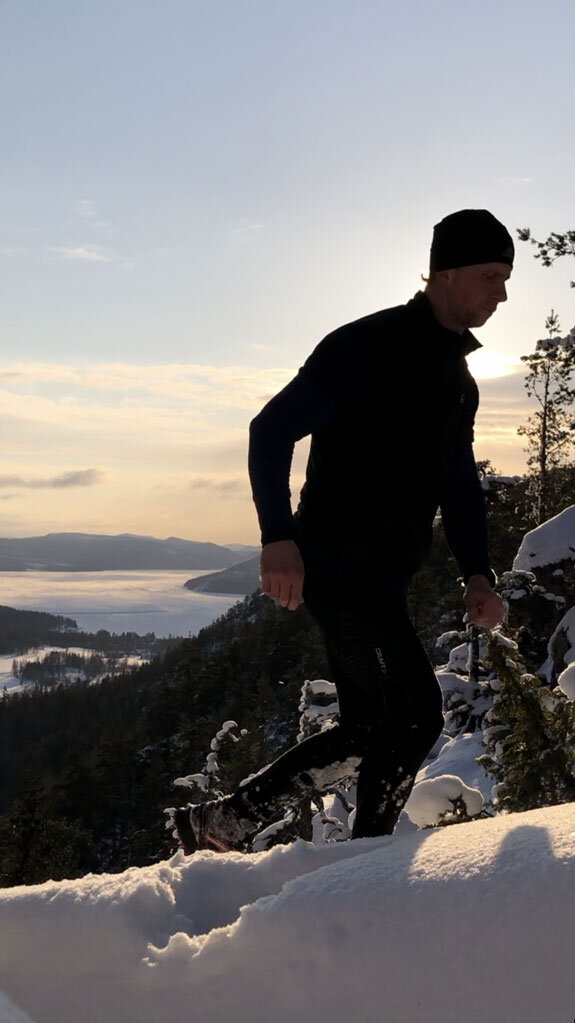
The trail to Vårdkallberget (or Värnsberget, as someone started to nickname it) is a well-balanced hike, with only one rugged path along the hilltop leading to the summit at 265m a.s.l.

The name "Vårdkallberget" means "beacon mountain”, and it evokes memories of the old signal fires. In the past centuries, big signal fires in the High Coast Mountains alerted the locals to impending enemy attacks. The beacon chain extended all the way along the coastline so that the armies could be gathered.

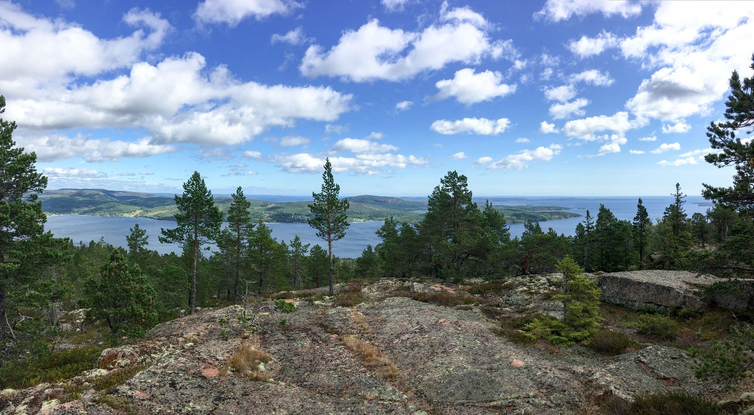
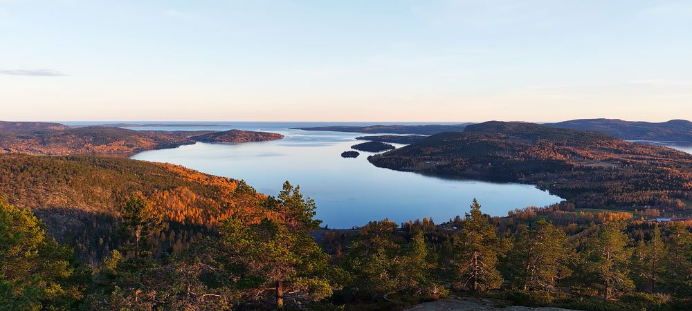
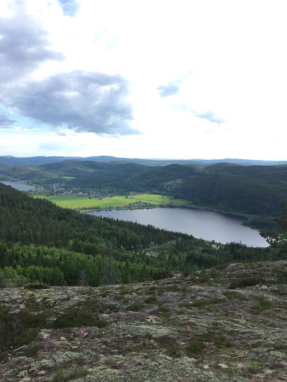
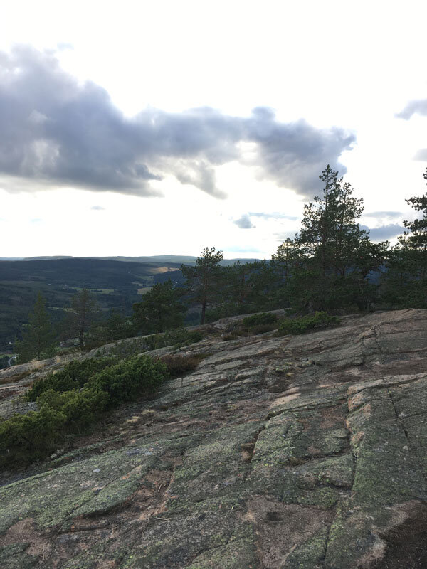
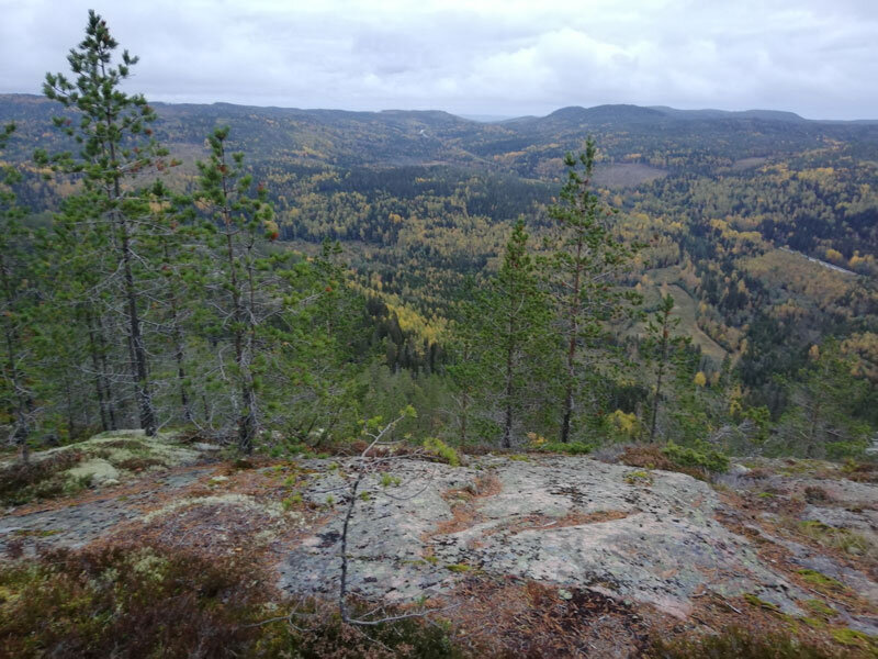
Overview from the summit toward south: on the right, the Fäberget Mount at the entrance of the Docksta fjord.

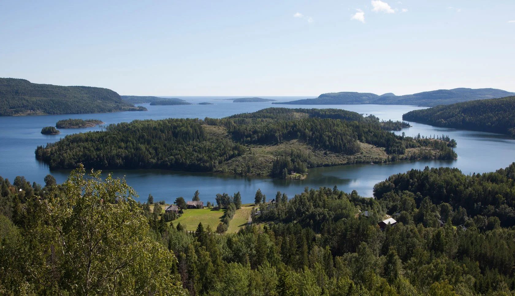
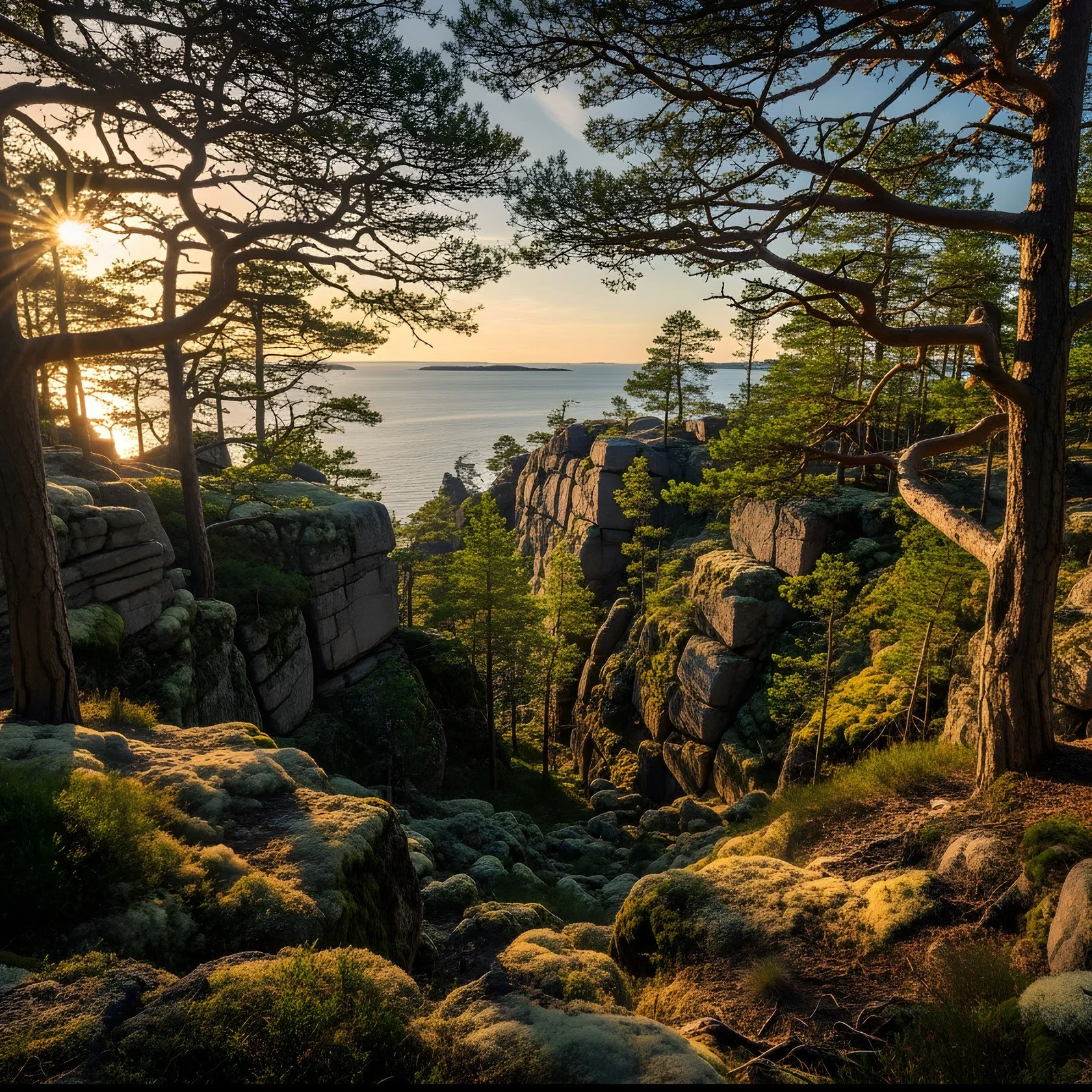
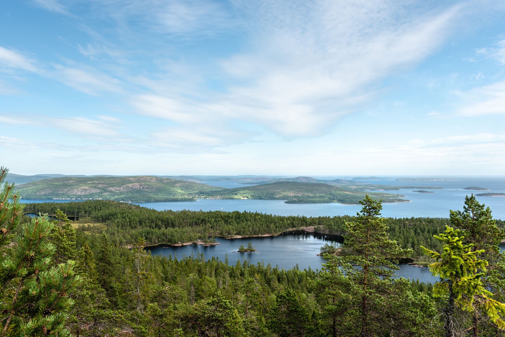
Rising from the sea, the mountain forms a peninsula, never more than a couple of kilometers wide, that divides the Docksta fjord from the Norrfjärden.

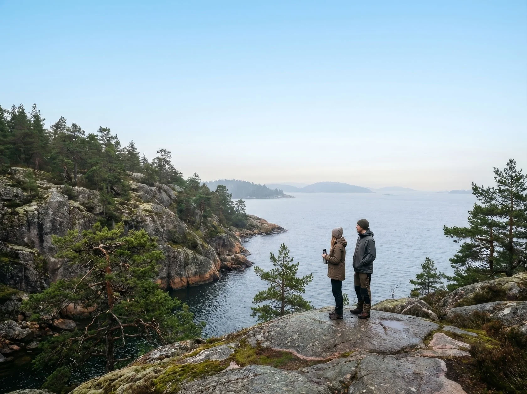
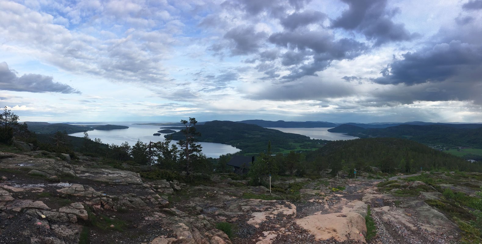
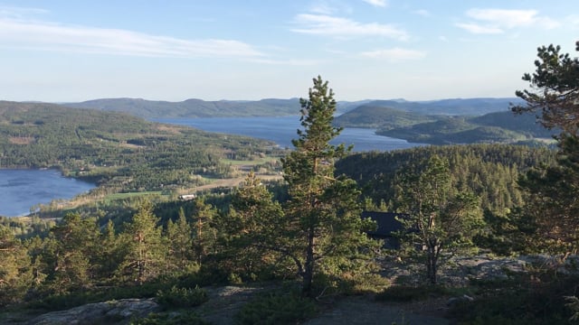
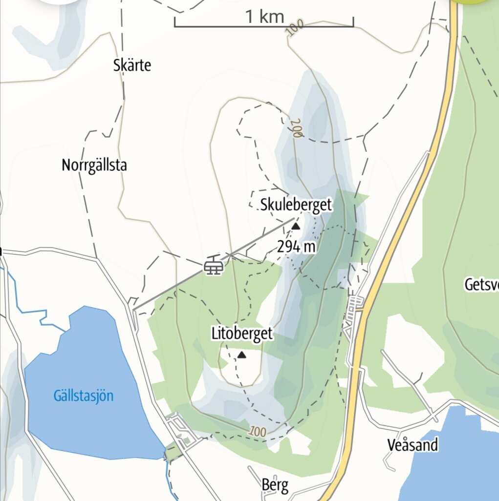
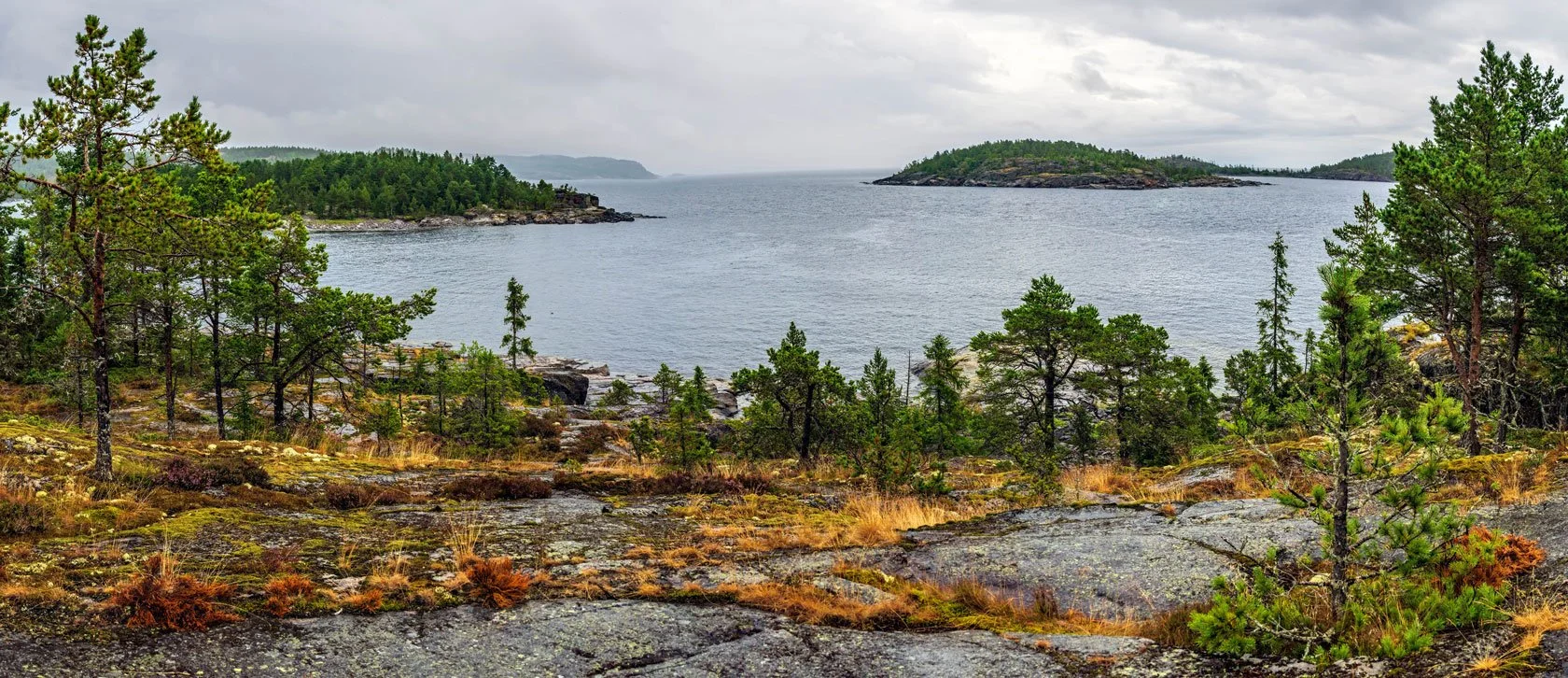
Between the North fjord and the Dockstafjäerden, the peninsula with Vårdkallberget Mount (panoramic view from the summit of Skuleberget)

On the right of the panorama, the summit of the Vårdkallberget Mount from the overview point at Getsvedjeberget.

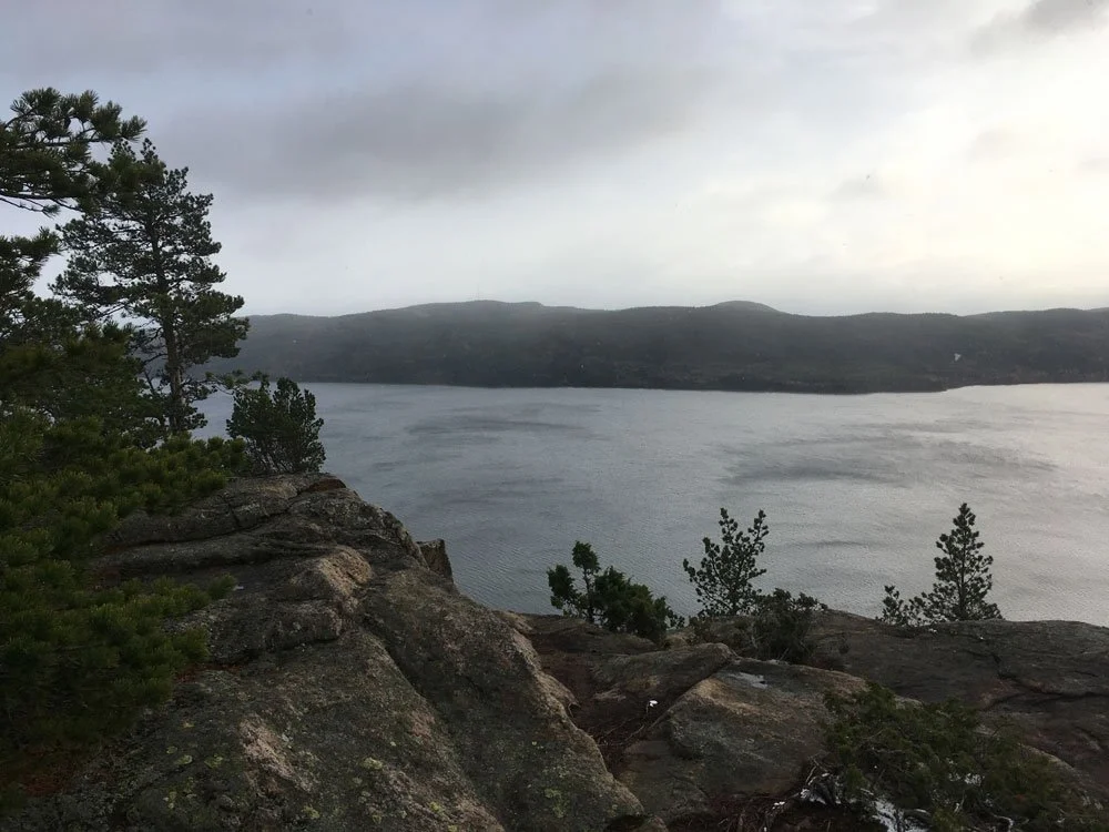
From the Per Olsbo’s shelter, near the Höga Kusten Leden, view of the Vårdkallberget Mount. From its height, it overlooks the smaller Valabergen Mount, characterizing the shape of the promontory overlooking the fjord “Ullångerfjärden” to the south.

Along the coast, there aren't many houses, and the mountain retain its amazing natural features.

The trail that leads to the top of Vårdkallberget is mostly known by locals and, fortunately, little visited, so it will be much easier to meet some wild animals, though you will probably only see traces of them in the summer.

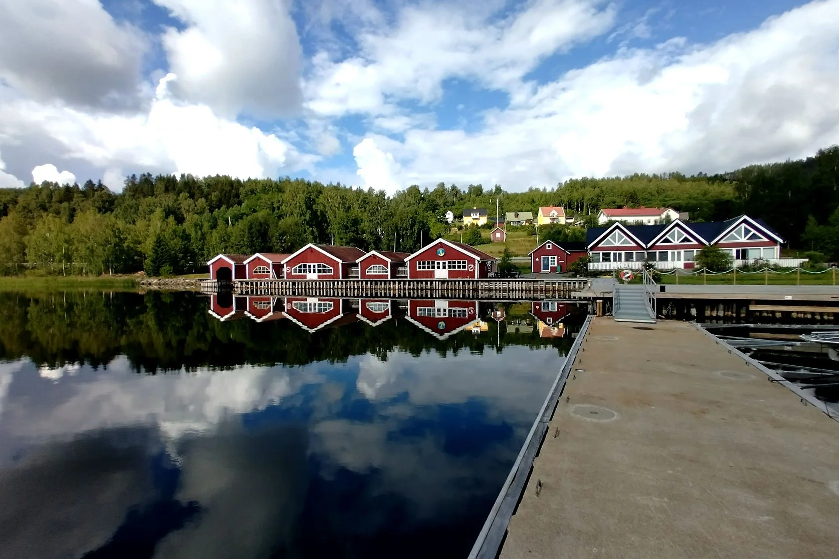
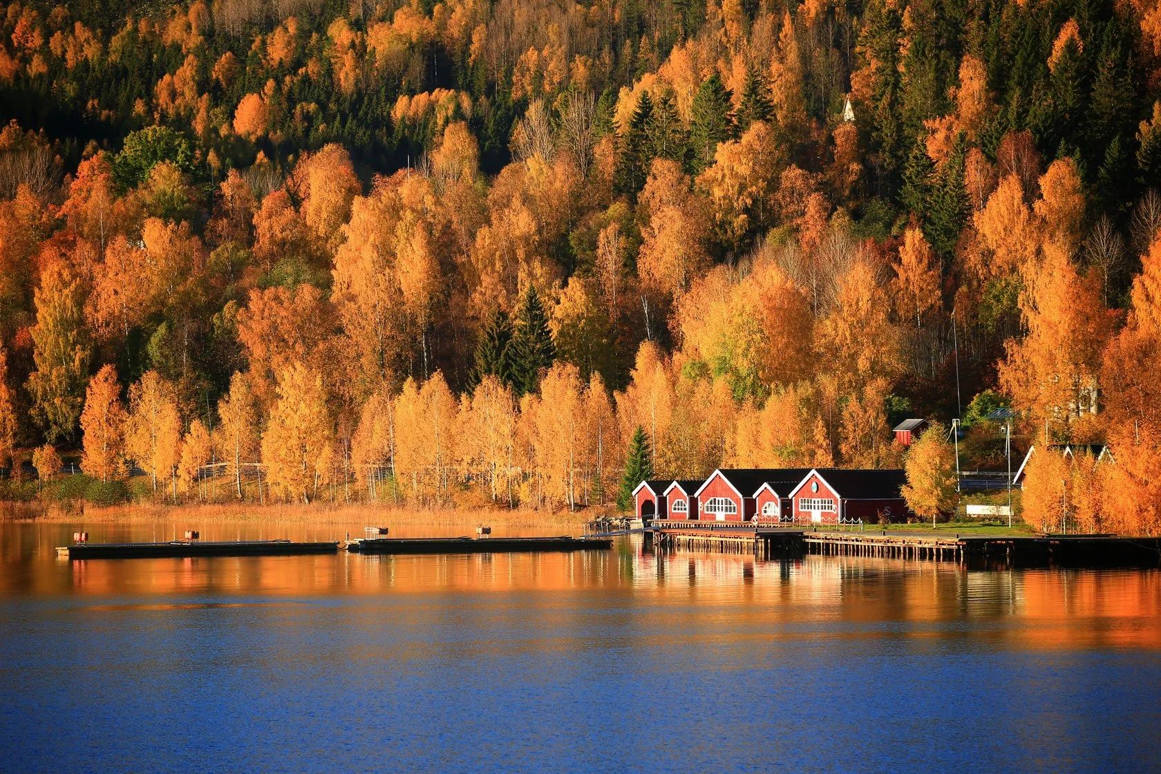
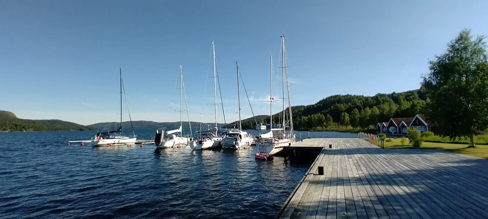
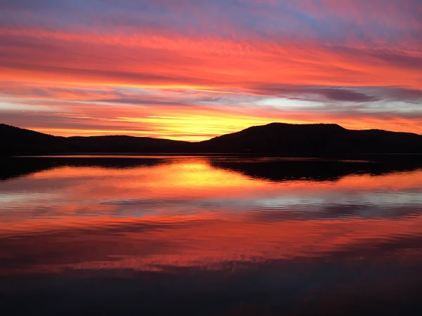
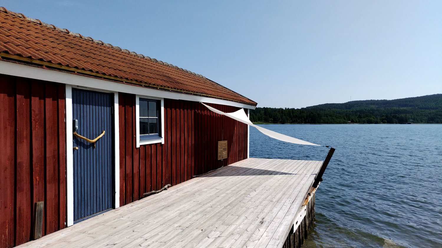
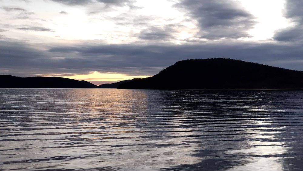
The Vårdkallberget Mount from the pier at Docksta Havet.

From the village of Docksta, looking south-east, you can see the mountain dominate the landscape at the beginning of the fjord. It is curious to think that it is only thirty meters lower than the top of the most famous Skuleberget.


🧭

Trail to Vårdallberget Mount: back and forward from the Antenna in Myre:

4.6KM, D+180M, ~2HRS

(for hikers of all levels)

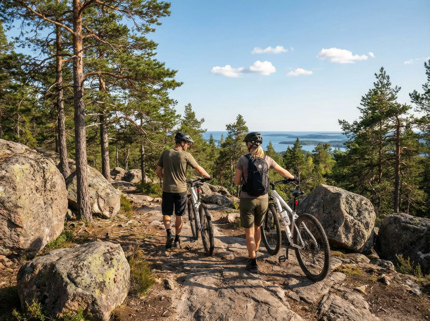
From the marina, it's easy to get to the beginning of the path by foot, bicycle, or by parking your car in Myre.

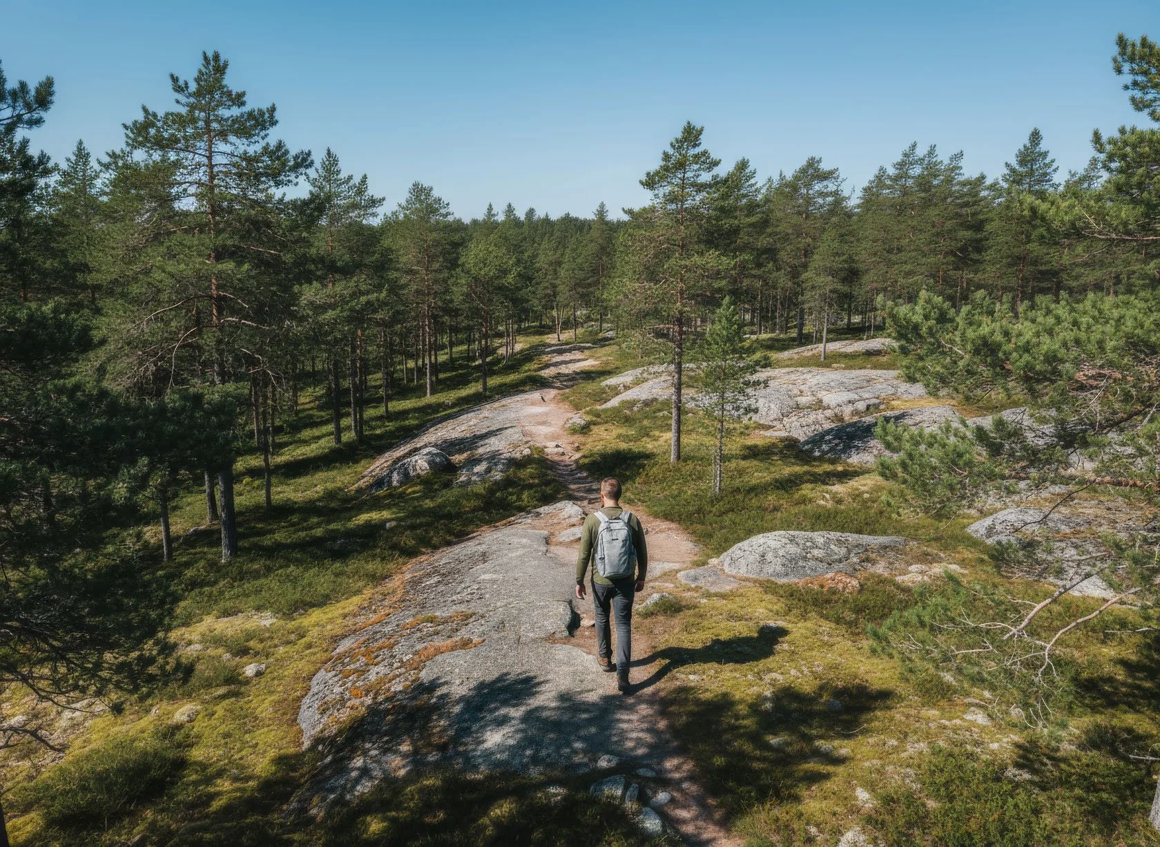
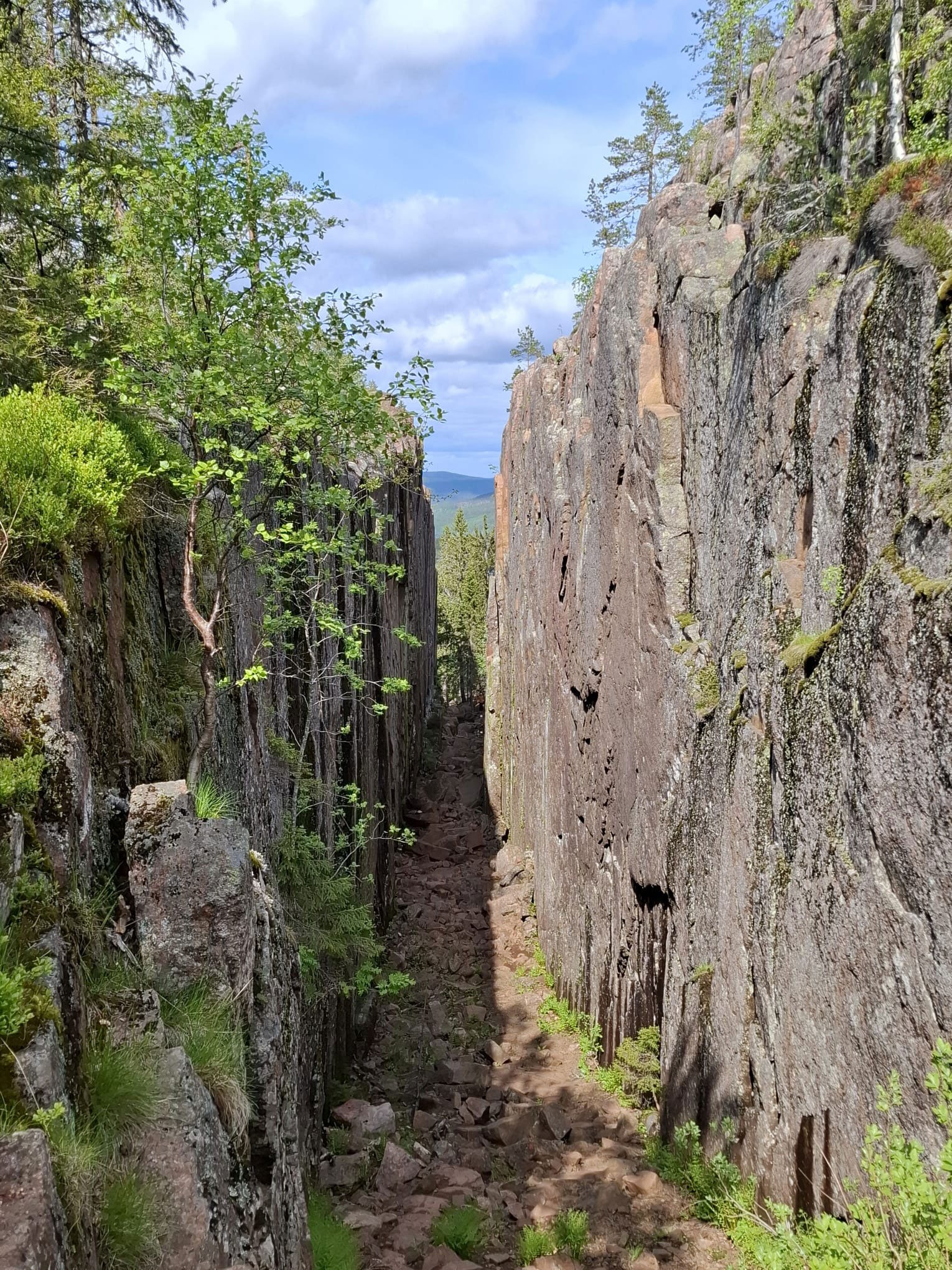
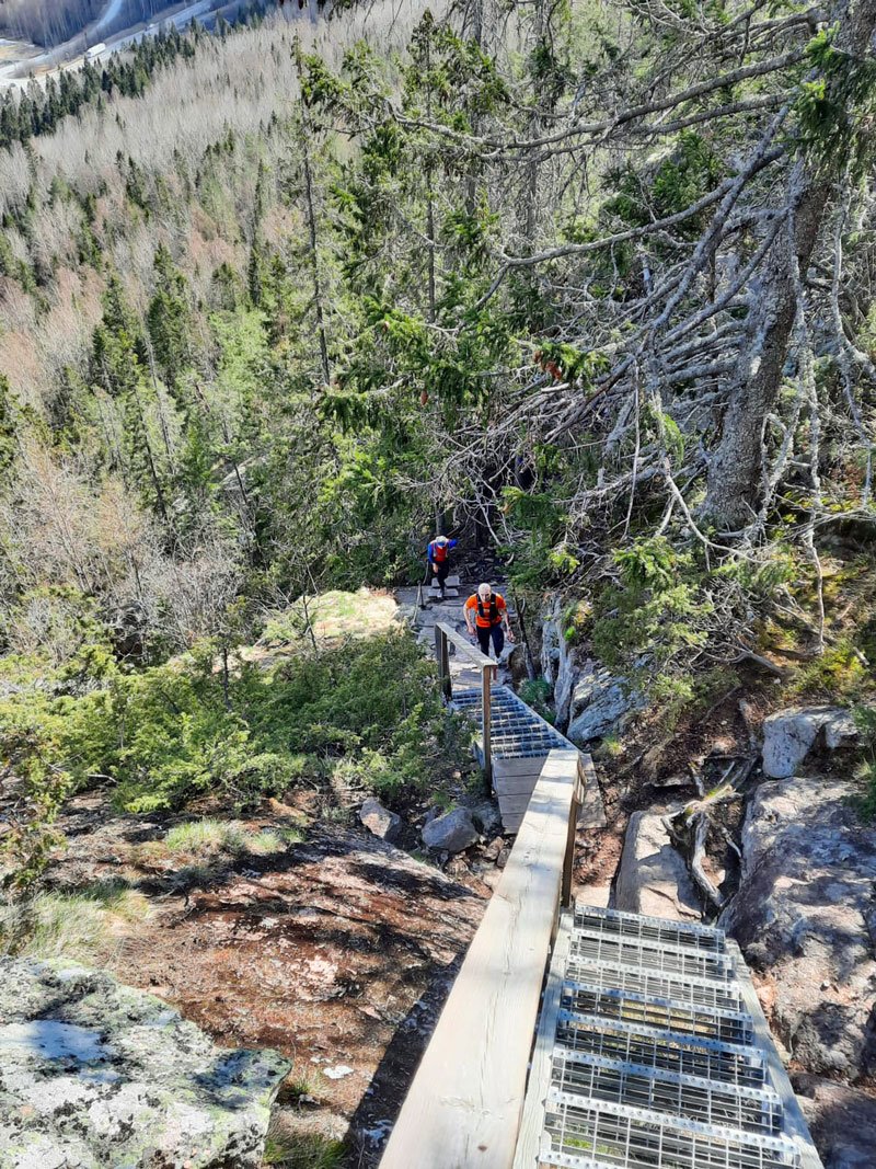
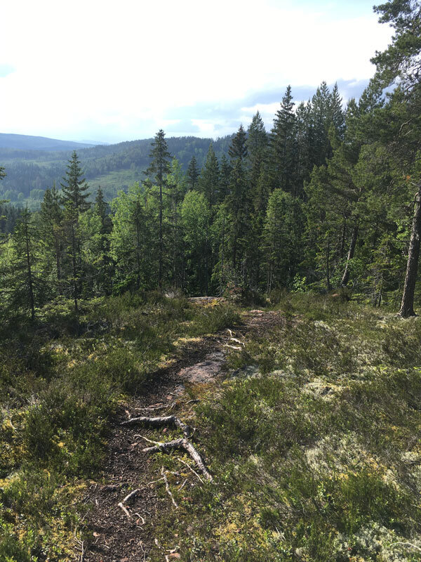
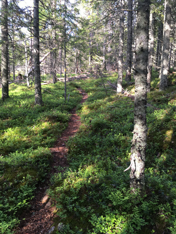
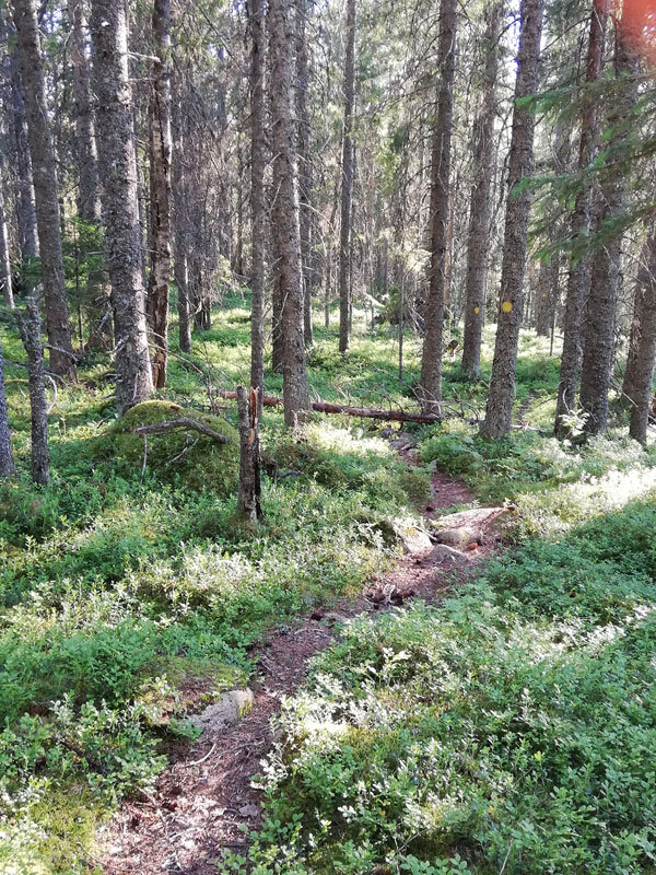
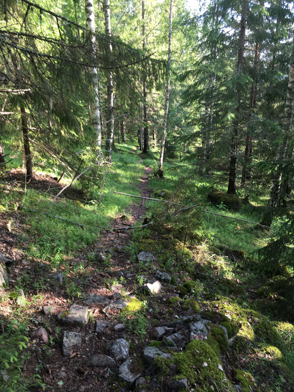
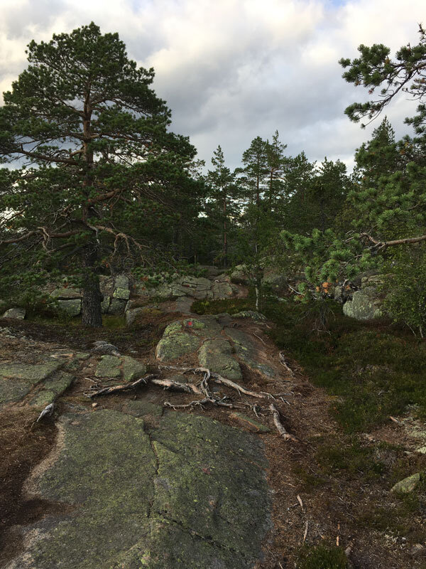
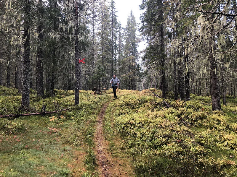
The trail climbs steeply along the short terrain road to the antenna in Myre, then crosses over a short stretch of recently cleared forest before entering the breathtaking wild area. This section of the woods is distinguished by its openness and exposure to the sun.

These particular forested areas, precious to biodiversity for flora and fauna, are called "rocky pine forests". You will understand what it means to cross a natural and undirsturbed old-growth wood in the High Coast.

The rocky pine forests are still dominated by natural dynamics and low human impact since they are considered low productive due to the low tree density (lack of water and rocky and nutrient-poor hilltops may contribute to it).

These are structurally diverse and heterogeneous forests and valuable habitats for organisms connected to sun-exposed dead woods; both snags and logs can be present for several centuries after death.

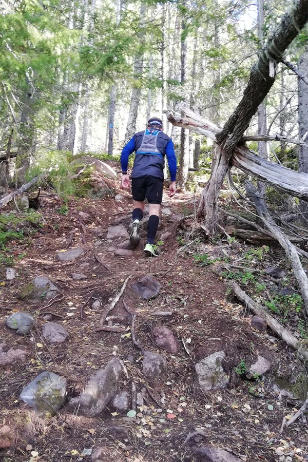
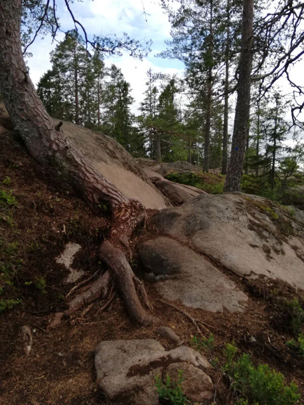
During your excursion, you will see very old pines (Pinus Sylvestris, particularly) that have been twisted by wind and snow, and you will likely need to climb or surround some storm-fallen trees, whose exposed roots will show you how almost everything here clings to a small layer of soil and to bare bedrock to survive.


At Vårdkallberget Mountain, you get a real taste of what hiking Nordic trails in areas with low human impact looks like


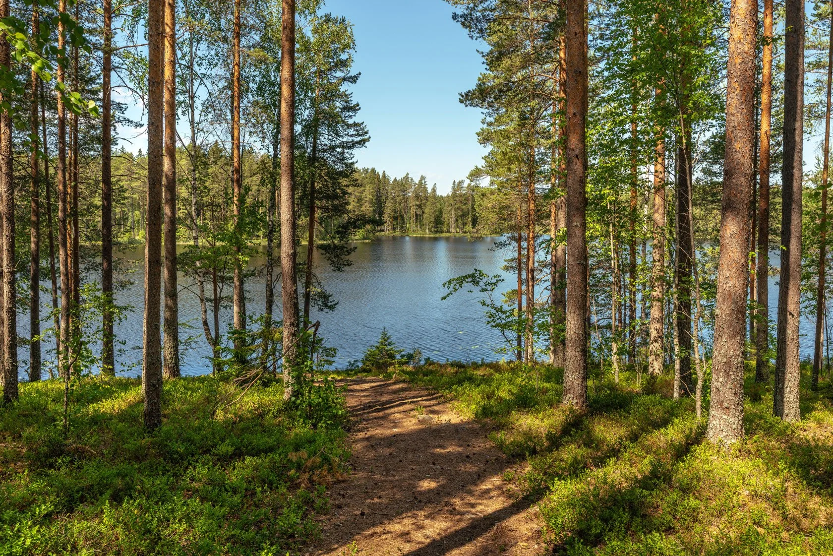
By walking a narrow single track surrounded by blueberry bushes, you will pass portions of thicker forest, passing next to a wet area, and walk a few tens of meters next to a beautiful lake but invisible from the path if you don't start looking for it.

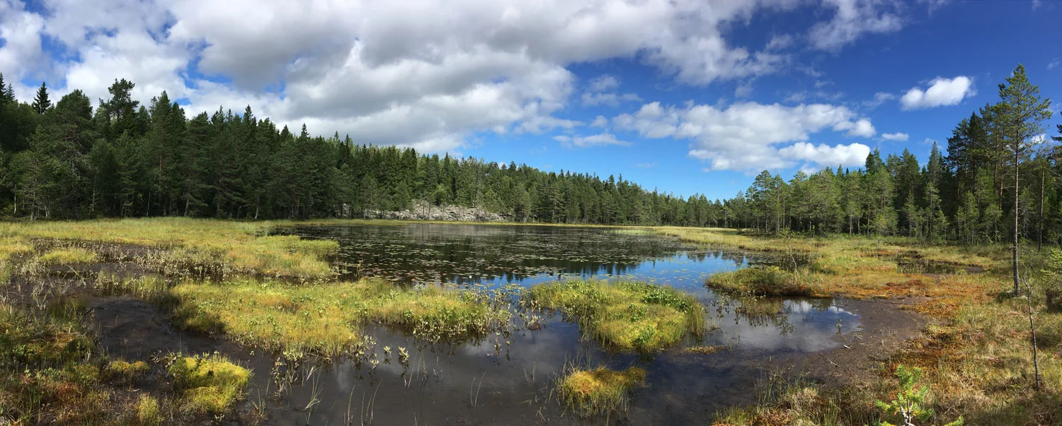
Finding the lake on the map and orienting yourself to get there should be fairly simple if you have a smartphone and a trekking app (like Komoot or Outdoorsctive). Just be cautious when approaching the wet area that is surrounded by a frequently occurring layer of moss under the surface of which there is water.

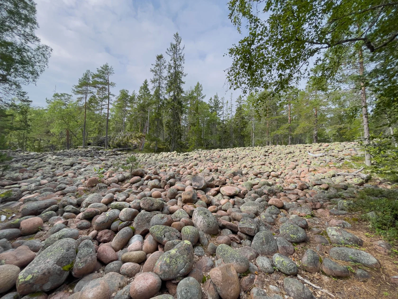
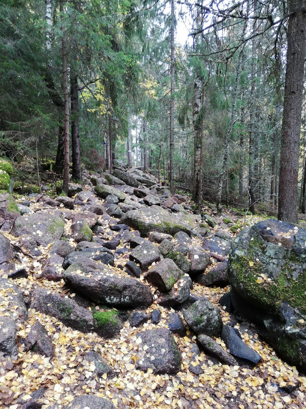
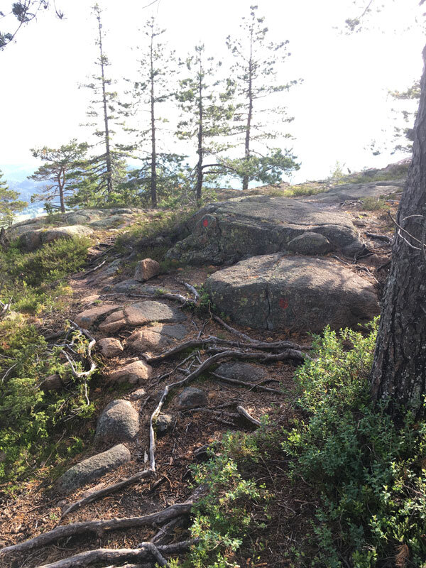
You will also cross a couple of the typical cobble fields whose pebbles have been rounded by the work of the waves because they were once at sea level around 10.000 years ago.

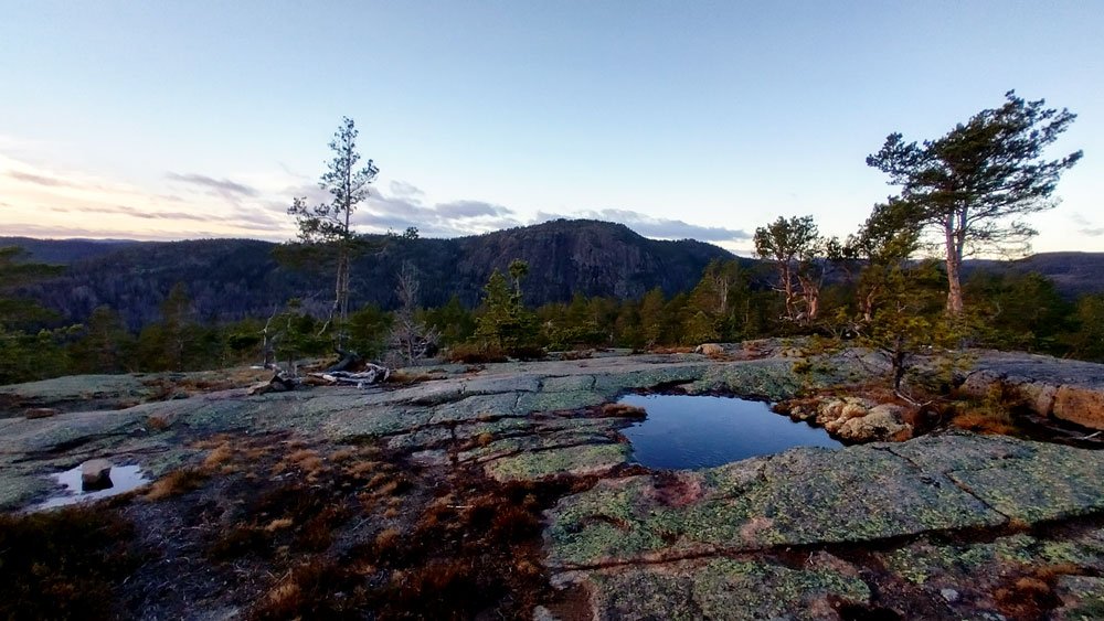
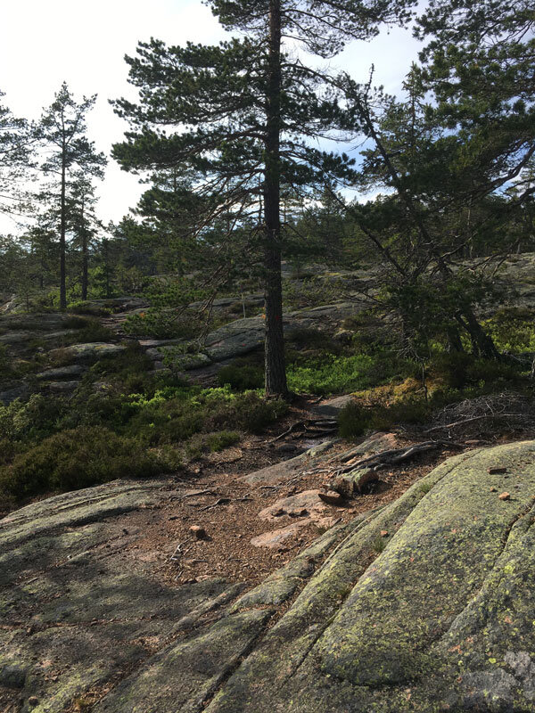
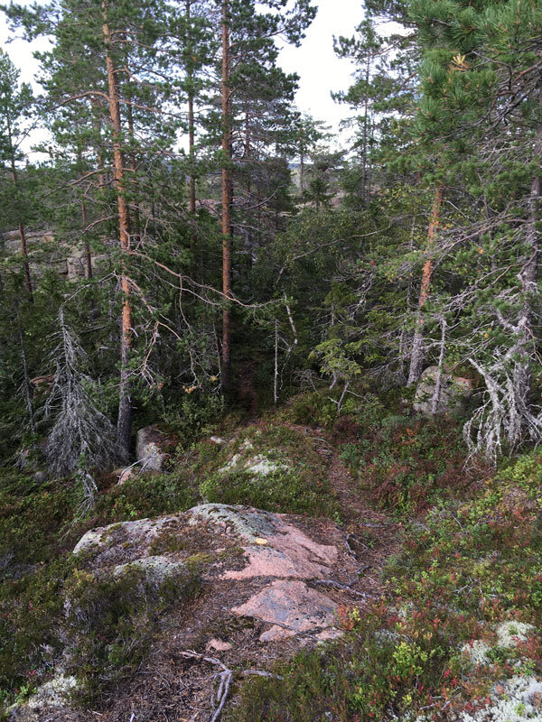
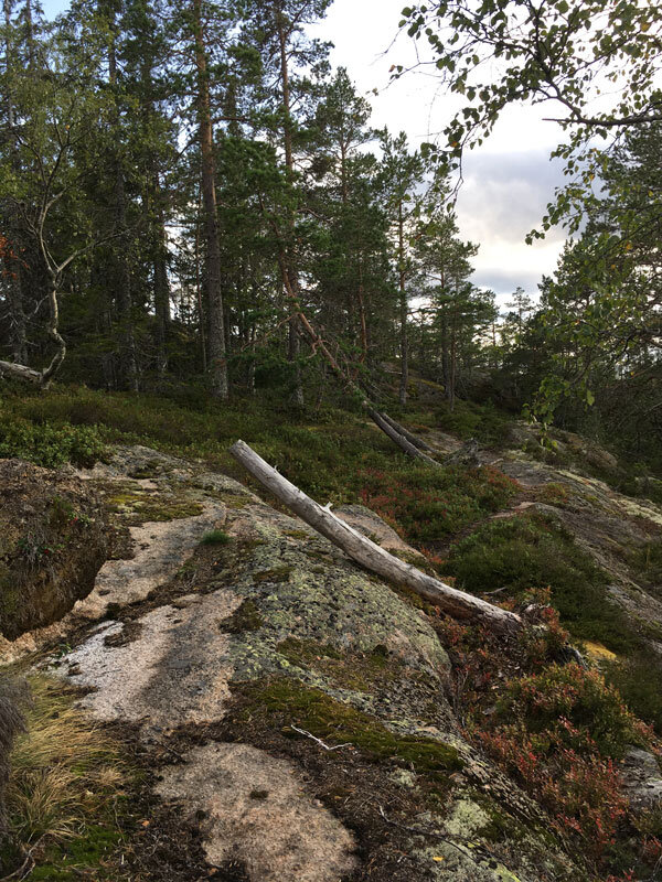
The final stretch of the trail has sparser vegetation, making it easy to jump over some broad, rocky reliefs of typical red granite that are covered in moss and lichen.

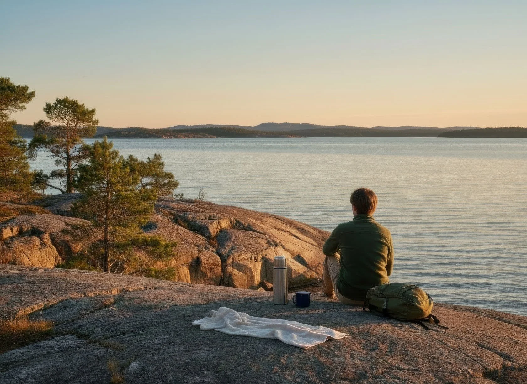
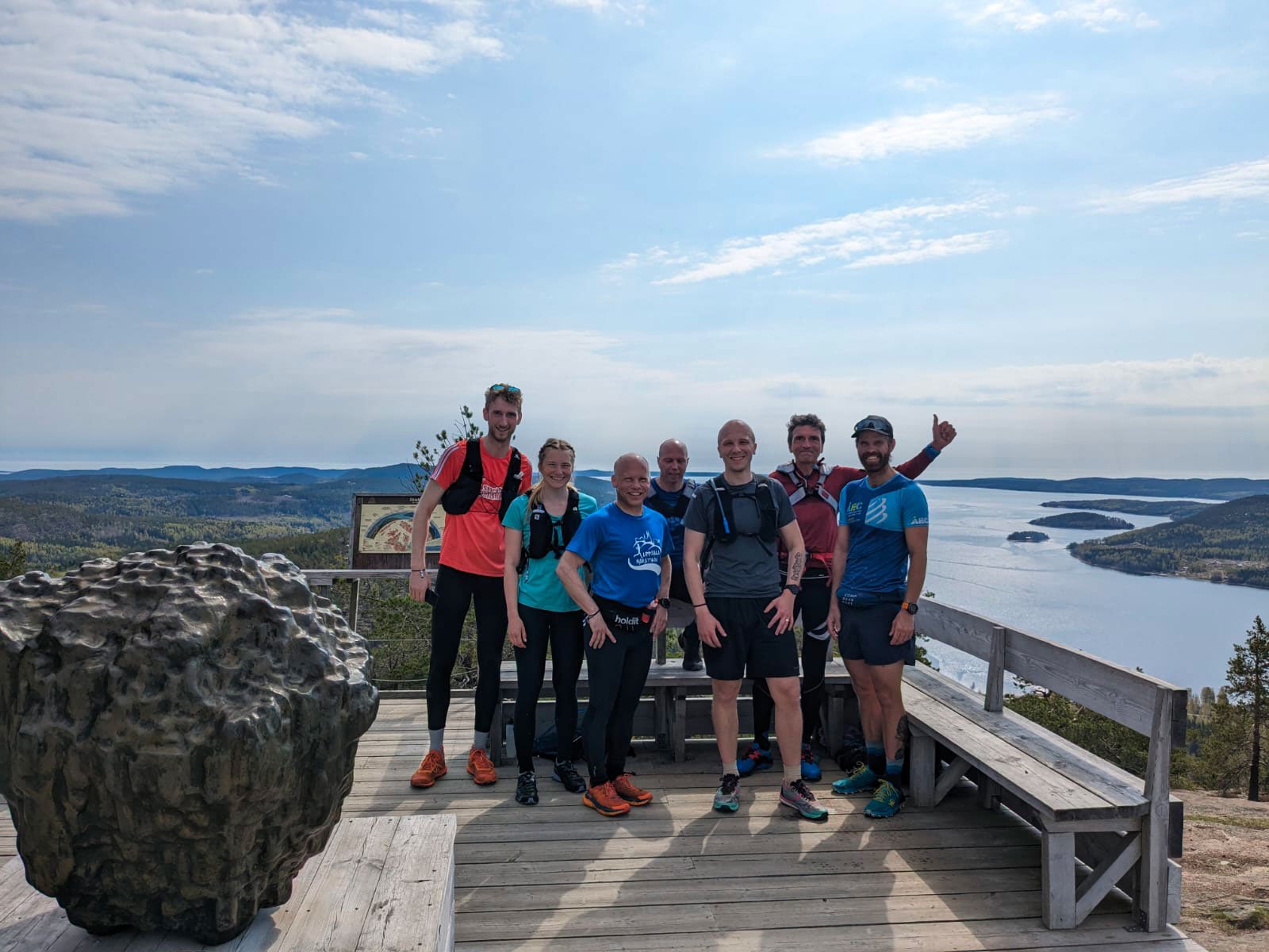
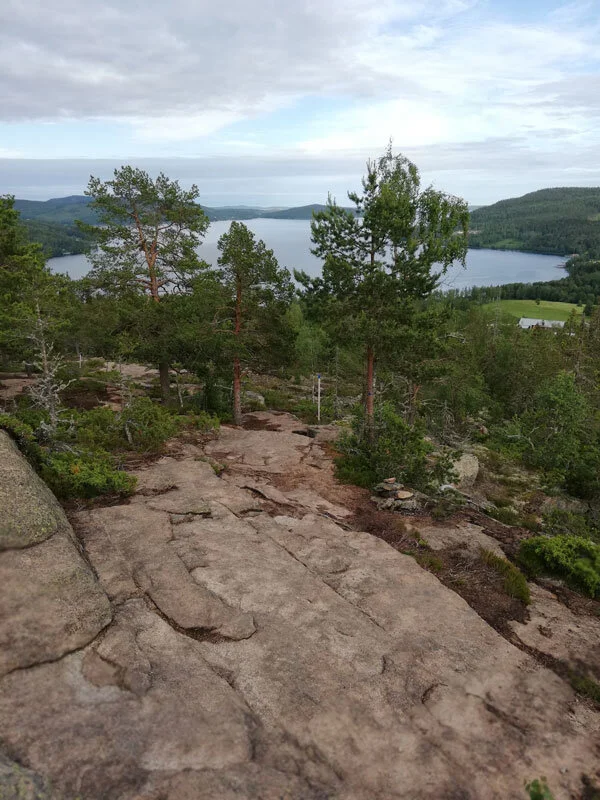
You will be able to identify the southern summit of the mountain by the stacked stones that accentuate some of the 360-degree panoramic points over the archipelago.

If you start exploring the surroundings a little from there, you will discover charming views to the Ullånger’s fjord and, just below the top, on the north side, a particular wind shelter.

Photo ©: courtesy by ArkNat

It's name is “He”, and it was built in 2019 within the ArkNat project by students from different Scandinavian schools of architecture. Because of the shelter's two-sided architecture, guests can tilt the main body for shade, or wind protection, or a gorgeously framed view of the Norrfjärden, toward the Skuleberget and the Skuleskogen National Park.

The whole route to the summit of Vårdkallberget, back and forth from the antenna, is roughly five kilometers long and has a level of difficulty that most people can handle.

Naturally, it is advised to wear a good pair of trekking shoes and a pair of long trousers (the single track path narrows between bushes at certain segments). You won't be disappointed when blueberries are in season, but don't forget to pack a water bottle and possibly some snacks.

When windy, the summit is typically fairly exposed. At Vårdkallberget, however, the sun will shine through the trees for a good chunk of your journey if the weather is good. Have fun!


Tommaso De Rosa

See my host profile and contact me on Airbnb

If you would like assistance planning your stay in one of our waterfront accommodations at the marina, need hiking advice at Skyleskogen Park or Mount Skuleberget, or have any other questions regarding things to do on the High Coast during the summer, please contact me via the Airbnb chat. You are welcome :)

_Tommaso

Please write me by email or WhatsApp at +46.763136909


Three unusual holiday accommodations by the sea on Sweden's High Coast

A great starting point for exploring the Höga Kusten World Heritage Site are these three vacation rentals: a comfortable dock house, a cozy boathouse, and a completely furnished apartment overlooking the sea, all of which face the marina in Docksta.

Docksta is a friendly community with a strong tourist vocation. Easily accessible by car or public transportation (plus, the village is crossed by Stage 5 of the Höga Kusten Leden), it's ideally located for seeing the well-known archipelago along Sweden's coast, and especially the amazing Skuleskogen National Park.

From here, you can even take the daily ferry to the island of Ulvön, which is accessible throughout the summer. In particular, some of the most well-liked locations for nature hikers may be discovered on foot or by bicycle, allowing you to temporarily forget about using your car.

All the "ingredients" that contribute to a holiday being special and unforgettable—like the trails leading to the summit of Skuleberget, the stimulating views from Getvedjeberget, Fäberget, or Vårdkallberget—are therefore all within a few regenerating hours' walk in the Nature.

Starting from a base by the sea affords you an envied view, even if you don't have a boat: this is where the coast pulls, drawing a landscape that isn't entirely marine or mountainous but instead delivers the finest of these kinds of locations, making it somewhat "strange" and exclusively Scandinavian.


Make the most of your trip to the High Coast by renting one of these incredibly distinctive vacation accommodations.


Staying in a traditional Nordic boathouse is a much-loved experience, especially for hikers and travellers. It features a minimal but charming room with one or two beds, preserving the extraordinary building’s connection with the water, which was built to accommodate fishing boats.

You can rent this hiker-friendly, tiny room for one night or more, alone or in a couple. For last-minute reservations and flexible check-in, contact the host via Airbnb for availability.


Have you ever considered sleeping just above the sea, but not in a boat? An ex-darsena who has been converted to spend the night claims to be able to see the sea up close during the summer.

It's a glamorous spot that blends indoor and outdoor spaces, is ideal for couples looking to spend special time by the sea.


This superbly furnished apartment is perfect for a family or couple's vacation and features stunning views of the sea. It is baricentric relative to everything you would like to see while on vacation on the High Coast.

There's a great view of the fjord from the loft bed area. The living area's expansive terrace and wall of windows look out onto the marina and its piers.


These holiday rentals are available for reservations on AIRBNB

KNOW WHO HOST

Tommaso De Rosa

See my host profile and contact me on Airbnb

If you would like assistance planning your stay in one of our waterfront accommodations at the marina, need hiking advice at Skyleskogen Park or Mount Skuleberget, or have any other questions regarding things to do on the High Coast during the summer, please contact me via the Airbnb chat. You are welcome :)

_Tommaso

Please write me by email or WhatsApp at +46.763136909


A World Heritage Site is just outside your door!

WHAT I HIGHLIGHT:


Superior panoramic views of the High Coast World Heritage archipelago

If you are planning a vacation on the High Coast and you love hiking, Docksta is a great place to start, making it your base camp to explore some of the most stunning trails on the World Heritage site.

Which destinations would I suggest? First, the Skuleskogen National Park and the Skuleberget Mountain Nature Area.

The list of summits is as follows: Skuleberget, Slåttdalsberget at Skuleskogen, Getsvedjeberget, Vårdkallberget, Fäberget, and Herrestaberget. From these mountains, the sweeping views of the archipelago are breathtaking.

They're all well worth the effort, but you'll probably have to decide which to focus on during your excursions. So, the following information may be helpful to you :)


Hiking to the best 6 viewpoints offering sweeping views of the Höga Kusten archipelago

All of these are a few-hour excursions, except for the one to the national park Skuleskogen where you will do well to devote an entire day.

Generally speaking, I advise you to leave the car parked and point out a few of these stunning mountains' peaks, which you can even reach on foot, starting from Docksta.


Skuleberget

296m above sea level

You can absolutely not miss the Skuleberget mountain; there are five gorgeous trails to reach its summit.

At the top, the circular path marked with red dots and named Kalottstigen allows you to walk, at 286m a.s.l., along the anchient coastline (it is the world’s highest point of land to have been uplifted by a postglacial isostatic rebound). Here you will enjoy some of the best overview points of the High Coast World Heritage.

It is a short walk or bike ride from the Docksta marina to the base of the mountain, which is less than two kilometers away.

I suggest you go up the east side, where there are the Naturum Museum and the Via Ferrata, because from there two unforgettable paths start: the "Eagle" (Grottstigen) and the "Lynx" (Östra Bergstigen).

  • The first begins just besides the museum; it is the steepest and takes you on top in just over 800m. The view towards the sea is incredible. It is a challenging path; at some points you will find iron steps in the rock, you will have to walk on large massifs, and you will also have to use your hands. It's not a climb, of course, but I don't recommend it if the ground is wet, just as I'd avoid going through it to get down.

  • The second option starts just under a kilometer north of the museum, following the Höga Kusten Leden. It climbs up the mountain through the beautiful forests of the natural area and, turning around the north side, offers a couple of truly unique sights, eastward and then towards the national park.

To return, I recommend following downhill the Höga Kusten Stigen / Södra Bergstigen Stigen (the #BIG5 path named “FOX”).

This panoramic path is facing south and 2.5 km long; crossing the summit of Litoberget Mountain brings you back to the valley along the sunny side of the mountain and its stunning panoramas over the Dockstafjärden and Norrfjärden.

Here you find more detailed descriptions of all the trails of the Skuleberget mountain, and the history of the path nicknames inspired by the wild animals of the area.


Slåttdalsberget

at 276m a.s.l, spanning between the archipelago and the horizons on the National Park

Since 2023, an unprecedented perspective has been opened towards the archipelago from the top of the mountain Slåttdalsberget. Its top, a basically flat “terrace” of red granite rock, where the vegetation is very scarce, can now be traveled along the path from both sides of the mountain that is split in half by the Slåttdalsskrevan, a 200-meter-long and 30-meter-high fissure.


Getsvedjeberget

Overlooking the Norrfjärden

The one that leads to the top of Getsvedjeberget mountain is a short excursion marked by satisfaction, although a bit challenging.

The segment that leads up begins steep and continues to be, but the effort is abundantly rewarded by the beauty it offers on the landscape of the fjord and the surrounding mountains. If you go there on a sunny, windy day, your jaw will drop in astonishment.

From Docksta, you can go there walking or biking (~3km); there is a pleasant road that leads to the Norrfjärden, avoiding crossing the highway. The path starts right inside the campsite.


Vårdkallberget

360 degrees views over the wild + the joy to walk the 2.5Km single track segment to the peak

Hiking in the stunning scenery of the High Coast can be experienced firsthand on this delightful and simple trail.

No component is left out. The path, almost a single track between blueberry bushes, slides quietly along the back of the mountain, crossing a beautiful rocky pine forest, where light easily penetrates. The contact with the sky is constant.

From the antenna, in Myre, you reach the summit at 265m a.s.l. in less than 3 kilometers, crossing wet areas, stretched on rocks covered with lichens and surrounded by very ancient pines, contoured by the wind. The path runs through a hidden and almost "secret" lake and crosses in a couple of points some of the typical cobble fields with round stones formed by the waves and sea ice around 10.000 years ago.

From the village, you can walk or bike to Myre to the “Antenna”, and start there your trail to Vårdkallberget: here you can download a free info-map about >


Herrestaberget

A special and privileged observation spot

This mountain protects Docksta and the northern part of the fjord from strong western winds coming from Norway.

From the main street of the village, you can hardly see but the Herrestaberget Mountain is there, at less than 1km; it rises in all its natural beauty, enclosing the precious treasure of a small natural area that preserves a portion of its oldest forest heritage from woodcuts.

The trail begins along the southwestern shore of Lake Gällstasjön; in this case, the track does not lead to the summit of the mountain but reaches a beautiful promontory overlooking the southeast. An observation point over Docksta, its fjords, and mountain reliefs will easily stay in your heart.

From the road that coasts the lake, you get there by a steep path in the woods, a little more than 500 meters and an oscillating divide of 129 meters.

From this panoramic point, the trail descends back and forth by taking a wide anti-clock tour around the mountain, leading to Sätra, with the wonderful old 1400 church of the village and the charming fields overlooking the south towards the fjord.


Fäberget

At the top of the mountain carved by ice and the sea

From its summit, there is an observation point with an incredible perspective. The mountain sits on the water at the intersection between Dockstafjärden and Ullångerfjärden. It is a cult deviation for all hikers walking along Stage No. 5 of the Höga Kusten Leden.

From the old church in Docksta, the trail crosses the Sätra meadows and enters, after a few hundred meters, into the forest. It is a really suitable walk for everyone, along a beautiful segment of the Höga Kusten Leden. At Skoved, you can safely cross the highway and walk the road toward the mountain and its shelter, facing east over the sea. Make time to explore the few small tracks around the summit toward the north, too. The peak has large, flat rocks covered by lychens and small trees.


During your walk to Fäberget, the short deviation to the shelter of “Per Olsbo” is unmissable.

This spot is a magical place, with a spectacular peak view of the fjord and Vårdkallberget, towards Docksta and the Skuleberget mountain.

Along the Höga Kusten Leden, it is marked with the "Utsight" sign approximately a few kilometers south of the church. Remember to sign the guestbook :)


Some tips to prepare your excursions

  • Move with a light backpack, always carry a reservoir of water with you and something to eat to replenish your energies.

  • With few exceptions, all the paths that lead you to climb or descend on the reliefs are very technical, you will also walk on rocks, roots and pebbles, you need suitable shoes. You do not need heavy or rigid shoes, good shoes are enough, for example for hiking or trail running, that are comfortable, with a good grip and possibly tasselled.

  • The paths that I have described are average well marked, you will generally find signs with the indications that are needed or more easily than signs made with colored paint on rocks and trees.

  • Bring a cell phone with the batteries charged but remember that you will not always have the coverage guaranteed, especially if you are in roaming with a non-Swedish telephone contract.


Tommaso De Rosa

See my host profile and contact me on Airbnb

If you would like assistance planning your stay in one of our waterfront accommodations at the marina, need hiking advice at Skyleskogen Park or Mount Skuleberget, or have any other questions regarding things to do on the High Coast during the summer, please contact me via the Airbnb chat. You are welcome :)

_Tommaso

Please write me by email or WhatsApp at +46.763136909


Sleep by the sea on the Höga Kusten at a dock house above the water

This glamorous dock house will be a less ordinary overnight stay during your next discovery of the High Coast World Heritage.

A fantastic location for lodging: close enough to stroll to Skuleberget Mountain and to readily reach the area's natural surroundings near Skuleskogen National Park.

At the "Dock3", situated within the marina in Docksta, you and your partner will enjoy sleeping OVER the sea and love the merging of the indoors with the outdoors.

This dock house was transformed towards the end of the 1970s (originally it was a fishing boathouse that was built above the water), preserving its character of being at one with the sea.

Under the floor, made of pre-impregnated wooden dock boards, you still see the reflection of the water, and the sound of the surf between the wooden walls serves as music as you sleep 1.5 meters above the sea's surface.

The accommodation is roomy; you have access to more than 40 m2 of inside surface area as well as the similar amount of private space outside, with access to the sea, on your own pier and terrace.


Your bed is undoubtedly the focal point of the sizable living area; it looks eastward out the 3-meter dock window onto the fjord. As if on a boat's deck, you will have an exclusive view of the ocean from your bed.

It is a real double bed (160x200), a one-of-a-kind piece of furniture made specifically for the dock, with comfortable bedding, including pillows, duvets, and additional blankets for more warmth if needed.


You will also enjoy living outside on the seafront by immediately accessing the large portion of the pertinent jetty around the dock. You can step out and start swimming in the water only a few steps away from your door.

This cabin provides an exceptional relationship with the water and the landscape view from the pier: here outdoor and indoor become one.


·

Take note before booking: you will have a glamorous experience, but pay close attention—there won't be any heating inside the dock (only the summer months are suitable for renting it). We also have additional blankets in case the weather decides to deceive you.

·


The spacious cabin's interiors ensure your comfort and freedom.

The building's design is straightforward, as are the traditional Nordic boathouses; inside, there is just a minimal amount of furniture—just what is necessary to enjoy your seaside accommodation—and wood is used to build everything from the walls and ceiling to the floor, which is constructed of pier boards.

There is a 33-square-meter area overlooking the water with sleeping and sitting areas where the bed and sofa are situated.


·

ACCOMMODATION

2 SLEEPS

·

FACILITIES

  • The lodging includes bed sheets (full bedding): at your arrival, you will find your beds already made up.

  • Private outdoor place by the sea, access to the water, and forniture (table and chairs, deck chairs).

  • You can keep your shoes, outerwear or backpacks in a separate, independent entry room.

  • There is a utility room (ca. 8 mq), where you will find an area for dining and a kitchenette, with a small fridge, microwave, coffee machine, toaster, and water boiler.


It is not a full kitchen, so there is no sink, oven, or stove, but there are a make-do platform and the essentials to store or heat your meal. This would be ideal for cold cooking, heating some easy dishes, and ready-to-wear food. There are table and chairs.

A “Kitchen Kit” with plates, glasses and cutlery for two people is available for hire.


  • Personal code to access the SERVICE HOUSE (that is located 50m from the Dock3 and dedicated to the Guests of the marina only) with TOILETS, SHOWERS with warm water all day, changing room, a countertop to wash the dishes, and LAUNDRY AREA (washing machine and dryer 50:- sek per tvätt/wash). Hot water available 24/7 included.

  • Personal “Towels Kits” are also available for hire.


  • Cars parking (free)

  • MTB bikes renting (80:- sek day)

  • You are welcome to stay and use your kajak or paddleboard to reach the water (free)


YOU SHOULD KNOW

  • The dock won't be heated, and only the summer months are appropriate for renting it out.

  • No smoking indoors and, please, on the piers, too.

  • Sorry, no pets :)


This holiday rental is already available for reservations on AIRBNB for the summer

The Dock3 is available on Airbnb for sea lovers and hikers as the "base camp by the sea" to easily access and enjoy the Skuleskogen National Park and the natural surroundings in the area of the Skuleberget mountain.

Bring your best studded shoes, mountain bike, kayak or paddleboard: the High Coast is right on your doorstep and is all to be experienced!


Overview from the Skuleberget mountain, there are 5 beautiful paths to reach the peak and a chairlift, too.

WHY

  • The accommodation is conveniently located nearby the Skuleberget mountain and the Skuleskogen National Park, making it a great place to stay and to start to discover the World Heritage Site while on vacation on the High Coast.

The marina is within walking distance of the "Naturum" museum, the High Coast World Heritage Center located at the feet of the easterly face of the Skuleberget mountain.

  • From the marina, you can easily access the area's natural beauty and participate in outdoor activities and events in Docksta, such as climbing "Via Ferrata" routes, running the Höga Kusten Trail and Twin Peaks races, or attending the outdoor concerts at Skulebergets Naturscen.

  • This unique lodging is anything but typical. From your bed, watch the sun rise across the fjord. Enjoy eating breakfast or an aperitivo on the docks with a view of the sea.

  • To spend a couple of glamorous nights on land, your kayaks (or boat) safely docked in the marina.


WHEN

DURING THE SUMMER ONLY

Check the availability of the apartment between June and August.


Know who HOST

Tommaso De Rosa

See my host profile and contact me on Airbnb

If you would like assistance planning your stay in one of our waterfront accommodations at the marina, need hiking advice at Skyleskogen Park or Mount Skuleberget, or have any other questions regarding things to do on the High Coast during the summer, please contact me via the Airbnb chat.

_Tommaso

Please write me by email or WhatsApp at +46.763136909

(You are welcome :)


Where is The marina

The dock house is situated on the Dockstafjärden at the guest harbor in Docksta.

When you arrive in Docksta on the E4, just at the end of the Dockstafjärden in front of the village, you will see our floating wharfs, docks, and boathouses. The marina is about 100 meters from the pier of the ferry to Ulvön Island and the bus stop "Docksta E4/Marina", and a few hundred meters from the bus stop in the village (near the ICA supermarket).

If you are hiking along the Höga Kusten Leden, you will find the marina 200 m from your track when it passes through the main road of the village or from the ICA store.


EXPLORING THE HÖGA KUSTEN

Seaview from the beach at Kälsviken within the Skuleskogen National Park.


A World Heritage Site is just outside your door. Explore it!

What we highlight:

The Slåttdalskrevan is one of the top hiking destinations within the national park.

The Skuleberget's #BIG5 uphill challenge boosts trailrunners' souls


Racing alongside someone in a natural environment elevates the beauty of trailrunning. However, when the experience is connected to a mountain like the Skuleberget, a sort of trace left by the paths remains in the runner’s soul.

One of the most suggestive places for hikers in Sweden is the summit of Mount Skuleberget, which is part of the UNESCO World Heritage Site Höga Kusten, or the High Coast. This place is a collection of unforgettable experiences and sensations for runners who enjoy being into the wild.

All year round, hundreds passionates get epic trailrunning sessions in its natural reserve.

The #HighCoastRunner group named the five trails and their steep segments that bring to the summit of the mountain “ELK, FOX, BEAR, EAGLE and LYNX”.

They are the “BIG5 uphill paths” of the Skuleberget.

Every run on these uphills will push you out of your comfort zone.


Know all the #BIG5 segments


The mountain stands proudly next to the village of Docksta, facing the fjords and the Skuleskogen National Park.

The peak at 296 m above sea level is paradoxically not the most significant point: at a just lower altitude, at 286 meters, there is the highest coastline in the world, which, due to the melting of the ice after the last glacial period, has risen from the sea level and continues to do so today, about 6/8mm per year.

This is where a challenge arose. It’s for athletes, not between athletes.

The #BIG5 Uphills Challenge is a call to gather a handful of daring runners with the goal of completing all five trails—the respective ascending segments, in particular, leading up to the top of the Skuleberget.


How the #BIG5 uphill paths were born

The #BIG5 segments names (and their challenge!) born in the 2019 summer, when two “brave” trailrunners - Johnny and me - wanted to complete one time all of the five uphills up to the peak of the Skuleberget. For the first time in one single long running session.


The first #BIG5 uphills Challenge (2019/07/09)

Johnny and Tom ran the 1st challenge of the 5 uphill segments in the evening, enjoying the summer light, estimating a course of ~20km and 4 hours long. Then, start and finish had been set from the sea level, at the marina in Docksta.

They have completed every uphill by touching the "Skrubban", the bronze sculpture at the summit. That starts to be a tradition when a trailrunner ends the segments by reaching the top.

Here you see how they ran the sequence of all the #BIG5 paths, in a course of 25km and ~ D+1.414m.

#BIG5pathLYNX uphill -> BEAR downhill -> #BIG5pathELK uphill -> FOX downhill -> #BIG5pathBEAR uphill -> LYNX downhill -> #BIG5pathEAGLE uphill -> ELK downhill -> #BIG5pathFOX uphill -> BEAR downhill


A little history about the #BIG5

Before this trail, we already had considered how difficult is to agree on the names of the segments... people used different names, or not at all, Strava highlights segments with very fancy nicknames, historical paths have lost fame and walkers risk losing them...

The increase in people running on the mountain in recent years was not accompanied by the knowledge of all paths. Many runner didn't even know how to call them, between Swedish definitions and fantasy strava segments.

The mountain fortunately remained largely wild, especially between autumn and spring but the western and northern sides experienced few opportunities to be mentioned and discovered by new runners and hikers. The two editions, in September and February, of the famous race "Höga Kusten Trail," which crosses and ends at the Skuleberget, are carrying competitors only on some of the most popular, the new "Höga Kusten Stigen" and the steep path on the ski slopes.

The “Gula Stigen”, one of the trails historically used to reach the summit from the western side of the mountain, running in the woods to the left of the ski slopes, was entering into oblivion.

It was then that Johnny and me invented the names to make all five ascending trails memorable and we decided to run and highlight them all during a single trailrunning session.

Johnny suggested connecting the five paths to the wild animals that live in these parts and also thought of a name for all the paths: "the BIG5".


That's the simple story of how this adventure began. Then, as soon as it was feasible, we tried to replicate the experience by growing the group, and other runners began to think about it as well. We arranged the second and third iterations of the #BIG5 uphill Challenge in 2022 and 2023.

So, the High Coast Runners did it again. The last two challenges have been held in early “Spring” editions. The runners attacked the steep paths when some of them were still presenting wide, snowy stretches. Definitely a couple of a bit crazy trails, from a weather point of view, with a mountain that gifted its best (sun, wind, snow, mud, icy rocks, and flowing water).

In the three editions to date, there are 10 athletes who have completed the challange: one woman and eight men, from Sweden, Italy, Switzerland and the Netherlands.


#BIG5 UPHILL CHALLENGE - 2022 SPRING EDITION

2022 EDITION of the #BIG5 uphill CHALLENGE


#BIG5 UPHILL CHALLENGE - 2023 SPRING EDITION

2023 EDITION of the #BIG5 uphill CHALLENGE


The rules of the #BIG5 uphill Challenge

We set it with very few rules: the challenge is open to everyone; you choose the intensity according to your abilities; there are no time limits; but it must be started and completed within the same 24 hours. To be codified, it must require the participation of at least two athletes to complete it. There's no cash fee and no formal registration. But High Coast Runners always start together :)


Roots, mud, rocks and stones, branches and trees, berries, lichens and flowers, leaves and pine needles, ice, snow, water, wind, the sound of your steps and the rhythm of your breathing… face the challenge by running or walking on Elk, Fox, Lynx, Beat, and Eagle uphills (for experience, not speed :)

Every walk or run—fast or slow—up to the summit following one of these trails has a proper meaning and will leave emotions in your memory.


Through the year, anyone can challenge themselves on the mountain climbing segments

All the 5 trails at the Skule have their dedicated #stravasegments and the ranks of the runners that completed them.

Set your #PB on the #BIG5 segments registering your running session with the STRAVA app.

Search the segments and join the High Coast Runner club on STRAVA.COM: you are welcome in the group!

Elite runners show impressive Personal Best on these uphills:

Enjoy the experience to set your new PB!

The MAP-POSTER above can be customized with your notes to record your #PB on the #BIG5 upphills.

You find it on the E-SHOP: the collections of map posters tailored for trailrunning in the Höga Kusten >


The High Coast Runner group is sharing running experiences within the High Coast World Heritage in Sweden: join the group on Strava.com!


Are you looking for information regarding the Skule #BIG5 and the #HighCoastRunner group?


CONTACT ME:

Tommaso De Rosa

@tominthehighcoast

+46 (0)76.3136909

or +39.335.1309207 (WhatsApp too)
dockstahavet@gmail.com


SHARE YOUR #HighCoastRunner PASSION:

HANG YOUR #HÖGAKUSTEN PASSION ON A WALL:

Hiking in Skuleskogen National Park during enchanted summer nights


The summer solstice is celebrated in June over a long weekend, and is known as "Mittsommar" in Sweden. It honors the longest day of the year.

But since the High Coast is above 60° North latitude, both June and July celebrate endless summer days that have 24 hours of daylight to enjoy!

Spending time outside right now is ideal to explore the Höga Kusten Unesco World Heritage.

During one of these bright "nights" and when the sun just dips a few degrees below the horizon, can you image yourself traversing the Slåttdalsskrevan cracks and hiking the Skuleskogen trails?

This is specifically the subject matter I wish to cover on the summers excursion in Skuleskogen, (and there could be no better base in Docksta where to leave for an unforgettable outdoor experience at the national park ;)


Step by step, along the nicest paths in the Skuleskogen in summertime.
This trek rocks.


MAP: hike the best trails at the Skuleskogen national park

🧭

~11.4KM, D+321m, ~4/6Hrs

(medium difficulty)

 
  • 🔵 Leave your car at the Southern Entrance of the park (Entré Syd);

  • 🟡 start heading to “Näskebodarna” on the beautiful path between the forest and the sea that follows the coastline;

  • 🟠 then, hike up along the trail (blue markings) to reach the "Tärnättvattnen" lakes and packed dinner there;

  • ⚫ next, in the midnight summer light and with a certain "Lord of the Rings" suggestion, traverse the 7 meters wide, 30 meters deep “Slåttdals” crevice (“Slåttdalsskrevan”) from north to south.

  • 🔴 from there, up on the short segment that climbs on the "Slottdalsberget" hill summit for coffee and chat with an overview of the whole archipelago;

  • 🟣 downhill from the summit, and slow walk back in the forest along the path marked with orange dots (boardwalks on about half of the segment);

  • 🔵 ending greeting of the day and the reborn sun with breakfast or a packed snack on the beach at “Kälaviken”, before to return to the parking of the Southern Entrance.


Tips and recommendations for your overnight hike

  • Pack lightly because the trail is tough. Only bring what is necessary to ensure that your hike is safe and pleasant enough in your backpack.

  • There are no shops or bars nearby! Carry your own food and water, including coffee or te. Stay hydrated and consider that you'll burn a lot of calories.

  • Even in the summer, the weather might quickly change. Be sure you are dressed appropriately. The paths are rough and some sections are challenging, with many rocks and roots: a pair of shoes with a good grip is highly recommended (you will need it a lot, particularly on the downhill or with wet conditions). Even a light pair of gloves to keep your hands safe when resting against the rocks might be helpful.

  • To orient yourself, stay on the indicated paths and follow the signs. Don't rely exclusively on your smartphone, which might not have reception or have a low charge, and instead bring a map of the national park with you. The permitted fireplaces and restrooms that are located along the trail are highlighted on the maps.

  • Beautiful spots are available to pause for a late dip at Kälaviken's sandy beach and the fresh waters of the lakes. Be mindful that while you could be hot after your hike, water is typically cold.

    WHERE YOU FIND TOILETS: Entré Syd, Näskebodarna, Tärnättvattnen, Kälaviken.


There are alternative trails and routes, of course, but I advise taking this trek at Skuleskogen* (during the summer) because it's balanced to give you a memorable experience of the national park's top locations and scenery.

(*) It's a hike that I have tested and wholeheartedly endorse. @Tominthehighcoast :)


BE IN TUNE WITH THE PARK

#SKULESKOGEN ETIQUETTE

  • keep the curves and the steps in the trails (or limit your go off trail), to avoid to contribute to the erosion of the path

  • leave nothing but footprints (don't litter)

  • keep it wild

  • say hello to those you meet

  • share the experience with other hikers

See also: safety and rules within Skuleskogen National Park >


Recommended places to overnight nearby the Skuleskogen National Park:


Exercising outdoor in Docksta, connecting with the High Coast Nature

If you like the idea to exercise outdoor, the area of the Skuleberget in Docksta delivers many training "playgrounds": you will see how is simple to really re-connect your body with the Nature!


What means to train in an outdoor natural setting

You can walk, run or swim in the Nature of the Höga Kusten - in some cases even cross it by bicycle (many dirt roads pass through woods and natural areas), or do your phisical exercise sessions as well.

Outdoor, you can bring with you a pair of nordic walking poles, a rubber band or your TRX straps, but you will hardly be able to carry into the woods that pair of kettlebells you use at home or your barbell. And you won't really need it.

Here we are talking about using for training the outdoor space and above all what it contains - stones, rocks, trees or logs.

These outdoors opportunities will break your indoor workout routines, putting your exercising easily out of your comfort zones: be prepared to adapt your workouts to the different environments, weather, temperature and terrain but also to definitely live memorable sessions and to have great rewards!


Green exercising in a nutshell

No gym floor (except for the naked earth), no pumping music (except for the song of the birds or the rustle of the leaves with the wind), no artificial lights (except for sunshine or moonlight), no air conditioner (except for a fresh northerly breeze): what seems to be missing is there.

A creek is your motivator, a steep hill is your opponent, the forest sets your circuit training, the soft sand of a beach challenges your body's movements.

These natural settings will let body enters into its own dimension, taking out what's inside and what is really able to do.

Look around and activate your fantasy because it is plenty of natural objects you can utilize:

  • grass, or sand on which to exercise or lay down

  • stones of different sizes and weight to lift

  • rocks to climb

  • tree branches to pull yourself up or trunks to carry…

    …use all them and you will transform the ways and the tools you exercise with!

Take good care of the natural environment when you’re training, respecting flora and fauna but the environment as a whole too.


Re-energize your body in the Höga Kusten. Strictly outdoor.

If you're based in Docksta, there are spots that are perfect to set your outdoor training sessions in the Nature one step away from your front door (and from the piers of the Marina, too).


Start from the basics


#POWERWALKING #NORDICWALKING #JOGGING

There is no better ways to improve your fitness than a brisk walk in the wood. From the old church at Vibyggerå, a couple of kilometers along the trail to south that follows the Höga Kusten Leden will bring you to a beautiful view point over the Dockstafjärden. At the Per Olsbo's shelter you will have a perfect spot to enjoy your set of bodyweight movements and to rest for a pause. On the way out, the path in the forest is slightly sloping. On the way back, we bet you'll want to jog along it! (Start planning your walk there: FREE DOWNLOAD info & map to reach the shelter from Docksta)


#CYCLING #MTB

Enjoy cycling following the sunny terrain road that leads you by the seaside along the Dockstafjärden and the feet of the Vårdkallberget mountain. It’s hilly but enjoyable: it will challenge your legs without being a strenuous phisical activity.


#GROUNDING #EARTHING

Combine your outdoor training activities with sessions to re-ground yourself in the nature walking barefoot: why grounding will boost your body energy in discovering 7 wild spots around Docksta >


BOOST your fitness at an higher level

#HIKING #TRAILRUNNING

Whether you’re hiking or trail running lover, there are so many paths at Skuleberget that will attract you like magnets training outdoors.

Start exploring these 5 big trails to reach the summit of the mountain and stop to enjoy a total body workout session along the way.

Enjoy the wildside of the Skuleberget but remember that you are a “guest” in a protected natural area. Respect its rules: i.e. here is not the place to lift and move stones and pay attention to don't damage the natural ground of the forest or its plants and bushes, neither to interfere with fauna’s lifes. Live the mountain but have care of its beauty :)


Photo: copyright © Marcus Lindberg Höga Kusten Träning


#WORKOUT #CIRCUITTRAINING

Every Monday and Wednesday - all year long and any weather conditions - you can commit to the outdoor phisical exercising classes by Marcus Lindberg (Instagram @marcuslindberghkt) in Berg (Docksta). It's circuit training, it's group, it's functional full body workout and absolutely… the sessions aren't held in an ordinary fitness playground but it is quality training over the top standards. You will practice with the elastic hooked to an old tractor or a bulldozer, moving stones, carrying heavy hoses of fire hydrants, lifting long iron pipes planted in the sand but also using dumbbells and kettlebells under the careful and expert guidance of Marcus. 100% outdoor and extra-fun for everyone at any fitness level and abilities!


Photo: courtesy & copyright © Marcus Lindberg Höga Kusten Träning


Hiking, grounding, trail running, exercising in the High Coast are instants mood boosters: all you have to do is get out and go to re-charge your body spending time in Nature


SHARE YOUR #DOCKSTASTYLE PASSION:

#DOCKSTA Höga Kusten
Sale Price:€18.00 Original Price:€20.00

[ HIKING #TAGMUG ]

Quantity:
Add To Cart
 
"DOCKSTA #OUTDOORS"
€22.00

[ HÖGA KUSTEN MAP POSTER ]

Quantity:
Add To Cart
 

Re-connect with nature: ground your bare feet in the Höga Kusten

The Höga Kusten in Sweden is an amazing destination to re-connect your body (and mind) with the Nature.

It will be beautiful to spend more time outdoor and, if you need a recharging power break, to boost all its benefits with an effective practice that you can easily combine with your walks, hikes or runs.

That practice is named grounding your body: it is simple, anyone can do it almost anywhere, and requires no special skills.

Grounding is highly recommended for everyone and particularly to whom spends a lot of the life in artificial environments.

(Sailors are included since spending most of their holiday time on a floating boat and very little time walking on dry land :)


Why grounding

When you walk barefoot on the Earth, you start an effective antioxidant process with health benefits: through your feet resting on the ground, you absorb free negative electrons from the Earth. You are “grounding” (or earthing) your body.

Research supports re-grounding practices as an essential element for boosting our overall health and well-being, improving sleep, and decrease stress.

If you spend much time indoors, the more you can walk barefoot on the ground in Nature, the better.


TO LEARN MORE


How grounding

The sand - or the stones of a beach close to the water, the grass covered with dew, the hard surface of a rock, even soil or mud are ideal to walk barefoot.

Asphalt, wood, plastic (as the rubber or plastic soles of your shoes) are not suitable since they will not allow the electrons to pass through.

Take off your hiking shoes and socks: let the skin of your feet come into contact with a natural surface of the ground

Take off your hiking shoes and socks: let the skin of your feet come into contact with a natural surface of the ground

Practice it by standing barefoot, walking few steps or laying: anything that allows your body to connect directly with on a natural ground.

Grounding technique in a nutshell: kick off your shoes, put your feet down and put pressure on the ground, take few steps.

Pay attention to the sensations that the feet transmit to the body: how it feels to put your foot on the ground and then lift it again.

How does your body feel with each movement and when your feet touch the ground?

Stop and stand up, maintaining a conscious contact with the ground.

How does the surface feel against your feet?

Give your feet a variety of sensory inputs, even walking on different natural surfaces or moving on surfaces that have different temperatures.

Be mindful with your breathing, keep it slow and silent, shut your mouth and breathe through the nostrils only, prolong a bit your exhales. Calm your mind and relax your body. You’re there and now.


What means grounding in the High Coast

Enjoy every step re-grounding yourself into the amazing Höga Kusten outdoors

Get rid of your shoes and walk barefoot, or even just put your feet on the bare earth where it uplift the most.

Take your time for your own grounding session when you go hiking one of your favorite trails at the Skuleberget mountain, or have a stop to enjoy it while you're running in a cozy forest along the Höga Kusten Leden, or simply laying on that sunny beach close to the southern entrance of the Skuleskogen national park. You can find a place for grounding almost everywhere.


7 suggestions for stunning wild grounding spots around Docksta:


Earthing where the sea meets the shore

  1. Laying on the rocks at the summit of Vårdkallberget that you reached after a beautiful walk in the forest (get the map here).

  2. Walking on the wide and smooth rocks of the Slåttdalsberget mountain within the Skuleskogen national park.

  3. Grounding with a great view on the red Nordingrå granite rocks along the southerly sunny segments of the Höga Kusten Stigen at Skuleberget (get the map here).

  4. Again at the Skuleberget, taking a pause at the shelter facing to south that you find along the Kalottastigen path on the summit (it’s marked with red dots).

  5. Hike along the segment of the Höga Kusten Leden two kilometers south of the old church in Docksta, and enjoy a mindful session with a fantastic view over the Dockstafjärden at the Per Olsbo's shelter (get the map here).

  6. Bury your feet a little beneath the sand’s surface of the beaches you find at the Kälaviken bay (Skuleskogen) or at the Storsand beach (Nörrfallsviken)

  7. Simply find a tree and hug it or snuggle up in its roots.


SHARE YOUR #OUTDOORS PASSION:

HÖGA KUSTEN SOUVENIRS

🧭

HÖGA KUSTEN SOUVENIRS 🧭


Rent the marina's guest house to base your discovering of the Skuleberget area


If you are looking for the ideal location to stay during your next holidays in the High Coast, Docksta is the place for you.

Having your "base camp" in the heart of the world heritage will offer you several advantages and countless opportunities.

From here, the whole archipelago is much more accessible and it will be easier and faster to reach its wonderful points of interest and to be able to move easily to discover and to explore.


docksta-havet-guest-house-apartment-seaside-skuleberget-hoga-kusten.jpg

In discovering the world heritage from Docksta, rent the marina's apartment

guesthouse-apartment-loft-4-sleeps-renting-holiday-hoga-kusten-skuleberget.jpg
seaview-guest-house-docksta-havet-skuleberget-fjord-holiday-apartment-renting.jpg

WHY

It’s a perfectly located accomodation:

  • walking distance from the Skuleberget mountain

  • to easily access the natural surroundings in the area of the Skuleskogen National Park

  • to join the outdoors activities and events in Docksta: i.e. climbing the “Via Ferrata” routes, running the Höga Kusten Trail and Twin Peaks races or enjoy the music contests at Skulebergets Naturscen

  • to enjoy stunning overnights with seaview over the Dockstafjärden

    This memorable accommodation is anything but ordinary. Wake up watching the sunrise over the fjord from your bed. Enjoy having breakfast outside on the terrace overlooking the sea.

  • to overnight ashore with your boat safely moored at the doorstep


WHERE

gasthamn-docksta-guest-house-holiday-apartment-renting-harbor-hoga-kusten.jpg

This large apartment by the seaside is situated within our private marina in Docksta and faces on the fjord and the piers of the guest harbor.

  • the foot of the Skuleberget mountain is less than two kilometers away;

  • close to the Skuleskogen national park, which you can reach even without using your car;

  • a stone's throw from the village;

  • just 50m from the bus stop “Docksta Marina” (on the E4) and the dock of the ferry “Höga Kusten Trafik”.


Welcome at the marina’s guest house

There are 2+2 sleeps in the loft, 2 bathrooms (1 shower), equipped kitchen, large living room with seaview, terrace, free wi-fi and car parking.

Towels and sheets are provided.

  • It is suitable for a family, a couple, a group of friends, or for a small sports team;

  • The kitchen is equipped and complete with dishwasher, electric and microwave owens, fridge and freezer to be able to cook as if you were at home

An additional accomodation with 2 sleeps extra is available: read about the overnight in our boathouse >

ADDITIONAL SERVICES

  • LAUNDRY AREA (washing machine and dryer 50:- sek per tvätt/wash)

  • MTB bikes renting (80:- sek day)

YOU SHOULD KNOW

  • No smoking indoors

  • Sorry, no pets :)

 
seaview-docksta-guest-harbor-fjord-skuleberget-hoga-kusten.jpg


WHEN

DURING THE SUMMER ONLY

Check the availability of the apartment between June and September.


This apartment is available on AIRBNB for your holiday in the Höga Kusten:


Tommaso De Rosa

If you would like assistance planning your stay in one of our waterfront accommodations at the marina, need hiking advice at Skyleskogen Park or Mount Skuleberget, or have any other questions regarding things to do on the High Coast during the summer, please contact me via the Airbnb chat.

_Tommaso

Please write by email or WhatsApp at +46.763136909

(You are welcome :)


EXPLORING THE HÖGA KUSTEN

RECOMMENDED:


HÖGA KUSTEN SOUVENIRS

🧭

HÖGA KUSTEN SOUVENIRS 🧭


Trailrunning in the High Coast: the #BIG5 paths of the Skuleberget Mount

summit-skuleberget-summer-view-over-the-archipelago-hoga-kusten.jpg
winter-view-from-summit-skuleberget-hoga-kusten-docksta-high-coast-runner.jpg

The summit of the Skuleberget mountain in Docksta is one of the top destinations for people visiting in Sweden the High Coast UNESCO world heritage.

In every season of the year, a trip at the Skuleberget is a phenomenal opportunity for people and families aiming to have fun spending an exciting day in the Nature.

People running within this natural reserve collect unique sensations and long-lasting memories of epic trailrunning sessions.

the-highest-uplift-of-land-in-the-world-summit-skuleberget-docksta-hoga-kusten.jpg
 

The Skuleberget stands proud on its surrounding area and has bagged itself a mountain status even topping out at “only” 296 m above sea level.

It has the character of a real mountain and encompasses its characteristics:

  • at 286m a.s.l. on its summit, the world’s highest point of land to have been uplifted by a postglacial isostatic rebound

  • natural reserve

  • breathtaking views over the fjords and the islands of the archipelago, and over the surrounding mountains and forests

  • paths in the woods, walkable safely, and segments on large rocks of red Nordingrå granite

  • wide natural areas still wild and parts that became an astonishing playground for hikers, runners, climbers, and skiers

  • hosting ski slopes - with an unique seaview! - and a brand new chairlift on the sunny side of the mountain and, at its steep eastern slope, the climbing routes of the "Via Ferrata"

  • at its summit, few well positioned shelters and the Toppstugan

  • at its feet, the museum Höga Kusten Naturum and the Tourist Center, the Via Ferrata, campsites and accommodation areas, and opportunities for organized outdoor activities (climbing, kayaking, cycling, classes of fitness outdoor).


Trailrunning passionates found at Skuleberget an unique playground because there are at least five different path to follow to run up and down on the mountain.


The #HighCoastRunner group named these five steep segments: “ELK, FOX, BEAR, EAGLE and LYNX”.

They are the “BIG5 uphill paths” of the Skuleberget.

Every walk or run - fast or slow - up to the summit following one of these trails have a proper meaning and will leave emotions in your memory.

Every run on these uphills will push you out of your comfort zone.


summit-skuleberget-docksta-seaview-trailrunning-hoga-kusten.jpg

Know all the #BIG5 segments

BIG5-FOX-PATH-docksta-skuleberget-icon-1.jpg


The FOX path at the Skuleberget

This is the youngest path: it was born in 2017 and it is known as the “Höga Kusten Stigen”.

Facing to southwest, the segment starts strong from the first hundreds of meters in the wood, where it engages you on steeps stairs, roots and stones.

When you're just out of the woods, your track will be an imaginary line drawn on the large rocks that brings you up-up-up to the first peak at the Litoberget.

From there, it will be a never-ending up and down in the wood again, over rocks and terrain paths of stones and roots before to restart again to firmly climb up to the last technical segment that will slow you to see the Toppstugan at the summit of the Skuleberget.

Skuleberget-uphill-path-FOX-BIG5-strava-segment.jpg

Find on Strava.com the segment:

SKULEBERGET FOX path [ BIG5™ uphills ]


SHARE YOUR #HIGHCOASTRUNNER PASSION:

Celebrate your session up on the FOX path!

 
"SKULEBERGET FOX PATH"
Sale Price:€18.00 Original Price:€20.00

[ SKULE BIG5 #TAGMUG ]

Color:
Quantity:
Add To Cart


BIG5-EAGLE-PATH-docksta-skuleberget-icon-1.jpg


The EAGLE path at the Skuleberget

This is the shortest and steepest segment to reach the summit following an almost vertical route on the east face of the mountain.

Starting from the museum, the path takes you directly to the top in just 800 meters, climbing big stones and steep steps of stairs fixed into the rocks.

trailrunner-on-the-steep-segment-eagle-big5-skuleberget-hoga-kusten-grottanstigen.jpg

On this segment, vertical runners and climbers are in their playground, but everyone will really enjoy this mission out of the comfort zone. Remember to have charged your camera: there are breathtaking views from up there that you can’t miss.

johnny-forslund-trailrunner-on-the-eagle-path-skuleberget-docksta.jpg

This is a one-way segment, from down to up: to walk it downhill is not recommended. Also wet conditions should have to be avoided, since this hike can become very difficult.

Find on Strava.com the segment:

SKULEBERGET EAGLE path [ BIG5™ uphills ]


SHARE YOUR #HIGHCOASTRUNNER PASSION:

Celebrate your vertical run on the EAGLE path!

 
"SKULEBERGET EAGLE PATH"
Sale Price:€18.00 Original Price:€20.00

[ SKULE BIG5 #TAGMUG ]

Color:
Quantity:
Add To Cart


The ELK path at the Skuleberget

You'll love to run or walk this segment because the “old yellow" is probably the most preserved path.

It is one of the historic trails leading to the top of the mountain but now very few hikers know it and is rare to meet people up there even during the summer.

It's marked with yellow dots, on trees & stones and few remaining wooden poles.

elk-path-skuleberget-shelter-yellow-trail-hoga-kusten.jpg
yellow-trail-skuleberget-high-coast-trail-running.jpg
overview-from-skuleberget-elk-path-big5-hoga-kusten-trailrunning.jpg

The late afternoon and the evening in the summer is the best moment of the day to be there: the light that filters through the trees from west is magical. It's a wonderful segment if you like trailrunning in the real nordic nature.

Downhill it is very technical: a mix of steep segments and challenging trails into the wood. Rocks and roots to "manage" and continue changes of direction. It's 100% pure fun.

During raining days, a lot of water flows downstream on the trail. It happens also to have to jump over a tree, even large ones, that obstructed the path blown down by the wind. It's impossible to lose the flow during this sort of mindful running…

Skuleberget-uphill-path-ELK-BIG5-strava-segment.jpg

Find on Strava.com the segment:

SKULEBERGET ELK path [ BIG5™ uphills ]


SHARE YOUR #HIGHCOASTRUNNER PASSION:

Celebrate your exploring the ELK path!

 
"SKULEBERGET ELK PATH"
Sale Price:€18.00 Original Price:€20.00

[ SKULE BIG5 #TAGMUG ]

Color:
Quantity:
Add To Cart


The BEAR path at the Skuleberget

The final meters of this segment reaching the summit at the Toppstugan are definitely challenging

The final meters of this segment reaching the summit at the Toppstugan are definitely challenging

Here you are on the ski slopes at the westerly side of the mountain.

The BEAR segment follows the steep terrain road that runs up to the summit from the start of the chairlift (Skulebergets Linbana). It is steep: it starts steep, continues steep, and finishes eve steeper at the summit by reaching the Toppstugan.

trail-on-the-ski-slopes-skulebacken-bear-path-big5-skuleberget-hoga-kusten.jpg

Runners that raced the 43k of Höga Kusten Trail remember this uphill: it represents the shocking final vertical segment that brings them to the finish line (and the second ascend to the peak of the mountain that the competitors run in the last 5k of this fantastic ultra trail).

Skuleberget-uphill-path-BEAR-BIG5-strava-segment.jpg

Find on Strava.com the segment:

SKULEBERGET BEAR PATH [ BIG5™ UPHILLS ]


SHARE YOUR #HIGHCOASTRUNNER PASSION:

Celebrate your steep run on the BEAR path!

 
"SKULEBERGET BEAR PATH"
Sale Price:€18.00 Original Price:€20.00

[ SKULE BIG5 #TAGMUG ]

Color:
Quantity:
Add To Cart


BIG5-LYNX-PATH-docksta-skuleberget-icon-1.jpg


The LYNX path at the Skuleberget

trailrunning-skuleberget-lynx-path-seaview-from-the-forest-hoga-kusten.jpg

If you are in Docksta, don't miss to run this segment, following the northerly path that starts from the east side of the mountain.

If you pass the High Coast tourist center and the museum "Naturum" following the Höga Kusten Leden to North, you find where the LYNX starts: it's a challenging, very steep segment that is shaped on rocks and roots and climbs up in the woods.

It is marked with blue dots of paint on trees and stones. To dominate it, you have to run, walk and also climb, keeping on changing the pace.

Skuleberget-uphill-path-LYNX-BIG5-strava-segment.jpg

If it's raining hard, you find a lot of mud and water on the trail. In winter, if the snow is deep, it can be really challenging to find the track (check if someone that really knows it have been there marking with his steps the route in the snow before to venture alone up there).

winter-view-from-skuleberget-trailrunning-in-the-snow-along-the-lynx-path-hoga-kusten.jpg

High Coast runners like this two kilometers uphill trail because there is a sort of tension that brings you up despite the rocks, roots and stones. Nevertheless, in summer it is unusual to find many people there: the trail is very technical and to keep effective your proceeding uphill you need to adapt fast your running to approach the different ground surfaces until the last meters of the segment at the peak.

forest-skuleberget-path-lynx-hoga-kusten-trail-big5.jpg
lynx-path-skuleberget-hoga-kusten-trail-uphill-docksta.jpg
seaview-from-the-LYNX-big5-trail-skuleberget-hoga-kusten-lopning-.jpg

Find on Strava.com the segment:

SKULEBERGET LYNX PATH [ BIG5™ UPHILLS ]


SHARE YOUR #HIGHCOASTRUNNER PASSION:

Celebrate your hiking the LYNX path!


"SKULEBERGET LYNX PATH"
Sale Price:€18.00 Original Price:€20.00

[ SKULE BIG5 #TAGMUG ]

Color:
Quantity:
Add To Cart


skuleberget-profile-approaching-the-mountain-from-docksta.jpg

The #BIG5uphills are calling your name and are waiting for you in Docksta!


If you're based in Docksta, the trails of the Skuleberget are one step away from your front door (and from the piers of the Marina, too).

All the segments start at a distance that you can cover by running (or walking) during your warm-up.

If you overnight in Docksta or if your boat is moored at the gästhamn, the feet of the mountain are less than 2km from the village.


overview-from-toppstugan-summit-skuleberget-docksta-hoga-kusten-trail-running.jpg
 

Trailrunning the #BIG5


High Coast Runner’s tips to get the most of the Skuleberget Mount


first-big5-trailrunning-in-2019-on-skuleberget-docksta-high-coast-runner.jpg

Roots, mud, rocks and stones, branches and trees, berries, lichens and flowers, leaves and pine needles, ice, snow, water, wind, the sound of your steps and the rhythm of your breathing.

Take your time to walk or run at the Skule: every path is different, with nuances that you can grasp by opening your real senses. Enjoy the outdoors.

 
  • DRINKING WATER: you don’t need to carry large supplies to hydrate yourself because at the summit you can stock up on drinking water at the sink which is available to the hikers you find at the back of the Toppstugan cabin.

  • TOILETS: at the Visitor Center and in the large parking area at the feet of the mountain close to the E4 road. At the summit, close to the Toppstugan and the chairlift's station.

SHOES: the paths are rough: wear a pair with the necessary grip (you will need it a lot, particularly on the downhill or with wet and icy conditions). You will run on ever-changing surfaces, over rocks and stones, encountering roots almost everywhere but also dirt and mud. On the snow, specific outsoles with deep lugs or metallic studs and a good pair of gaiters are reccommended.


Be in tune with the mountain

#BIG5 trailrunning ETIQUETTE

  • keep the curves and the steps in the trails (or limit your go off trail), to avoid to contribute to the erosion of the path

  • leave nothing but footprints (don't litter)

  • keep it wild

  • say hello to those you meet

  • share the experience with other runners


The MAP-POSTER above can be customized with your notes to record your #PB on the #BIG5 upphills.

You find it on the E-SHOP: the collections of map posters tailored for trailrunning in the Höga Kusten >


How to sequence the #BiG5

Do you have 3 trailrunning sessions to spend in Docksta?

Here we would suggest you how to mix the experiences of these paths at Skuleberget:

DAY 1#

LYNX path UPHILL

FOX
path DOWNHILL

DAY 2#

EAGLE (or BEAR) path UPHILL

ELK
path DOWNHILL

DAY 3#

FOX path UPHILL

LYNX
path DOWNHILL

 
The High Coast Runner group is sharing running experiences within the High Coast World Heritage in Sweden: join the group on Strava.com!

The High Coast Runner group is sharing running experiences within the High Coast World Heritage in Sweden: join the group on Strava.com!


tommaso-de-rosa-trailrunner-hoga-kusten-high-coast-runner.jpg

Do you need info about the Skuleberget #BIG5 and the #HighCoastRunner group?

CONTACT ME:

Tommaso De Rosa

@tominthehighcoast

+46 (0)76.3136909

or +39.335.1309207 (WhatsApp too)
dockstahavet@gmail.com

trailrunner-in-the-snow-skuleberget-big5-paths-high-coast-runner.jpg


HÖGA KUSTEN SOUVENIRS

🧭

HÖGA KUSTEN SOUVENIRS 🧭

HANG YOUR #HÖGAKUSTEN PASSION ON A WALL: