Sailing to Skuleskogen: the National Park between land and sea
One of the best green breaks, in your cruise discovering the High Coast, is a visit to the National Park of Skuleskogen.
The National Park designation is the best a nature area can receive, as well as unique locations of outstanding natural beauty which ensure that nature can be fully experienced.
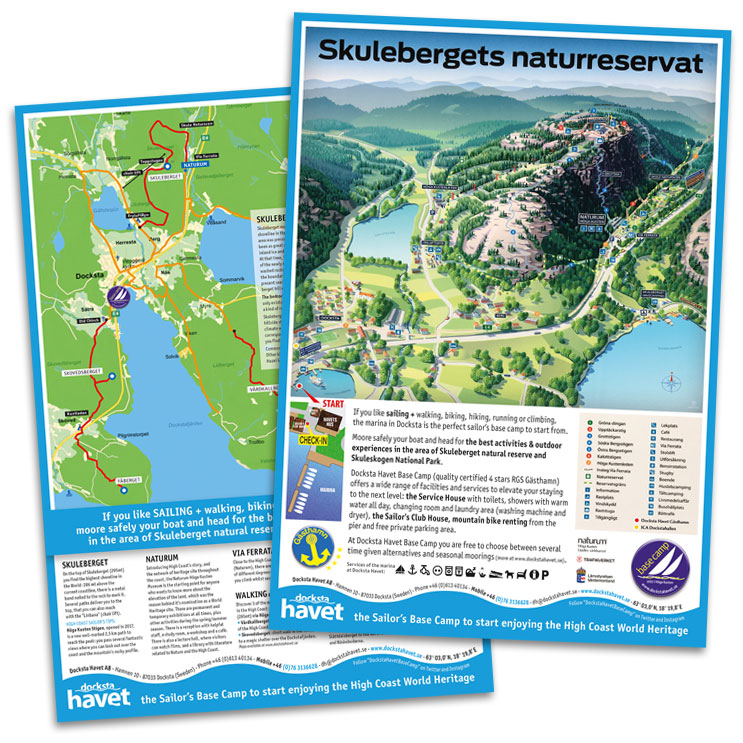
Skuleskogen is close to Docksta Havet Base Camp so - by bus, or walking/biking from the piers - it's a fantastic destination after your days of serious sailing around the coast!
Suggestions for cruising in the High Coast:
Sailing to Skuleskogen National Park to enjoy its stunning natural beauty
Sights:
The views over undulating forest and the sea.
Slåttdalsskreven.
The Kalottbergen mountains and their forested peaks and bare slopes.
The flora.
The Bronze Age barrows.
Area: 2,360 hectares.
Established: 1984, extended 1989.
Location: Approximately 40 kilometres south of Örnsköldsvik in Örnsköldsvik and Kramfors municipalities, Västernorrland County.
Visiting Skuleskogen: Signs on European Highway E4 show the way to the national park. There is an access road from the south via Käl, and from the north via Näske. The High Coast Visitor's Center (Naturum Höga Kusten) provides an introduction to the park´s human and natural history. There are 30 kilometres of hiking trails, as well as three sleeping cabins and two shelters that are open year around.
Skuleskogen National Park is a wild and majestic section of Ångermanland’s “High Coast”, where the rolling hills of the Norrland forest meet the northern Baltic Sea. This roadless wilderness offers the visitor magnificent views over sea and forest, beautiful lakes, verdant spruce-clad valleys, and fascinating geological formations which, more clearly than anywhere else, demonstrate how much of modern Sweden has risen from the ancient sea.
This national park is a heavily undulating rift valley adjoining the coast, featuring forest and outcrops of flat bedrock, in untouched condition where vegetation and animals have been able to develop freely. This area will offer the visitor the opportunity of enjoying fabulous experiences of unspoilt nature. Features especially worth seeing are Slåttdalsskreven, a gorge, 200m long, 40m deep and 7 metres wide, the bronze age cairn, extensive shingle fields, interesting vegetation and, not least, magnificent views of the archipelago. There is a total of thirty kms of marked trails which offer the hiker several alternative circular routes. The High Coast trail crosses the national park. Overnight cabins are located at Skrattaborrtjärn, Lillruten, Tärnättvattnet and Näskebodarna. (Font: www.y.lst.se)
HIGH COAST SAILOR'S TIPS:
Sailing to the heart of the World Heritage: experience Skuleberget and Skuleskogen National Park >
Skuleskogen National Park (1984) and Nordingrå Nature Conservation Area (1983) are classified Category V - Protected Landscape/Seascape: protected area managed mainly for landscape/seascape conservation and recreation - and defined as "Area of land, with coast and sea as appropriate, where the interaction of people and nature over time has produced an area of distinct character with significant aesthetic, ecological and/or cultural value, and often with high biological diversity. Safeguarding the integrity of this traditional interaction is vital to the protection, maintenance and evolution of such an area."
The purpose of Skuleskogen National Park is to preserve in unspoiled condition a coastal landscape of forest, rocky terrain, fissure valleys and steep rolling hills where plant and animal life may develop naturally. (Font: www.naturvardsverket.se)
Skuleskogen is a stupendous area. It combines high mountains, ancient forest and sea coast in a landscape which is without equal in Sweden. Pronounced peaks covered with windswept rocky pine forest are divided by deep rift valleys sculpted by the sea and the inland ice.
There are, in spite of the deserted appearance, traces of human habitation. The oldest of these are Bronze Age burial cairns. The inland ice was unusually heavy here, and pressed the mountains down under sea level. The country has been rising from the sea ever since, to reach today's level of almost 300 metres above sea level. There are also bare boulder fields, swamps and tarns in the park.
The fertile stream valleys are home to many species of bird, such as the very rare grey-headed woodpecker. Several Swedish plants have their most northerly limit in Skuleskogen, for example the decidious trees maple, lime and hazel. The trees are probably relics from warmer ages when deciduous forest was found this far north.
The foremost sights of Skuleskogen are the views of the rolling forest and the sea, Slåttdalsskrevan ravine, Kalottberget mountain with its forested top and treeless slopes, the flora and the Bronze Age burial cairns.
(Font: www.naturvardsverket.se and www.y.lst.se)
Free download the map of the Skuleskogen National Park (.pdf) >
Your boat safely moored to start exploring Skuleskogen and Skuleberget


