The Marine Realm

The biological character of the High Coast's marine environment is a consequence of several major controlling influences such as: brackish waters of very low salinity; the most sharply contoured submarine topography in the Baltic, extending to depths in excess of 200m close inshore; little tidal influence, with shifting water levels determined mainly by changing weather conditions of air pressure and wind; and seasonal ice cover.
Natural environments have undergone dramatic changes since glacial times, passing through marine, brackish and freshwater conditions. The resultant mosaic of shallow, sheltered embayments and deep, open waters provides a range of habitats for a mix of marine, brackish and freshwater species, low in species diversity but high in population numbers for some macrofauna species. Some species are relics of earlier periods, and others are at the extremes of their latitudinal and environmental limits. For the most part, however, the marine biota are described as being typical and representative of that found throughout the Baltic, rather than special or unique.
The special feature of the marine realm, imparting the greatest scientific significance, is that it represents the submarine extension of the topographical continuum of landscapes undergoing isostatic uplift.
Continual elevation of the land results in inlets becoming progressively cut off from the sea, transforming them into estuaries and ultimately lakes (some of which retain their name as bays). Meanwhile, shorelines are constantly reshaped, new islands are born offshore, and others become peninsulas as they unite with the mainland. The terrestrial influence progressively extends seawards into the Bothnian Sea. This process has major effects for the associated plants and animals that must constantly adapt to the changing environments. Thus, the nearshore marine area constitutes an integral part of the ongoing geological evolution of the High Coast and, as such, it is an important natural component of the entire property.
Although the 56% of the size of the High Coast site is marine, only 2% of it is protected: only 15 km2 of the 800 km2 marine component of the area is under protective status.
(Font: UNESCO - World Heritage Nomination - The High Coast (Sweden) - Addendum to 1999 IUCN Technical Evaluation)

The High Coast's terrestrial fauna is typical for the region, but the range of marine habitats provides for a mix of marine, brackish and freshwater species. These are low in diversity but high in populations for some of the macrofauna, some of which are relicts of earlier periods, others at the extremes of their latitudinal and environmental distribution (Dingwall, 2000). All are tolerant of the varying salinity of the brackish water, which off the High Coast ranges between 3 and 6 ‰. There is a major sill across the bottom of the Kvarken Straits at about 25m. Species numbers decline abruptly at the Gulf’s entrance from the Baltic and continue to decrease northwards - from 41 fish species in the Baltic to 20 species in the Gulf and only 6 in the Bay of Bothnia. The consequence is that the northern part of the site is near the northern limit of several species. Two northeastern Atlantic seals are present in the waters off the High Coast, the ringed seal Phoca hispida and the grey seal Halichoerus grypus. The latter occurs in greater numbers, although there are no suitable haul-out areas for the large gatherings of grey seals which are found in the Northern Quark Archipelago and south of the High Coast.
Saltwater and fresh water fish species regularly occur and reproduce along the High Coast within shallow and deep-water areas of the Archipelago. Warm-water species found in shallow waters include perch Perca fluviatilis and roach Rutilus rutilus. Cold-water species of fresh and salt-water origin are the white fish Baltic herring Clupea harengus, salmon Salmo salar, four-horned sculpin and eel pout Zoarces viviparus. Immigrant species include sprat Sprattus sprattus, cod Gadus morhua (VU) and European flounder Platichthys flesus. Fish are only found in deeper waters in the summer. Shoreline fauna species include the acorn barnacle Balanus improvisus, the common mussel Mytilus edulis, the coralline Electra crustukenta and thefreshwater snail Theodoxus fluviatilis. Shallow water crustaceans include the amphiopods Gammarus zaddachi, G. oceanicus at its northern limit, G. salinus, Pallaseaquadrispinosa, a relict species primarily found in fresh water and Corophium volutator. Several snail species are foundin the mid-archipelago zone: Paludestrina jenkinsi, Theodoxus fluviatilis, Lymnaea peregra and Bithynia tentaculata. The benthic fauna of the deeper waters is dominated by a small number of species. These include the isopod Saduria entomon, the amphipod Monoporeia affinis, the Baltic mussel Macoma bathica, a few semi-pelagic opossum shrimp species (Mysidae) and the common sea snail Liparis liparis. (Font: UNEP-WCMC)

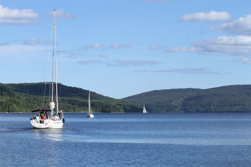
Explore the High Coast on your boat
The Höga Kusten is World Heritage also for sailing